|
|


Environment - San Diego Weather Notes / Blog
John S. Stokes III
john.s.stokes3@gmail.com
https://www.instagram.com/johnstokesiii/
San Diego County CA - My gauge is in the western Elfin Forest area about half way between Encinitas and Escondido and south of San Marcos.
Elevation 777 feet.
When there is rain I usally post NWS figures for Oceanside, Carlsbad, Encinitas, San Marcos, Escondido, Rancho Bernardo, Poway, San Diego, La Mesa, Ramona and Julian
|
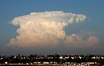
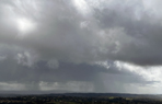
Friday, July 3, 2026 - 12:13 PM - I posted the annual July through June seasonal rain chart for San Diego at rain. Tuesday, June 2, 2026 - 4:12 PM - I meant to post that there was another .02" here the next night, (May 28-29) completing a .02", .01", .02" sequence and bringing the monthly total to .82". Thursday, May 28, 2026 - 10:06 AM - On Tuesday evening a shower dropped .02" in the gauge, and last night another shower dropped a little more than .01". There have not been any recent rain total updates from the NWS. Tuesday, May 5, 2026 - 7:27 PM - The .77" we had crushed the coastal totals! NWS reported 24 hour totals as of 2:17 PM today: Oceanside .05", Carlsbad .14", Encinitas MISSING, San Marcos MISSING, Escondido .38", Rancho Bernardo .39", Poway .47", San Diego .22", La Mesa .22", Ramona .30", Julian .71". Tuesday, May 5, 2026 - 9:43 AM - Yesterday morning we had a trace of rain. Late in the evening and during the night and early this morning we had some much heavier showers with two downpour bullseyes! Amazingly .77" in the gauge! I'll post the final NWS figures when available. Wednesday, April 29, 2026 - 10:24 AM - NWS posted a final update for the recent rain on Monday, April 27 at 5:08 AM with 3 day totals: Figures I track here were the same except the suspicious San Marcos figure was removed. Sunday, April 26, 2026 - 6:28 PM - NWS posted their 2 day storm totals at 4:15 PM (correction not 4:30 PM): Oceanside .19", Carlsbad .32", Encinitas MISSING, San Marcos .01" (doesn't seem right as they are so close to us), Escondido .31", Rancho Bernardo .42", Poway .16", San Diego .06", La Mesa .11", Ramona .73", Julian .76". Our total .40". Sunday, April 26, 2026 - 12:10 PM - Rain! Yesterday light rain showers brought .04" (.03" early, .01" afternoon), 27" overnight with at least one heavy shower, then three showers this morning .09", resulting in a storm total of .40"! NWS hasn't reported since yesterday at 9:30 PM, with scattered figures of .01-02". Some showers are still falling well inland. Friday, April 24, 2026 - 4:07 PM - Last Tuesday we had a trace of rain. The NWS posted 12 hour totals for this event Tuesday evening at 10:31 PM. Oceanside 0, Carlsbad .01", Encinitas 0, San Marcos 0, Escondido 0, Rancho Bernardo 0, Poway 0, San Diego 0, La Mesa 0, Ramona .01", Julian .05". Some light rain is predicted for this weekend and then perhaps again next Wednesday. Tuesday, April 14, 2026 - 9:14 AM - The NWS posted 3 day totals as of 11:05 PM last night. As mentioned we received .23" during this time: Oceanside .35", Carlsbad .13", Encinitas 0, San Marcos .01", Escondido .12", Rancho Bernardo .13", Poway .10", San Diego .14", La Mesa .04", Ramona .09", Julian .84"!!!. Monday, April 13, 2026 - 5:37 PM - Two more areas of rain went through today, the first dropping a trace and the second .03". So our one day total is .20", two day total .21" and three day .23". No figures from the NWS today so far. Monday, April 13, 2026 - 9:13 AM - We just got scraped by the southern end of a strong blob of rain to the north moving west to east. .17" in the gauge within about 15 minutes! Sunday, April 12, 2026 - 10:08 PM - Today we had a couple very light sprinkles resulting in just .01" in the rain gauge. The NWS posted 24 hour totals as of 9:44 PM just a few minutes ago: Oceanside .15", Carlsbad .02", Encinitas 0, San Marcos 0, Escondido .05", Rancho Bernardo 0, Poway 0, San Diego .08", La Mesa .01", Ramona 0, Julian .32". Areas to the north received more. Sunday, April 12, 2026 - 10:53 AM - We had a light period of rain yesterday morning, with .02" in the gauge, a duplicate of April 2. The NWS posted 24 hour totals as of 6:32 PM yesterday: Oceanside .01", Carlsbad .03", Encinitas 0, San Marcos 0, Escondido 0, Rancho Bernardo .05", Poway 0, San Diego .03", La Mesa 0, Ramona 0, Julian 0. Miramar received .19", Kearny Mesa .15" and Fashion Valley .14" indicating one area of heavier rain! Yesterday I updated my Time Lapse Lichen and Time Lapse Moss project pages.Thursday, April 2, 2026 - 3:01 PM - Yesterday around 4:30 in the morning we had a short period of light rain, with .02" in the gauge, the first rain since February 20th. The NWS posted 24 hour totals as of 5:02 AM: Oceanside .03", Carlsbad 0, Encinitas 0, San Marcos .01", Escondido 0, Rancho Bernardo 0, Poway 0, San Diego 0, La Mesa .03", Ramona .01". Julian .02". Some places in the San Bernardino Mountains received over 1/2 inch. The month of March was particularly warm, with the San Diego Airport average temperature for March at 66 degrees, .6 degree short of the record set in 2015.Saturday, March 7, 2026 - 11:13 AM - I've updated the annual chart for Carbon Dioxide Levels. Monday, March 2, 2026 - 10:50 AM - I've updated the annual chart for San Diego Sea Levels. Meanwhile there was widespread record heat during the past few days, cooler weather is upon us now. No rain in the forecast for this week. Friday, February 20, 2026 - 9:07 AM - The third and last storm of the series went through yesterday afternoon with a few lingering showers into the evening. Top wind gust was 36 MPH at 4 PM with the frontal passage. Our third storm total was .59" and the three storm total 2.48". NWS posted third storm totals at 6:18 AM today (24 hour totals): Oceanside .36", Carlsbad .45", Encinitas (missing), San Marcos .40", Escondido .44", Rancho Bernardo .40", Poway .57", San Diego .41", La Mesa .59", Ramona .40", Julian .95". Wednesday, February 18, 2026 - 2:15 PM - The second storm of three went through last night. It was very windy in the early morning with heavy rain. The local SDGE weather station recorded a gust of 44 MPH at 2:30 AM and 54 MPH at 4:10 AM! We had a few hundredths of an inch in light showers yesterday afternoon with the final total at .44" as of around 7 AM this morning. Our 2 storm total is 1.89". NWS posted 3 day totals as of 10:05 AM: Oceanside 1.01" (+.32), Carlsbad 1.70" (+.33), Encinitas (missing), San Marcos 1.61" (+.37), Escondido 2.26" (+.79!), Rancho Bernardo 1.88" (+.56), Poway 2.08" (+.59), San Diego 1.16" (+.13), La Mesa 1.98" (+.47), Ramona 2.61" (+.73), Julian 4.78" (1.62!!). 2-3 feet of snow has fallen in the San Bernardino mountains. The third storm is predicted to drop lighter rain amounts here starting early tomorrow. Tuesday, February 17, 2026 - 11:54 AM - Thunderbolt and lightning, very, very frightening! Well.... not frightening. At 2:30 AM vivid lightning and loud thunder with very heavy rain woke us up. Final storm total 1:45". NWS posted 2 day totals as of 10:50 AM: Oceanside .68", Carlsbad 1.37", Encinitas (missing), San Marcos 1.34", Escondido 1.47", Rancho Bernardo 1.32", Poway 1.49", San Diego 1.03", La Mesa 1.51", Ramona 1.88", Julian 3.16"! More rain coming tonight! Monday, February 16, 2026 - 3:56 PM - Rain! Light rain started here around 11 AM and increased in intensity as a front went through around 2PM. The local SDGE weather station reported a peak gust of 46 MPH! Only very light rain falling now. As of about 3:15 PM we have .73" in the gauge. The NWS posted a half hour earlier (2:45 PM), so their figures should increase: Oceanside .33", Carlsbad .62", Encinitas (missing), San Marcos .45", Escondido .59", Rancho Bernardo .48", Poway .55", San Diego .23", La Mesa .60", Ramona .59". Julian .76". Wednesday, February 11, 2026 - 2:08 PM - Rain! The current dryspell is over. As of 1:30 PM we have .32" in the gauge, no rain falling now. NWS posted 12 hour totals as of 1:31 PM: Oceanside .57", Carlsbad .33", Encinitas .30" San Marcos .23", Escondido .14", Rancho Bernardo .13", Poway .20", San Diego .21", La Mesa .10", Ramona .02". Julian 0! Areas to the west and north received more than south and east. Substantial rain is predicted for early next week. Friday, February 6, 2026 - 4:28 PM - We has a brief sprinkle yesterday evening, a minimal trace. No NWS figures. Saturday, January 24, 2026 - 9:47 AM - The NWS posted a 2 day total yesterday at 7:57 PM. Our total remained at .05" as of that time. The new totals were: Oceanside .06" (+.01), Carlsbad .02" (+.01), Encinitas 0, San Marcos .02" (+.02), Escondido .06" (+.06), Rancho Bernardo .05" (+.05), Poway .04" (+.03), San Diego .02" (+.02), La Mesa .06" (+.04), Ramona .13" (+.13), Julian .06" (+.06). Overnight we had another .01" may have just been fog, total .06" Friday, January 23, 2026 - 3:34 PM - Very light rain fell here late yesterday with .02" by 9 PM. As of this morning our total was up to .05". The NWS posted yesterday at 7:31 PM, nothing since then. Those totals were: Oceanside .05", Carlsbad .01", Encinitas 0, San Marcos 0, Escondido 0, Rancho Bernardo .01", Poway .01", San Diego 0, La Mesa .02", Ramona 0, Julian 0. Friday, January 9, 2026 - 5:57 PM - My chart for Nitrous Oxide Levels has been updated with a chart from last May. Meanwhile we have entered a dry period, light winds are blowing from the East. Thursday, January 8, 2026 - 12:14 PM - My annual Arctic and Anarctic sea ice charts have updated. Monday, January 5, 2026 - 8:51 AM - Another night, more rain! Light to moderate rain here dropped .49" overnight, skies were clearing this morning. The NWS posted 2 day totals as of 5:04 AM this morning. For comparables our 2 day total is .59". Oceanside .94", Carlsbad 1.49"!!!, Encinitas .33", San Marcos .69", Escondido .53", Rancho Bernardo .50", Poway .87", San Diego .89", La Mesa .70", Ramona .79", Julian 1.36". More "shortwaves" are predicted but rains will likely stay to the north. Sunday, January 4, 2026 - 7:58 PM - Very light rain this afternoon with one few minute burst of heavy rain dropped .10" here. No NWS figures. Moon is out now. The word "heavy" is gone again, for tonight. Sunday, January 4, 2026 - 10:40 AM - Light rain fell late yesterday afternoon and overnight: .20" of new rain in the gauge as of around 7 AM, bringing our January total to 1.82" corrected 2/1/26). The skies are partly cloudy. The NWS posted 24 hour totals as of 6:48 AM, meaning they ignored the previous night's rain: Oceanside .16", Carlsbad .18", Encinitas .11", San Marcos .16", Escondido .26", Rancho Bernardo .10", Poway .16", San Diego .21", La Mesa .18", Ramona .21", Julian .49". A rather uniform distribution excluding Julian of course. The word "heavy" is back in the forecast, this time for possible heavy showers tonight. Meanwhile everything is incredibly green here! Saturday, January 3, 2026 - 9:30 AM - Overnight we had dense fog and light showers: .05" here as of this morning. Now partly cloudy with some sun. No NWS updates since 5:25 PM on January 1. Friday, January 2, 2026 - 11:12 AM - We had some light showers drizzle yesterday afternoon and overnight, adding .07" to the gauge and bringing our storm total to 1.87". The NWS has not updated for overnight activity. They did update yesterday afternoon at 5:25 PM: Oceanside .95" (+.05), Carlsbad 1.34" (+.06), Encinitas .92" (+.07), San Marcos 1.89" (+.06), Escondido 2.30" (+.04), Rancho Bernardo 2.06" (+.04), Poway 2.06" (+.04), San Diego 2.45" (+.07), La Mesa 2.78" (+.03), Ramona 2.29" (+.02), Julian 3.83" (+.42!). There is a 70% chances of showers tomorrow night, although the word "heavy" has been removed. Thursday, January 1, 2026 - 3:23 PM - The NWS posted 24 hour totals as of 1:18 PM today: Oceanside .90", Carlsbad 1.28", Encinitas .85", San Marcos 1.83", Escondido 2.26", Rancho Bernardo 2.02", Poway 2.02", San Diego 2.38"!, La Mesa 2.75"!, Ramona 2.27", Julian 3.41!". Our total remains at 1.80". Thursday, January 1, 2026 - 11:54 AM - Overcoming some older computer problems I have updated the annual charts and commentary for San Diego rain and temperature. The rain has ended, at least for now, our storm total is 1.80"! .30" was credited to December, 1.50" will be to this month. NWS figures pending. Thursday, January 1, 2026 - 9:19 AM - Happy New Year! RAIN! Yesterday we had hours of light rain, by 9:30 PM we had .30". After that some drizzle, closing in on .31" by 11 PM. This figure will be added to the 2025 total, after rain that to this month. The NWS posted 24 hours totals as of 9:51 PM. Our .30" compares well with the NWS figures: Oceanside .26", Carlsbad .33", Encinitas .26", San Marcos .28", Escondido .26", Rancho Bernardo .22", Poway .32", San Diego .31", La Mesa .32", Ramona .24", Julian .53". This morning at about 7 AM we were up to .58" and just 2 hours later with heavy rain a super suprising 1.44" storm total and it is still raining! Sunday, December 28, 2025 - 4:16 PM - The NWS posted 4 day totals as of 3 PM yesterday. The figures here are the increases since the December 26 figures. Our total remains at .29". Oceanside .30", Carlsbad .20", Encinitas .16", San Marcos .03", Escondido .02", Rancho Bernardo .03", Poway .07", San Diego .26", La Mesa .16", Ramona .13", Julian .62". FWIW. Saturday, December 27, 2025 -10:00 AM - Very light rain the previous night then stronger showers later yesterday brought .29" here. The NWS keeps changing their starting time for their totals, there are no comparables for this rain. Friday, December 26, 2025 - 12:44 PM - At 11:46 PM on December 24, the NWS posted final 2 day figures for the rain ended on the 24th: Oceanside .58", Carlsbad .61", Encinitas .34", San Marcos .67", Escondido .72", Rancho Bernardo .64", Poway .58", San Diego .54", La Mesa .66", Ramona .80", Julian .94". Our total remained at .65", well inline with the nearby areas. A line of showers is currently approaching from the west. Wednesday, December 24, 2025 - 5:06 PM - The band of rain arrived early afternoon with a few heavy bursts, and has now cleared from the west just moments ago. Storm total now .65". Much heavier rains fell in L.A. and the mountains has had some extreme totals, up to 10"! NWS 24 hours figures as of 3:01 PM: Oceanside .33", Carlsbad .45", Encinitas .17", San Marcos .37", Escondido .33", Rancho Bernardo .25", Poway .27", San Diego .20", La Mesa .23", Ramona .39", Julian .50". These figures will increase as rain was still well under way of of 3:01 PM. Wednesday, December 24, 2025 - 9:55 AM - Where's the rain? The heavy rain predicted to develop last night and continue heavy today is missing in action. So far our "storm" total is .07". That said, there is an impressive wide band of rain which has been soaking the L.A. area and is moving slowly towards us with the individual cells moving to the NNE as usual. The question is how much of a tail to the system will there be when it reaches us. The NWS has already reduced the coastal numbers from 2.5-4" to 1". As consolation, there is more rain predicted for late Thursday into Friday. Tueday, December 23, 2025 - 9:13 PM - Although an atmospheric river is predicted, today was under whelming as the start-up day. 03" here. We had a lot of foggy days in the past week, our gauge received .05" from those days (NWS didn't report anything). Sunday, November 23, 2025 - 1:15 PM - Yesterday, late morning showers added .02" bring our third storm totals to .46". Today is very sunny and nicely warmer. NWS 3 day totals as of 5:22 AM today: Oceanside .59" (+.02), Carlsbad .47" (+.01), Encinitas .62" (+.01), San Marcos .43" (+.01), Escondido .26" (+.01), Rancho Bernardo .36" (unchanged), Poway .33" (+.02), San Diego .58" (unchanged), La Mesa .54" (unchanged), Ramona .24" (+.02), Julian .84" (+.27!). Forecast is sunny next 5 days, then maybe rain. Saturday, November 22, 2025 - 7:48 AM - Extensive rain continues in east county into Imperial County. Windy here but no rain here overnight, our total remains at .44". NWS 2 day totals as of 6:20 AM today: Oceanside .57", Carlsbad .46", Encinitas .61", San Marcos .42", Escondido .25", Rancho Bernardo .36", Poway .31", San Diego .58", La Mesa .54", Ramona .24", Julian .57". Friday, November 21, 2025 - 9:42 AM - Showers overnight ended for now around 8:30. Rain gauge @ 9:00 .44". NWS 24 totals as of 5:02 AM today: Oceanside .46", Carlsbad .34", Encinitas .50", San Marcos .37", Escondido .19", Rancho Bernardo .15", Poway .24", San Diego .52"!, La Mesa .45", Ramona .24", Julian .40". Overall, totals came in someone less than the 1" predicted for coastal areas. Thursday, November 20, 2025 - 7:59 PM - The third and last storm of the series has begun, with rain starting here late this afternoon. As of a few minutes ago we have .12" in the rain gauge, with light rain falling. Tuesday, November 18, 2025 - 4:35PM - Starting yesterday evening through early this morning we had .66" here. Late morning showers brought our storm total to .73". NWS posted 2 day totals as of 5:04 AM this morning, I don't think this includes late rain from the previous storm: Oceanside .62", Carlsbad .88", Encinitas .51", San Marcos .74", Escondido .93", Rancho Bernardo .53", Poway .61", San Diego 1.07"!, La Mesa .46", Ramona .34, Julian 0.87". Some showers are still around. EDIT 11/19/25 - The NWS did not follow up with a later update to include later showers. Monday, November 17, 2025 - 7:47 AM - The last rain from yesterday's storm ended mid-afternoon yesterday. Final total 1.61". NWS 3 day figures posted at 6:06 PM yesterday: Oceanside 2.64", Carlsbad 2.26", Encinitas 1.25", San Marcos 1.70", Escondido 1.59", Rancho Bernardo .94", Poway 1.03", San Diego 1.43", La Mesa .81", Ramona 1.43", Julian 2.59". More rain coming, from a new storm, mainly overnight tonight with 1/2" to 3/4" predicted! Sunday, November 16, 2025 - 10:24 AM - We had several showers overnight and by 6:15 AM our storm total was up to 1.54". NWS 3 day figures posted at 5:20 AM today: Oceanside 2.48", Carlsbad 2.15", Encinitas 1.15", San Marcos 1.50", Escondido 1.22", Rancho Bernardo .94", Poway .89", San Diego 1.43", La Mesa .80", Ramona 1.27", Julian 1.77". We've had more showers since our 6:15 AM reading, more updates to come! Saturday, November 15, 2025 - 9:20 PM - Periods of heavy rain came and was wonderful. Storm total here by 4 PM was 1.38". We've had just a trace of drizzle since then. NWS 2 day figures posted at 4:34 PM this afternoon: Oceanside 2.30"(!), Carlsbad 1.73", Encinitas .97", San Marcos 1.29", Escondido .99", Rancho Bernardo .79", Poway .82", San Diego 1.27", La Mesa .73", Ramona .83", Julian 1.25". Saturday, November 15, 2025 - 9:58 AM - The big storm has manifested, but here we've been stuck between bands to the west and east. By yesterday evening our total was up to .17" and overnight just .01" to bring the total to 18". Heavier rain finally arrived around 8:15 AM dropping .30" by 9:15 AM bringing our total to .48". Now we are between bands again. NWS 2 day figures posted at 9:04 AM this morning: Oceanside 1.04"(!), Carlsbad .75", Encinitas .63", San Marcos .39", Escondido .23", Rancho Bernardo .19", Poway .28", San Diego .55", La Mesa .31", Ramona .09", Julian .25". LAX has received over 2". Friday, November 14, 2025 - 2:58 PM - Rain! Overnight we had some light rain, a forerunner of a major storm, predicted. Overnight rain as of early morning was .05". NWS 24 hour figures posted at 7:17 AM this morning: Oceanside .07", Carlsbad .05", Encinitas .06", San Marcos .06", Escondido .04", Rancho Bernardo .03", Poway .04", San Diego .05", La Mesa .01", Ramona .02", Julian .03". A rather uniform distribution! Saturday, October 18, 2025 - 7:38 PM - Finally getting around to posting the final totals for the recent rain: Out final total was .50". NWS 2 day figures posted at 8:32 AM October 15: Oceanside .48", Carlsbad .45", Encinitas .26", San Marcos .34", Escondido .39", Rancho Bernardo .36", Poway .40", San Diego .39", La Mesa .42", Ramona .40", Julian 1.07 (!)". Tuesday, October 14, 2025 - 6:27 PM - We had some light rain since the last post. As of 5 PM we were up to .45", at about the same time as the NWS 2 day total posted at 5:03 PM: Oceanside .47", Carlsbad .43", Encinitas .14", San Marcos .30", Escondido .32", Rancho Bernardo .30", Poway .37", San Diego .39", La Mesa .34", Ramona .29", Julian .42". Palomar Observatory 1.39", even higher amount to the north. Tuesday, October 14, 2025 - 2:54 PM - In the past hour a rather vigorous front went through here with heavy rain, preceded by some very light rain. .41" in the gauge! A rather early start to the rainy season! Will check for NWS figures after the front has exited the county. Saturday, October 11, 2025 - 9:39 AM - The remnants of tropical storm Pricilla brought pretty mid-level clouds during the past few days and some light rain in east county. Nothing here except a trace both Thursday and Friday. NWS 24 hour totals as of 5 AM yesterday: Oceanside 0, Carlsbad 0, Encinitas 0, San Marcos 0, Escondido 0, Rancho Bernardo 0, Poway 0, San Diego .02", La Mesa .01", Ramona .01", Julian .04". Sunday, September 21, 2025 - 8:41 PM - We've had scattered showers here off and on most of the day, total here .05" as of 8:35 PM. NWS 24 hours totals as of 7:20 PM today: Oceanside .02", Carlsbad (airport) .02", Encinitas .02", San Marcos .02", Escondido 0, Rancho Bernardo .01", Poway 0, San Diego 0, La Mesa 0, Ramona 0, Julian .03". Saturday, September 20, 2025 - 7:59 PM - Later this past Thursday, the NWS issued final storm totals at 6:18 PM. Figures basically the same, only different ones shown here: Encinitas .21", San Marcos .28", Ramona .17", Julian .36". There was a spectacular cluster of thunderstorm storms around the north end of the Salton Sea with constant lighting visible from north county.  Lighting during strong thunderstorms - evening September 18, 2025 - from remnants of Tropical Storm Mario Thursday, September 18, 2025 - 10:06 AM - Late yesterday, around 11 PM, rain! It continued and woke me up around 3 AM this morning, coming down pretty hard! Remnants of tropical storm Mario. Storm total here 31"! NWS 24 hours totals as of 5:02 AM today: Oceanside .16", Carlsbad .27", Encinitas .20", San Marcos .27", Escondido .36", Rancho Bernardo .32", Poway .24", San Diego .45" (!!!), La Mesa .35", Ramona .15", Julian .34". Saturday, September 6, 2025 - 3:17 PM - The NWS continues to ignore recent rainfalls. Yesterday there was rain in east county, Julian had at least .02" according to the river website, no rain totals published by the NWS since September 2. Clouds have developed over the spine again today, but activity is much less pronounced. September 5 - Cumulous trying to convert to Cumulonimbus but not doing too well September 4 - Cumulous exploding into Cumulonimbus Friday, September 5, 2025 - 4:37 PM - Yesterday, again, thunderstorms developed along the interior spine. Again NWS did not post anything. The rivers website said Julian received .30", nothing elsewhere. Today. once again, some thunderstorms have developed, although less widespread along the spine. I'm working on a time-lapse, will figure out how to post here once it is done. Wednesday, September 3, 2025 - 3:34 PM - Large thunderstorms have sprung up again today moving along the interior spine. Meanwhile NWS did post totals for yesterday. For the 24 hours ended 10:32 PM yesterday: all zeros except Ramona (airport) .30", Julian .03". Tuesday, September 2, 2025 - 7:03 PM - Monsoonal moisture showed up big time today in southeast San Diego county and moved to the north and northwest. I saw some virga to the east but no rain drops here today. I saw a video of heavy rain in Ramona. So far the NWS has not posted. Friday, August 29, 2025 - 4:57 PM - Yesterday we received some light rain from the remnants of Tropical Storm Juliette. Storm total here was .04". Higher totals south and east. NWS 24 hours totals as of 6:45 PM yesterday: Oceanside 0, Carlsbad .03", Encinitas .03", San Marcos .02", Escondido .01", Rancho Bernardo .01", Poway .05", San Diego .05", La Mesa .07", Ramona .03", Julian .25". Mt Laguna had the most, .76". Note: On August 25, 2025 Julian received .01" and further east Agua Caliente received 1.17" and Palm Canyon Creek 1.42" from monsoonal thunder boomers! Tuesday, August 26, 2025 - 4:10 PM - Last week I was on vacation in Stone Harbor, NJ. Hurricane Erin passed off the coast bringing windy conditions and high tides, very cool! Flying back to San Diego late Sunday, we flew through some impressive storms over eastern southern California and Arizona. Storms were back yesterday, El Centro received almost an inch of rain. Today the storms are back but smaller. Nothing here.  Somewhere over southern Arizona, early eveing August 24, 2025 Saturday, July 26 , 2025 - 11:20 AM - I finally obtained methane data for 2024, see Methane Levels. Friday, July 18 , 2025 - 2:52 PM - Last night at about 1:27 AM a massively loud crack of thunder, followed by heavy rain for a few minutes. Power went out and didn't come back on until shortly before 8 AM this morning. Lighting apparently struck a nearby transformer. Rain gauge .06". NWS 24 hours totals as of 1:17 PM today: Oceanside .03", Carlsbad .07", Encinitas .02", San Marcos .01", Escondido 0, Rancho Bernardo 0, Poway 0, San Diego 0, La Mesa .0, Ramona 0, Julian 0! Big Bear Lake has the most in this period, .73"! NWS did update their June 4 figures at 8:48 AM June 4, adding .01" to Carlsbad and San Marcos. Friday, June 6, 2025 - 10:03 AM - Light rain / drizzle overnight dropped another .07" here. No NWS figures. So we have had .20" for June already! NWS did update their June 4 figures at 8:48 AM June 4, adding .01" to Carlsbad and San Marcos. Wednesday, June 4, 2025 - 7:10 AM - Further light rain and drizzle has brought our total to .13", a month's worth for June! NWS 24 hours totals as of 4:47 AM today: Oceanside .02", Carlsbad .02", Encinitas .07", San Marcos .09" (nearest station to us), Escondido .07", Rancho Bernardo .03", Poway 0, San Diego 0, La Mesa .02", Ramona .24", Julian 0! Tuesday, June 3, 2025 - 9:15 PM - A band of showers accompanied by lightning and thunder reached us, mostly from the north, in the past hour and is now dissipating. .08" in the gauge as of a few minutes ago. No rain falling now. NWS posted 24 hours figures as 8 PM, all local stations not shown except San Marcos .07". Much heavier figures to the north, Temecula .43" for example. Note: We had a trace of rain here on May 31 and June 1./p> Thursday, May 29, 2025 - 10:32 AM - Heavy drizzle late yesterday and at times last night gave us .04". No NWS figures. Sunday, May 18, 2025 - 1:13 PM - Light rain and drizzle overnight gave us .05". NWS continues to have "missing" results for many of the local stations. NWS 24 hour figures as of 5:32 AM today: Carlsbad Airport .02", San Diego .02", Ramona Airport .04", Julian .17". Wednesday, May 14, 2025 - 6:34 PM - Early morning on May 13, we received .02". San Diego reported .05". No NWS figures. Monday, May 5, 2025 - 10:12 AM - We had an addtion .07" yesterday afternoon into evening, and another .05" overnight into this morning, bringing our 2 day total to .46" and 3 day to .51"!. NWS posted 2 day totals as of 8:48 this morning but many stations were missing!: Oceanside (no figure), Carlsbad .25", Encinitas (no figure), San Marcos (no figure), Escondido (no figure), Rancho Bernardo (no figure), Poway (no figure), San Diego .08", La Mesa (no figure), Ramona (no figure, although the Ramona Airport .11"), Julian .37". Some locations in San Bernardino county received over 2"! Sunday, May 4, 2025 - 12:09 PM - Friday night into Saturday morning drizzle and very light rain dropped .05" here. Last night despite the forecast of "slight chance of showers" , it rained a lot here and this morning we have .34" of rain in the gauge! Maybe a normal month's total for May! Cloudy and cool right now with a small eddy offshore. No NWS figures. Monday, April 28, 2025 - 4:59 PM - No further showers here, but some elsewhere. NWS posted 3 day figures as of this morning 10:03 AM: Oceanside .03" (+.02), Carlsbad .11" (no change), Encinitas .08" (no change), San Marcos .05" (no change), Escondido .10" (+.05), Rancho Bernardo .13" (+.03), Poway .08" (+.07), San Diego .21" (+.20 !!!), La Mesa .14" (.04), Ramona .18 (+.03), Julian .40" (.09). Our figure remains at .08". Sunday, April 27, 2025 - NWS posted 24 hours figures as of yesterday night at 10:31 PM: Oceanside .01", Carlsbad .11", Encinitas .08", San Marcos .05", Escondido .05", Rancho Bernardo .10", Poway .01", San Diego .01", La Mesa .10", Ramona .15, Julian .31". Our figure remains at .08". Saturday, April 26, 2025 - 6:18 PM - Overnight we had a touch more than .05" of rain and with scattered showers this afternoon our total reached .08". No NWS figures. Friday, April 18, 2025 - 9:22 PM - Last night with light drizzle we had .01". Our 2 day total is .01". NWS 2 day totals as of 7:48 PM today Oceanside .06", Carlsbad .08", Encinitas 0, San Marcos 0, Escondido .01", Rancho Bernardo 0, Poway 0, San Diego 0, La Mesa 0, Ramona .01", Julian .16". Thursday, April 17, 2025 - 5:23 PM - We had a trace of rain overnight. No NWS figures. Saturday, April 12, 2025 - 12:55 PM - Updated my Time Lapse Lichen and Time Lapse Moss project pages. Friday, April 4, 2025 - 3:19 PM - Yesterday, dark ominous clouds were visible to the east most of the afternoon. Showers came close, but we received zero, nada! It was an inland story. NWS 24 hour figures as of 9:17 PM yesterday evening: Oceanside 0, Carlsbad 0, Encinitas 0, San Marcos 0, Escondido .02", Rancho Bernardo .07", Poway .03", San Diego .01", La Mesa .03", Ramona .48"!, Julian .03". Fairly dark inland clouds are back today with the Weather Underground radar showing lots of showers. EDIT: nothing here from the 4/4/25 showers, no NWS figures posted. Wednesday, April 2, 2025 - 5:28 PM - This morning our final read was .17". Nearby San Marcos had the same figure, not much else along the coast. Inland a lot more. NWS 24 hour figures as of 11:32 AM this morning: Oceanside 0, Carlsbad .02", Encinitas .01", San Marcos .17", Escondido .09", Rancho Bernardo .07", Poway .09", San Diego 0, La Mesa .01", Ramona .33", Julian .57" with snow indicated. Tuesday, April 1, 2025 - 8:52 PM - Around 7:30 PM, a short while ago, rather heavy rain began! The Weather Underground showed just one small green blob right over us, and a couple others following, looked like they were training off Catalina Island, nothing showing in the rest of the county! The rain has stopped now, .15" new rain in the gauge! Tuesday, April 1, 2025 - 10:33 AM - Light rain and drizzle continued into the evening, final read .27". NWS has been releasing figures since yesterday. NWS 2 day figures as of 7:18 AM this morning: Oceanside .11", Carlsbad .16", Encinitas .10", San Marcos .18", Escondido .19", Rancho Bernardo .18", Poway .23", San Diego .09", La Mesa .17", Ramona .22", Julian .47". Monday, March 31, 2025 - 12:22 PM - We've had showery light rain and drizzle all morning, currently foggy. As of a few minutes ago .15" in gauge, bettern than predicted. No NWS figures. Friday, March 28, 2025 - 5:31 PM - Last night we had .05" light rain. No NWS figures. Wednesday, March 26, 2025 - 2:30 PM - Last night we had .02" of drizzle. No NWS figures. Wednesday, March 19, 2025 - 9:02 PM - On Monday March 17 we had light rain after 5 PM, ending by 9:30 PM. .09" in the gauge. The NWS completely ignored this one. Hopefully the federal cutbacks are not an issue here. San Diego airport had .01" based on their daily figures. Sunday, March 16, 2025 - 8:43 PM - On March 14, rain came in two waves, morning and evening with the evening light rain accompanied by raw winds. The morning rain totalled .28" here and the final total was .43". The NWS did not break out the March 14 rain, rather their last report was for 2 days ended Friday at 10:48 AM, useless for comparisons. Month to date our total is 3.56", San Diego International Airport 2.81". Thursday, March 13, 2025 - 6:26 PM - Rain ended here in the early afternoon, final storm total: .98". Our 2+ day total: 1.49". NWS 2 day totals as 2:17 PM: Oceanside 1.57", Carlsbad 1.46", Encinitas .76" (they have been having reporting problems), San Marcos 1.17", Escondido 1.57", Rancho Bernardo 1.17", Poway 1.32", San Diego 1.42", La Mesa 1.70", Ramona 1.55", Julian 1.49". NWS's use of a 2 day total as of 2:17" clips the begining rains of March 11. Our comparable is at the most 1.46", maybe another 1/10" less. Thursday, March 13, 2025 - 11:25 AM - Our total for the March 11-12 rain was .51", the NWS did not post final totals for this one. Early this morning heavy rain began with .52" from the first wave and increasing to .82" after the second wave. Moments ago we had thunder and a some heavy rain again. NWS 24 hour totals as of 10:02 AM this morning: Oceanside .77", Carlsbad .94", Encinitas .23" (they have been having reporting problems), San Marcos .72", Escondido 1.10", Rancho Bernardo .89", Poway .98", San Diego .66", La Mesa 1.14", Ramona 1.16", Julian .98". These figures will certainly increase, particulary inland. Wednesday, March 12, 2025 - 10:36 AM - Overnight we had an addtional .02" bringing the storm total to .46" as of 7 AM. We have had addtional showers since then. Meanwhile the NWS updated their storm totals as of 9:17 PM yesterday as I was doing my last update. NWS 24 hour totals as of 9:17 PM yesterday: Oceanside .63", Carlsbad .43", Encinitas .51", San Marcos .39", Escondido .33", Rancho Bernardo .28", Poway .28", San Diego .90"!!!!!, La Mesa .38", Ramona .25", Julian .45". Scattered showers predicted for today and another storm late tonight and tomorrow bringing "around" an inch along the coast! Tuesday, March 11, 2025 - 9:24 PM - Last night an approaching solid looking rain front broke up and we received just .01". An addtional .02" fell by 1:30 PM this afternoon at which time steadier heavier rain began. As of 9:15 PM this evening the rain has stopped and the moon is out. Storm total: .44" within the .4" to .6" range predicted by the NWS. NWS storm total figures haven't been updated since 4:17 PM. Will post figures tomorrow morning, if updated. Friday, March 7, 2025 - 2:25 PM - The rain tapered off after the last post, final total here for the storm 1.53". NWS posted 3 day totals as of 12:33 PM today: Oceanside 1.16", Carlsbad 1.14", Encinitas .1.21", San Marcos 1.28", Escondido 1.16", Rancho Bernardo 1.13", Poway 1.93"!, San Diego .78", La Mesa .89", Ramona 1.48", Julian 1.47" with 4" of snow. While it has been mostly sunny here today, I see clouds piled up over towards Julian, light wet snow is falling there now. The storm was unusual in that the rain area was like a blob instead of a front. I'm including some screenshots of from the Weather Underground website starting at 7:35 PM yesterday through 9:56 PM yesterday  The yellow blob makes a direct hit Thursday, March 6, 2025 - 10:10 PM - For the last hour we had heavy rain, even lightning and thunder! A yellow-orange blob sat over us for least a half hour, being near the epicenter of the small storm. Current gauge reading 1.49"!! Since late January 4.84"!! (corrected from 4.73" on 4/1/24). Will have radar pictures tomorrow along with NWS and our totals. Looks like the steady rain should end within an hour or so. Thursday, March 6, 2025 - 6:12 PM - Rain begain yesterday afternoon and continued into this morning. The showers stopped by 11 AM with .51" in the gauge here since yesterday. NWS posted 2 day totals as of 9:47 AM today: Oceanside .47", Carlsbad .37", Encinitas .19", San Marcos 0.37", Escondido .39", Rancho Bernardo .34", Poway .35", San Diego .18", La Mesa .27", Ramona .41", Julian .80". New rain moved in here around 4:00 PM. Haven't check our gauge. Good steady rain is falling now. More rain is predicted for around Monday, and perhaps a substantial storm around Wednesday or Thursday! Monday, March 3, 2025 - 11:35 AM - By early morning another .01" here in the gauge then a frontal system after daybreak brought an additional .06" for current day total of .07". NWS posted 2 day totals as of 9:49 AM (our comparable 2 day total is .08"): Oceanside (no figure), Carlsbad .06", Encinitas (no figure), San Marcos 0.06", Escondido .05", Rancho Bernardo .05", Poway .16", San Diego .07", La Mesa .04", Ramona .29", Julian .60". A more substantial system may reach us Wednesday night and again early next week! Sunday, March 2, 2025 - 4:06 PM - Very light early morning rain here, .01" in the gauge. NWS 12 hour figures posted as of 5:40 AM: Carlsbad .01, Ramona .01". That's it. No figures were posted for the more substantial Saturday morning rain. Saturday, March 1, 2025 - 6:56 PM - Light early morning rain here, .03" in the gauge. No NWS figures posted. The California Nevada River Forecast Center site shows 24 hrs at 6 PM: Oceanside 0, Carlsbad 0, Encinitas 0, San Marcos (not covered), Escondido .02", Rancho Bernardo .01", Poway 0, San Diego 0, La Mesa 0, Ramona .04" Julian .06". Friday, February 14, 2025 - 3:51 PM - Some sun here, no additional rain, storm total remains at 2.22". NWS 3 day totals as of 2:34 PM: Oceanside 1.72" (+.01), Carlsbad 1.71" (+.01), Encinitas (incomplete), San Marcos 1.97" (no change), Escondido 2.73" (+.06), Rancho Bernardo 2.29" (+.02), Poway 2.4" (+.02), San Diego .75" (no change), La Mesa 1.62" (+.06), Ramona 1.98" (+.11), Julian 3.83" (+.16). Friday, February 14, 2025 - 10:07 AM - Except for some possible residual showers, the storm is over. 2.22" here! NWS 3 day totals as of 6:19 AM today: Oceanside 1.71", Carlsbad 1.70", Encinitas (missing), San Marcos 1.97", Escondido 2.67"!, Rancho Bernardo 2.27" (new addition to this list), Poway 2.47" (new addtion to this list), San Diego .75", La Mesa 1.56", Ramona 1.87", Julian 3.67"! So... since January 26 we've had 3.24" an excellent reprive from the recent record dryspell. Thursday, February 13, 2025 - 9:32 PM - Heavy rain here in the past half hour, the main front appears to have passed. Rain gauge now up to 1.85" as of a couple minutes ago! No new NWS figures. Thursday, February 13, 2025 - 12:19 PM - Shortly after my last post, NWS posted 2 day totals as of 10:18 AM: Oceanside .84", Carlsbad .75", Encinitas .34" (strangely low), San Marcos .95", Escondido .99", San Diego .21", La Mesa .51", Ramona .57", Julian 1.17". Just drizzle here since my last post, a good blob is approaching from the west. Thursday, February 13, 2025 - 9:47 AM - Rain! By about 9:30 yesterday evening we were up to .44" and as of 9:30 this morning, 1.05"! Currently overcast, no rain falling; the main bulk is on its way for late today and tonight! NWS has not updated since yesterday afternoon. Harrumph. Wednesday, February 12, 2025 - 10:14 AM - Rain! The big Thursday storm first noted here on Feb 7 is still on track. Light rain and drizzle is in progress from the first, lighter storm, .13" in the gauge as a few minutes ago. The current rain could total .5-1" by tonight, tomorrow's storm could bring 1-1.5" per the latest SD NWS forecast discussion. With the rains since January 27th (1.15" total here), the fire danger is on track to being eliminated for the time being. Grass (and the inevitable weeds) aready sprouting nicely as are some veggie seeds. Saturday, February 8, 2025 - 2:55 PM - Our storm total remains at .34". NWS 3 day totals as of 10:15 PM yesterday: Oceanside .25", Carlsbad .26", Encinitas .23", San Marcos .23", Escondido .27", San Diego .17", La Mesa .13", Ramona .26", Julian .57". The storm predicted for next Thursday is still on track with 1" along the coast "likely"! Friday, February 7, 2025 - 5:46 PM - Light rain, drizzle and fog have ended. Storm total here .34". NWS has not updated. Friday, February 7, 2025 - 10:34 AM - Rain! Blades of grass showing up from the late January rain! As of 10 AM we've had .27", with overall total .28". NWS 24 hours totals as of 8:02 AM: Oceanside .22", Carlsbad .21", Encinitas .18", San Marcos .19", Escondido .23", San Diego .11", La Mesa .08", Ramona .20", Julian .32". As some of our rain fell after NWS's 8:02 AM timestamp these figures should increase. Indications there could be a nice storm next Thursday, time will tell. Thursday, February 6, 2025 - 12:47 PM - Last night we had very light rain, totaling just over .01". There as been some light scattered rain this morning, bring the "storm" total to .02". NWS hasn't posted anything since 9:32 PM last night. Carlsbad and San Marcos are showing .01". I updated the San Diego Sea Levels chart for 2024 with commentary. Tuesday, January 28, 2025 - 9:44 AM - No addition rain here, total remains at .68". NWS 2 day totals as of 7:17 PM yesterday: Oceanside 1.07", Carlsbad .75", Encinitas .44", San Marcos .75", Escondido .64", San Diego .21", La Mesa .65", Ramona .73", Julian 1.16". Monday, January 27, 2025 - 10:05 AM - OK, it was our turn last night with 2 periods of rain, one quite heavy! Rain gauge now at .68" storm total, yay! A patch of rain just off the coast here has been weakening, hopefully we will get some more in the next few hours. NWS 2 day totals as of 5:03 AM: Oceanside 1.06" (!), Carlsbad .73", Encinitas .43", San Marcos .58", Escondido .54", San Diego .21", La Mesa .63", Ramona .53", Julian .85". Sunday, January 26, 2025 - 5:29 PM - Where's the rain? Seems nearly everywhere except here! OK we've had a total of .10" (.06" in the first wave and .04" in the second, both early this morning). There are still plenty of showers around, but some of them have been drying out before reaching here, or heading up the coast to L.A. NWS 24 hour totals as of 4:49 PM: Oceanside .19", Carlsbad .16", Encinitas .02", San Marcos .11", Escondido .13", San Diego .02", La Mesa .37"(!), Ramona .32", Julian .73"(!). Saturday, January 25, 2025 - 10:25 AM - Rain is in the forecast! How dry has it been? In the last 6 months of 2024, the San Diego International Airport received .16" an all time low for San Diego since the records began in 1850. Going back nine months, .39" also a record low! The ground is so brown and crunchy! Hope is high for an inch of rain in the coastal area during the next few days of showers. Monday, January 6, 2025 - 12:02 PM - I've update the Ice charts for both hemispheres. A slight combined increase in ice overall although the combined long term downtrend remains intact. Saturday, January 4, 2025 - 8:41 PM - My Carbon Dioxide Levels page has been updated with 2024 data and commentary. A new record high was set and the amount of increase was also a record. Tuesday, December 31, 2024 - 8:57 AM - Very thick fog last night, .06" in the gauge this morning with scattered puddles! NWS nothing. I was away during the light drizzle of December 24-25. NWS 24 hour totals as of 6:32 AM December 25: All zero except San Marcos .01" and Julian .03". Tomorrow I'll be posting annual rain and temperature figures and commenting on the historic April-December dry spell. Friday, December 13, 2024 - 3:58 PM - Yesterday evening we had very light rain here, less than .01" in the gauge, goes down as a trace, a big zero. NWS 24 hour totals as of 8:17 AM: Oceanside 0, Carlsbad 0, Encinitas 0, San Marcos 0, Escondido 0, San Diego .01", La Mesa .03", Ramona 0, Julian .01". It has been VERY DRY in Southern California after three excellent months to start of 2024. San Diego Airport received just .38" for the period March through November 2024. Looking at the records going back to 1850, this is the third driest stretch. In 1894 there was .26" and 2009 there was .33". Both of those years had over 2" in December. So far San Diego has had .01" which fell yesterday. The outlook for the next 10 days is dry. Sunday, November 24, 2024 - 10:08 AM - Last night araound 9PM light rain / heavy drizzle with fog began and by 10 PM we had .03". Ended early this morning exactly .10" total here. NWS 24 hour totals as of 8:17 AM: Oceanside .04", Carlsbad .05", Encinitas .01", San Marcos .05", Escondido .09", San Diego .03", La Mesa .02", Ramona .07", Julian .13". Saturday, November 16, 2024 - 12:05 PM - There have been showers around the county these past 2 days, but nothing here except the slightest trace. NWS 2 day totals as of 11 AM: All zeros except Ramona .03", Julian .29". Tuesday, November 12, 2024 - 3:55 PM - Overnight we had .03" in the gauge. There was a very light shower in the evening producing a wet trace and presumably more overnight. No NWS totals published. Sunday, November 3, 2024 - 11:02 AM - We had light showers overnight! .06" in the gauge this morning. NWS 24 hour totals as of 7:16 AM: Oceanside .08", Carlsbad .11", Encinitas .13", San Marcos .04", Escondido .07", San Diego .10", La Mesa .09", Ramona .06", Julian .18". Tuesday, October 29, 2024 - 10:29 AM - Yesterday there were showers inland, nothing here. Julian had .09" as of the 24 hour period ended 5:01 AM, nothing in the other locations tracked here. There are increasing odds for something more significant this coming weekend. Friday, October 18, 2024 - 9:13 PM - Yesterday evening just before 10 PM, rain! We could hear it on the rooftop and outside, a nice rain! But five minutes later it was all over. Nothing on the radar. .03" here. Carlsbad had .01", nothing in the other locations tracked here. Tuesday, September 17, 2024 - 9:55 AM - With the recent weather change to much cooler temperatures, we had a trace of rain (just a few raindrops) on Sunday and yesterday. In the past 24 hours, Escondido reported .02", nothing in the other locations tracked here. NWS is saying a chance of showers this Thursday before warmer weather returns. Sunday, September 8, 2024 - 11:12 AM - Been Very Hot here. Even hotter in Escondido, 109º Friday, 106º yesterday and already 105º today. Monsoonal storms developed over the mountain spine yesterday and are predicted again today. Nothing here.  Cumulonimbus to the east @3:42 PM yesterday afternoon. Sunday, August 11, 2024 - 9:07 PM - Strong thunderstorms in the county today! But nothing here. All locations monitored here zero except Julian with 1.24"! At least one Weather Underground station reported over 2" near Julian.  Dark storm to the east with some mammatus. Saturday, August 10, 2024 - 8:49 PM - The annual methane data finally came out. I've updated the charts using the NOAA data from Mauna Loa obvervatory in Hawaii and added annual commentary at Methane Levels. Thursday, June 13, 2024 - 8:40 AM - Yesterday morning thick fog and light drizzle, .02" in the gauge. No NWS figures. Friday, May 31, 2024 - 4:22 PM - While there has been no measurable rain here since May 18, I noticed the NWS posted .03" for San Diego for the 12 hours ended at 8:31 AM on May 25. No other locations followed here had any. And as of 1 PM on the 24th, .01" at Carlsbad, no other locations followed here had any. Saturday, May 18, 2024 - 7:00 PM - Yesterday morning, early, fog and some drizzle. 04" in the gauge, NWS nothing "None issued by this office recently." Sunday, May 5, 2024 - 12:32 PM - Catching up again. Early Friday May 3 heavy fog and some drizzle. 02" in the gauge, no NWS numbers. Yesterday morning, light fog and light drizzle, .01" in the gauge, no NWS numbers. This morning light rain briefly moderate with a frontal passage, .16" in the gauge after the rain ended before 7:30 AM. NWS 24 hour figures as of 8:32 AM today: Oceanside .08" Carlsbad .08", Encinitas 0 (maybe missing?), San Marcos .10", Escondido .14", San Diego .01", La Mesa .13", Ramona .09", Julian .33". No rain predicted for the next week although coastal fog could be frequent. Friday, April 26, 2024 - 10:12 AM - Some drizzle overnight, .01" in the gauge. No NWS numbers. Thursday, April 25, 2024 - 7:59 PM - Bit behind here... catching up. Later on April 23 at 4 PM NWS posted numbers: all stations zero except Escondido .01" and Ramona .07". Early morning on the 24th, we had another .02" in the early morning. Nothing posted by NWS. This morning we had drizzle and light rain, .04" in the gauge. NWS 24 hour figures as of 2:02 PM today: Oceanside 0, Carlsbad .06", Encinitas 0. San Marcos .04", Escondido .03", San Diego 0, La Mesa 0, Ramona .06", Julian .08". There is a chance of rain tonight but with less than .10". Tuesday, April 23, 2024 - 10:06 AM - Yesterday, morning fog and evening drizzle dropped .02" here. Nothing posted by NWS. Monday, April 15, 2024 - 4:43 PM - NWS posted final totals - 2 day totals as of 9:03 AM this morning: Oceanside .09", Carlsbad .19", Encinitas .05", San Marcos .25", Escondido .18", San Diego .04", La Mesa .11", Ramona .29", Julian .62". Monday, April 15, 2024 - 7:31 AM - Yesterday evening .04" and then another .04" overnight for a total of .08" and a 2 day total of .23". NWS 2 day totals as of 9:05 PM (this was before our final .04"): Oceanside .09", Carlsbad .19", Encinitas .05", San Marcos .18", Escondido .17", San Diego .04", La Mesa .10", Ramona .15", Julian .48". No rain in the forecast for the next week. Sunday, April 14, 2024 - 10:11 AM - Light to briefly moderate rain fell for several hours yesterday evening: .15" here as of this morning. NWS 24 hour totals as of 3:01 AM: Oceanside .06", Carlsbad .12", Encinitas .05", San Marcos .08", Escondido .14", San Diego .04", La Mesa .08", Ramona .15", Julian .47". Much higher totals in mid Calfornia. Another somewhat simlar band is forecast to pass through mid-day today and a smaller band tonight. Saturday, April 13, 2024 - 12:03 PM - Yesterday morning heavy drizzle. .02" in the gauge. We may receive some very light rain tonight and again tomorrow night. Today I did the annual update of my Time Lapse Lichen and Time Lapse Moss project pages. Sunday, April 7, 2024 - 9:38 PM - I've been out of town the past few days. .21" in the gauge while I was away, presumably all last Friday. NWS 24 hour totals as of 6:02 PM last Friday April 5: Oceanside .25", Carlsbad .15", Encinitas .21", San Marcos .16", Escondido .18", San Diego .10", La Mesa .39", Ramona .33", Julian .84" with 3" of snow.; Monday, April 1, 2024 - 8:45 AM - Mostly clear skies this morning, no additional rain here since the last post, final storm total 1.17". NWS storm totals as of 4:33 AM: Oceanside 1.39", Carlsbad 1.39", Encinitas 1.01", San Marcos .97", Escondido 1.84", San Diego 1.63", La Mesa 1.60", Ramona 1.75", Julian 2.10". Sunday, March 31, 2024 - 8:03 PM - Showers around us all afternoon, finally one hit us around 6 PM. Today's total is .30" bringing the storm total to 1.17". NWS storm totals as of a stale 4:32 PM: Oceanside 1.29", Carlsbad 1.31", Encinitas .98", San Marcos .89", Escondido 1.63", San Diego 1.58", La Mesa 1.58", Ramona 1.68", Julian 1.73". Showers are still around. Sunday, March 31, 2024 - 11:28 AM - Sorry for missing the promised post late yesterday. FWIW, there was no more rain and no additional NWS posts. Last night and this morning up to 11 AM we had .19" more, bringing the storm total to 1.06" (corrected). Again more rain fell to the north. NWS storm totals as of 10:01 AM: Oceanside 1.26", Carlsbad 1.28", Encinitas .98", San Marcos .87", Escondido 1.39", San Diego 1.58"!, La Mesa 1.43", Ramona 1.46", Julian 1.20". Saturday, March 30, 2024 - 4:19 PM - The "fourth hunk" didn't do much here. Total as of a couple minutes ago .87" just .02" more. The visible satellite and radar are showing a lot of wrap-around cloud activity and many instability showers queuing. Gauge emptied, will make one more post today late this evening. Saturday, March 30, 2024 - 1:42 PM - Rain! Rain started here around 6 AM this morning, with the frontal rain ending around 1:15 PM today. .85" in the gauge. The storm had two narrow bands and then a wider less intense band. The first two bands split up to perfectly shortchange us! NWS posted 24 hour totals at 1:17 PM just 2 mintues after my gauge reading. Areas north and south of here received more thanks to the splits. Rain continues inland. NWS storm totals: Oceanside 1.01", Carlsbad .97", Encinitas .74", San Marcos .67", Escondido 1.16", San Diego 1.08", La Mesa 1.10", Ramona 1.03", Julian .87". Fashion Valley to the south received 1.57" and San Onofre to the north received 1.93"! Post frontal showers are expected through Sunday. EDIT: looks like a fourth hunk of the inital system is headed this way! Friday, March 29, 2024 - 12:16 PM - Low pressure moving southest along the coast is predicted to dump 1.5 to 2" rain here Saturday through Monday. Gauge ready! More the following weekend? Monday, March 25, 2024 - 12:57 PM - Very light showers last night. Close to .02" in the gauge but calling it .01". No NWS figures although their discussion mentions the light showers. Sunday, March 24, 2024 - 9:19 PM - The last showers for today (so far) ended around 6 PM, our total is now .24". A bright full moon is shining. NWS 3 day storm totals as of 7 PM: Oceanside .20" (no change), Carlsbad .27" (.+.01), Encinitas .07" (+.04), San Marcos .19" (+.01), Escondido .34" (no change), San Diego .10" (no change), La Mesa .46" (no change), Ramona .46" (+.06), Julian 1.55" (+.03). The increase here and Encinitas was thanks to training from Catalina Island. Sunday, March 24, 2024 - 1:11 PM - Just a few sprinkles since the last post. Storm total is now .20" as of 1 PM. NWS storm totals as of 12 noon: Oceanside .20", Carlsbad .26", Encinitas .03", San Marcos .18", Escondido .34", San Diego .10", La Mesa .46", Ramona .40", Julian 1.52"! Lake Cuyamaca leads the mountains with 2.40"! Sunday, March 24, 2024 - 9:40 AM - Scattered post cold front instability showers are in progress. Most of the local rain has been south and east of here, washing up on the mountains, so-to-speak. As of 15 minutes ago we had .09" new rain in the gauge bringing the total to .19". NWS rather stale 24 hour totals as of 4 AM today: Carlsbad .10", Encinitas .03" San Marcos .08", Escondido .28"!, San Diego .06", La Mesa .42"!!, Ramona .33", Julian .99"!!!!! Oceanside now way behind with .19". Starting with the next update I'll be adding Oceanside to the local pantheon. Yesterday, I reorganized the SunRing section. Saturday, March 23, 2024 - 3:03 PM - A front with some rain passed through here about an hour ago. We had .10" in the gauge as of 2:15 PM. NWS 12 hour totals as of 2:01 PM: Carlsbad .07", Encinitas .01" San Marcos .02", Escondido .03", San Diego .05", La Mesa 0, Ramona .10", Julian 0. Oceanside leads coastal areas with .17" and Deer Springs leads the valleys with .30". Monday, March 18, 2024 - 7:10 PM - That low pressure hanging out over southeast Callifornia / Arizona retrograded westward, bringing dark skies and scattered rain. A severe thunderstorm warning was issued for areas east and south of here, only dark clouds and some gusty downdrafts were noted here. .02" in the gauge here from rains between 3-5 PM. NWS 12 hour totals as of 5:01 PM: Carlsbad 0, Encinitas 0, San Marcos 0, Escondido 0, San Diego 0, La Mesa 0, Ramona .10" and .21" at the Ramona airport, Julian .08". Saturday, March 16, 2024 - 8:38 PM - No rain here since yesterday's post. That cell north us dissipated. Abroader area of rain north of here today, slid well east of here. NWS 24 hour totals as of 9:30 PM yesterday evening: Carlsbad .04", Encinitas 0, San Marcos .04", Escondido .17", San Diego .03", La Mesa 0, Ramona .17", Julian .34". For today's activity NWS totals (time period not listed) as of 7:05 PM, everyone zero except Julian with .01". Lake Cuyamaca lead the mountains with .38". Friday, March 15, 2024 - 8:53 PM - Around 5:45 PM a line of very dark clouds approached from the north, followed shortly by some moderate rain. Around 6:45 one of the most intense rainbows I've ever seen awed the neighborhood! .12" in the gauge from this event. I'll post NWS figures tomorrow, nothing up since 4 PM. There is one cell north of here west of Temecula which may give us another dose. 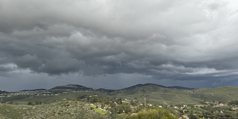 Approaching rain from the north - 5:42 PM
Friday, March 15, 2024 - 2:41 PM - Santa Ana winds and a closed upper level low now in Yuma AZ have brought foreboding clouds here at times, but we haven't had a drop of rain since Tuesday. NWS 24 hour totals as of as of 9:47 AM: Carlsbad 0, Encinitas 0, San Marcos 0, Escondido 0, San Diego .03", La Mesa 0, Ramona .03", Julian .15" with 1" snow. Tuesday, March 12, 2024 - 12:23 PM - Last night I woke up @ 3:25 AM and it was raining! Heard it on the roof and the gutters were gurgling. This morning's Weather Underground site shows .25" near Lake San Marcos. We had .17" as 11 AM (nothing since then). NWS 12 hour totals as of as of 11:31 AM: Carlsbad .08", Encinitas 0, San Marcos 0, Escondido .07", San Diego .04", La Mesa 0, Ramona .03", Julian .01".  Rain this morning Friday, March 8, 2024 - 11:51 AM - I'm baffled! No rain was predicted for yesterday evening, but it poured here and we had .40" new in the gauge! The nearby San Marcos Landfill gauge had .16" and not much of anything else nearby! NWS 12 hour totals as of as of 9:05 PM last night: Carlsbad 0, Encinitas 0, San Marcos .16", Escondido 0, San Diego .01", La Mesa 0, Ramona 0, Julian .25". The fact San Marcos picked up .16" indicates something happened in our area! Thursday, March 7, 2024 - 9:09 AM - Rain has ended, skies clearing. We had .18" in the gauge late yesterday and what is likely a final .25" storm total this morning. South county received more. NWS 24 hour totals as of as of 8:32 AM: Carlsbad .31", Encinitas .25", San Marcos .24", Escondido .21", San Diego .47"!!!, La Mesa .62"!!!, Ramona .69", Julian .43". Wednesday, March 6, 2024 - 6:35 PM - Rain has arrived as advertised. Light rain here started around 4:10 PM and as of 6:15 PM we have .08". NWS posted 12 hour totals as of 6:01 PM: Carlsbad .11", Encinitas .08", San Marcos .08", Escondido .05", San Diego .01", La Mesa 0, Ramona .03", Julian 0. Monday, March 4, 2024 - 8:40 AM - Some very scattered showers last night added .01" bringing our storm total to .60". NWS 3 day figures as of 6:03 AM: Carlsbad .31" (+.05), Encinitas .22" (no change), San Marcos .39" (+.02), Escondido .85" (+.20!), San Diego .20" (+.03), La Mesa .28" (+.03), Ramona .61" (+.19), Julian 1.98" (+.50!). Some rain in the forecast, centered around this Wednesday night. Sunday, March 3, 2024 - 4:56 PM - Looks like the scattered shower activity is finally over. By yesterday evening we had another .05", then .02" overnight and .04" today bringing the gauge's storm total to .59" as of 4:45 PM. NWS 2 day figures are stale, the latest as of 12:18 PM: Carlsbad .26", Encinitas .22", San Marcos .37", Escondido .65", San Diego .17", La Mesa .25", Ramona .42", Julian 1.48"!!! Will post the latest NWS tomorrow morning if updated. Saturday, March 2, 2024 - 10:52 AM - Rain! We had a couple hours of moderate rain, fog, drizzle this morning ending around 9 AM, .48" in the gauge. Looks like our location on a ridge trounced nearby readings.NWS 24 hour figures as of 9:02 AM: Carlsbad .21", Encinitas .21", San Marcos .34", Escondido .43", San Diego MISSING, La Mesa .12", Ramona .13", Julian .27". Friday, March 1, 2024 - 9:52 PM - Didn't see anything on the radar, but about an hour ago a nice short robust shower went through here: .04" in the gauge! Stars are out now. Of course no NWS figures. Tuesday, February 27, 2024 - 10:39 AM - Mid yesterday morning we had a couple showers, .02" in the gauge. NWS 24 hour figures as of 7:01 AM: Escondido .01", Ramona .01", that's it! Wednesday, February 21, 2024 - 11:49 AM - More rain overnight added .28" here bringing our storm total to 1.04". NWS 3 day figures as of 9:19 AM: Carlsbad .86", Encinitas .83", San Marcos .84", Escondido .78", San Diego .83", La Mesa .66", Ramona .70", Julian .81". Fashion Valley and Point Loma led the coastal pack each with 1.11". Some light residual showers may occur this afternoon in the mountains, looks like we're done here. Tuesday, February 20, 2024 - 5:22 PM - Shortly after the last post, the rain stopped and there has been none since then: .76" in the gauge, now emptied. Another band of rain is predicted for tonight. NWS 3 day figures as of 4:03 PM: Carlsbad .59", Encinitas .60", San Marcos .63", Escondido .53, San Diego .40", La Mesa .33", Ramona .25", Julian .19". Tuesday, February 20, 2024 - 12:29 PM - The rain continues and is heavier. As of 12:20 PM .72" in the gauge! NWS 2 day figures as of 12:04 PM: Carlsbad .58", Encinitas .60", San Marcos .47", Escondido MISSING, San Diego .21", La Mesa .05", Ramona .11, Julian .09". Tuesday, February 20, 2024 - 10:17 AM - Rain! A light steady rain has been falling since early morning, .36" in the gauge as of 10 AM. 04" of that fell late yesterday afternoon. The atmospheric river is in progress and is forecasted to intensify later today as it move southeast. The latest NWS totals are as of 2 hrs ago so the local figures are lower, 2 days as of 8:03 AM: Carlsbad .17", Encinitas .20", San Marcos .12", Escondido .04", San Diego .02", La Mesa 0, Ramona 0, Julian .04". Obviously at this point northwest county has the most. Monday, February 19, 2024 - 5:20 PM - Very light rain arrived here about 1/2 hour ago. The storm noted last week has remained in the forecast, but pushed back a bit, with tomorrow night being the main event, with whole event totals predicted to be .75-1.3" locally, more to the north, less to the south. Yesterday morning we had a period of light rain / drizzle with .015" in the gauge, rounded down to .01" per protocol. No NWS figures for yesterday. Monday, February 12, 2024 - 11:07 AM - The triple low prediction noted on Saturday has been replaced with a smaller system in the Feb 18-19 timeframe. Smaller fetch for a possible atmospheric river although still looks like some rain could come. Saturday, February 10, 2024 - 11:34 AM - Sun! Our final total remains at 4.12" and month-to-date at 5.70" and year-to-date at 9.35". Impressive as this is, the NWS National Centers for Environmental Prediction's Global Forecast Model (GFS) is showing a triple low pressure system off the CA coast by February 18. On the south side there could be another atmmospheric river?  GFS February 18, 2024 Friday, February 9, 2024 - 8:31 PM - What may be a final .09" fell in scattered showers today since the last reading, bring the total since last Sunday to 4.12". NWS 7 day figures as of 3:35 PM today: Carlsbad 4.11" (+.12), Encinitas 3.43" (+.18), San Marcos 3.29" (+.07), Escondido 3.93" (+.10), San Diego 2.85" (+.11), La Mesa 3.26" (+.11), Ramona 3.91" (+.30), Julian 6.27" (+.89!!). Still some chance of shares before the return of glorious sunshine! Some indications of a return to lower pressure the weekend following this one. Friday, February 9, 2024 - 8:05 AM - Another .20" overnight up to about 6 AM, total up to 4.03". Mostly cloudy with a few breaks and with showers still around. NWS 6 day figures as of 5 AM today: Carlsbad 3.99" (+.30), Encinitas 3.25" (+.36), San Marcos 3.22" (+.35), Escondido 3.83" (+.30), San Diego 2.74" (+.06), La Mesa 3.15" (+.05), Ramona 3.61" (+.19), Julian 5.38" (+.42). This should finally be over by tomorrow morning with another .10 to .25" predicted locally. Thursday, February 8, 2024 - 9:16 PM - Showers are getting more frequent. Another .15" since the last post, total up to 3.83". No NWS update. 5.41" for February already! Thursday, February 8, 2024 - 4:56 PM - Repeated light showers training off Catalina Island in a narrow band directly reaching us have added another .11" bringing the total since February 5 to 3.68" as of a few minutes ago. NWS 5 day figures as of 4 PM today: Carlsbad 3.69" (+.05), Encinitas 2.89" (+.01), San Marcos 2.87" (+.05), Escondido 3.53" (+.03), San Diego 2.68" (no change), La Mesa 3.10" (+.02), Ramona 3.42" (+.04), Julian 4.96" (+.46!!!). Thursday, February 8, 2024 - 1:01 PM - Late yesterday evening an intense rain squall passed over us with gusty wind and some hail. We had a lighter shower this morning with some BB sized hail. Morning gauge showed .53" of new rain at 7 AM and since then .05" more until now for a new total of .58" bringing the total since February 5 to 3.57". NWS 5 day figures as of 10:20 AM today: Carlsbad 3.64" (+.37), Encinitas 2.88" (+.43), San Marcos 2.82" (+.33), Escondido 3.50" (+.61), San Diego 2.68" (+.29), La Mesa 3.08" (+.41), Ramona 3.38" (+.68), Julian 4.50" (+2.33!!! and snowfall). More showers are out and about. Wednesday, February 7, 2024 - 11:27 AM - A few sprinkle has added .04" bringing our storm total to 2.99". Heavier showers and snow occurred further inland. NWS 4 day figures as of 10:20 AM today: Carlsbad 3.27" (+.05), Encinitas 2.45" (+.09), San Marcos 2.49" (+.44), Escondido 2.89" (+.53), San Diego 2.39" (+.22), La Mesa 2.67" (+.36), Ramona 2.74" (+.30), Julian 2.17" (+.12 and snowfall). Wednesday, February 7, 2024 - 8:00 AM - An intense rain shower went through here in the past hour or so, doubling our overnight rainfall to .72" and bringing our storm total to 2.95". NWS figures are as of 5:04 AM so the latest squall is not yet accounted for. NWS 4 day figures as of 5:04 AM today: Carlsbad 3.22" (+.26), Encinitas 2.36" (+.31), San Marcos 2.05" (+.12), Escondido 2.36" (+.38), San Diego 2.17" (+.27), La Mesa 2.31" (+.41), Ramona 2.44" (+.71), Julian 2.05" (+.82). The mountains are catching up. Yet more rain is predicted for tonight, .50-.75" projected for coastal areas! Tuesday, February 6, 2024 - 7:44 PM - Just a few showers here, adding .08" bringing our storm total to 2.23". Heavy showers were missing us all day! NWS 3 day figures as of 2:19 PM today: Carlsbad 2.96" (+.43), Encinitas 2.05" (+.12), San Marcos 1.93" (+.07), Escondido 1.98" (+.05), San Diego 1.90" (+.43), La Mesa 1.90" (+.58), Ramona 1.73" (+.33), Julian 1.23" (+.53). Tuesday, February 6, 2024 - 9:21 AM - Heavy rain ended early this morning. At 7 AM 2.15" storm total here, skies cloudy. NWS 3 day figures as of 7:04 AM: Carlsbad 2.53", Encinitas 1.93", San Marcos 1.86", Escondido 1.93", San Diego 1.47", La Mesa 1.32", Ramona 1.43", Julian .71". The "river" is done. Plenty of heavy, scattered radar echos remain in all directions. Monday, February 5, 2024 - 9:07 PM - The rain continues! As of 8:56 PM, gauge now at 1.42". NWS 2 day figures as of 8:18 PM: Carlsbad 1.75", Encinitas 1.22", San Marcos 1.12", Escondido 1.00", San Diego .37", La Mesa .35", Ramona .24", Julian .08". Eastward movement of the atmospheric river continues very, very slowly. At least La Mesa is getting something now. A lot more coming here! L.A. at 4.25". Monday, February 5, 2024 - 4:59 PM - After a short patch of no rain, the rain has resumed, moderate rain falling now. Exactly 1.00" around 4:45 PM. NWS 2 day figures as of 4:18 PM: Carlsbad 1.42", Encinitas .86", San Marcos .79", Escondido .66", San Diego .08", La Mesa .03", Ramona 0, Julian .02". Eastward movement very slow if at all. A remarkable difference in figures NW to SE. Monday, February 5, 2024 - 2:55 PM - The steady light to moderate rain continues, we had .81" as of 2:06 PM. NWS 2 day figures as of 1:48 PM: Carlsbad .89", Encinitas .72", San Marcos .66", Escondido .53", San Diego 0, La Mesa 0, Ramona 0, Julian .02". Eastward movement still excruciatingly slow. Monday, February 5, 2024 - 11:49 AM - The steady light to moderate rain continues, we have .49" in the gauge as of 11:35 AM. NWS 24 hour figures as of 10:47 AM: Carlsbad .51", Encinitas .32", San Marcos .37", Escondido .30", San Diego 0, La Mesa 0, Ramona 0, Julian .01". The advance across the county is so slow! Regretfully I clobbered my first entry for today posted around 7:30 AM announcing the arrival of the atmospheric river. At that time there was .08" in the gauge from overnight fringe showers and steady rain was just beginning. NWS 24 hour figures as of 7:02 AM were: Carlsbad .14", Encinitas .04", San Marcos .06", Escondido .05", San Diego 0, La Mesa 0, Ramona 0, Julian 0. Sunday, February 4, 2024 - 7.55 PM - Where's the rain? Partly cloudy with stars. Very little if any southward progress of the heavy rains up north. Looks like the heavy rains have been pushed to Monday night. Sunday, February 4, 2024 - 11:43 AM - That rain I mentioned yesterday approaching L.A. was a feint, not related the atmospheric river and is long gone. The sun is shining, a beautiful day! So where's the rain? Delayed but still coming. The radar imagery, while showing extensive rain north and west of L.A. isn't super convincing, but the NWS continues on track with a 2-4" prediction for here. That light rain of yesterday did sprinkle here, .02" in the gauge this morning, now emptied. No figures from NWS for the light sprinkles. The California Nevada River Forecast Center shows for the last 24 hors as of 11 AM this morning: Carlsbad .01", Encinitas .01", San Marcos (not tracked), Escondido 0, San Diego (trace), La Mesa 0, Ramona .01, Julian 0. Palomar Mountain and Mount Laguna both had .02". Saturday, February 3, 2024 - 8:08 PM - All eyes are on the approaching major storm, an "atmospheric river', with 2-4" predicted along the coast through Tuesday. Already, rain is approaching Los Angeles. The reason for posting now is to post the final totals for the February 1-2 storm as there were more showers yesterday particularly in the mountains. NWS 2 day totals as of 4:03 PM yesterday: Carlsbad 1.38" (+.07), Encinitas 1.35" (+.01), San Marcos 1.20" (no change), Escondido 1.64" (+.10), San Diego .90" (+.01), La Mesa 1.44" (no change), Ramona 1.64" (+.09), Julian 2.96" (+.52!). Our total remained at 1.56". Friday, February 2, 2024 - 10:23 AM - Post frontal showers brought an additional .34" here overnight and early morning, with one particularly strong cell, bringing our storm total to 1.56" as of 10 AM NWS 2 day totals as of 10:03 AM: Carlsbad 1.31", Encinitas 1.34", San Marcos 1.20", Escondido 1.54", San Diego .89", La Mesa 1.44", Ramona 1.55", Julian 2.44" (!). We continue to be on track for a major storm early next week. Thursday, February 1, 2024 - 3:10 PM - The main front associated with the first storm passed through mid-day with wind and heavy rain. The rain has stopped for now although some is still falling in east county as the front exits. 1.22" in the gauge! NWS 24 hour totals as of 1:47 PM: Carlsbad 1.25", Encinitas 1.25", San Marcos 1.11", Escondido 1.26", San Diego .56", La Mesa .82", Ramona .49", Julian .75". Nice tight cluster amongst the first 4 location along with my own reading. Wednesday, January 31, 2024 - 2:55 PM - My San Diego Sea Levels page has been updated. Also updated my San Diego Rain page with monthly data in an improved format (assuming no rain today to close out the month). Meanwhile the long predicted storms are coming. Over the past week the first storm was pushed back just a little - on track for tomorrow with Thursday-Friday rainfall for the coastal areas expected to be 1.5-2". Numbers are now up for the next Monday-Tuesday storm with a wide range of 1.5-3.5". This may be narrowed as time nears. Wednesday, January 24, 2024 - 9:34 PM - Light rain or drizzle last night, .02" in the gauge. No figures from NWS. Might be it for January, maybe we'll get something late on the 31st, the NWS continues to mention big changes for early February. Tuesday, January 23, 2024 - 5:16 PM - Light overnight rain brought our storm total to 1.91" and 2.66" for the two storms. The extreme rainfalls and flooding in south county made the New York Times! The NWS posted 4 day two storm totals as of 1:34 PM. Carlsbad 3.29", Encinitas 3.10", San Marcos 2.26", Escondido 2.73", San Diego 3.37"!!!, La Mesa 4.76"!!!, Ramona 2.21", Julian 2.80". Looks like tranquil weather to close out the month. Some weather models have large low pressures off the central coast beyond one week out. Monday, January 22, 2024 - 5:53 PM - Continued drizzle and light rain has brought the gauge to 1.81" and 2.56" for the two storms. The NWS posted 3 day two storm totals as of 3:03 PM. Carlsbad 3.04", Encinitas 2.93", San Marcos 2.16", Escondido 2.44", San Diego 2.55", La Mesa 3.89"!!!, Ramona 2.06", Julian 2.33". Residual showers are still possible. Local flooding closed CA-78 and even I-15 North around exit 32 due to clogged drainage. Monday, January 22, 2024 - 12:07 PM - A little drizzle has brought our storm totlal to 1.63" and 2.38" for the two storms. The NWS posted 3 day two storm totals as of 11:18 AM. Carlsbad 3.00", Encinitas 2.78", San Marcos 2.12", Escondido 2.44", San Diego 2.40", La Mesa 3.13"!!!, Ramona 1.85", Julian 2.08". Heavy rain continues in east county. Monday, January 22, 2024 - 11:22 AM - Rain finally letting up although still raining. Now 1.62" and 2.37" for the two storms. San Diego way more than here... as of 11 AM 2.37" this morning and 2.96" for the two storms. Point Loma 3.84" today!!!. NWS has been sending out flood warning alerts. Monday, January 22, 2024 - 9:56 AM - HEAVY RAIN! 1.34". Monday, January 22, 2024 - 8:59 AM - HEAVY RAIN! We've already had .98" this morning as of a few minutes ago. Before the onslaught, the NWS tweaked the first storm's totals at 4:03 AM: Encinitas .77" +.02", Escondido .73" +.02", La Mesa .70" +.01", Ramona 71" +.02", Julian 1.06" +.02", the rest unchanged. No change here .75" was the total. Will post new figures this afternoon. Sunday, January 21, 2024 - 6:20 PM - The morning drizzle brought our storm total to .75". Gauge now empty waiting for tomorrow's storm! NWS 2 day totals as of 4:17 PM: Carlsbad 1.10"!, Encinitas .75", San Marcos .59", Escondido .71", San Diego .59", La Mesa .69", Ramona .69", Julian 1.00". Sunday, January 21, 2024 - 9.53 AM - Light rain and drizzle late yesterday and then a blob this morning has brought our storm total to .73" as of 9AM. Only very light drizzle since then. NWS 2 day totals as of 8:03 AM: Carlsbad .82", Encinitas .71", San Marcos .52", Escondido .45", San Diego .41", La Mesa .44, Ramona .41", Julian .50". The forecast for Monday's storm is still on track with a slight increase in predicted coastal rains - 1.00-1.5"! Our yard is loving it! Saturday, January 20, 2024 - 4:32PM (edited 5:12 PM) - Rain! Good soaking rain started here shortly before noon and ended around 4PM. May get more showers before the predicted Monday storm. .45" in the gauge. NWS 24 hours totals as of 4:17 PM: Carlsbad .54", Encinitas .42", San Marcos .36", Escondido .32", San Diego .33", La Mesa .38", Ramona .23", Julian .23". Interior figures will certainly increase. Thursday, January 11, 2024 - 8:43 PM - At least two showers passed through the area early this morning: .07" in the gauge. NWS precipitation summary as of 10:17 AM: Carlsbad .01", Encinitas 0, San Marcos .02", Escondido .32", San Diego .13", La Mesa .12", Ramona 0.34", Julian 0.90". Quite a variance! Wednesday, January 10, 2024 - 10:40 AM - My Carbon Dioxide Levels page has been updated with 2023 data and commentary. A new record was set and the amount of increase was also a record. Sunday, January 7, 2024 - 10:57 AM - A polar front passed through this morning before sunrise with strong winds and some rain. Our total: .13". NWS precipitation summary as of 10:02 AM: Carlsbad .06", Encinitas .06", San Marcos .06", Escondido .14", San Diego (missing - was .03" as of 5:46 AM), La Mesa .07", Ramona 0.15", Julian 0.47". Thursday, January 4, 2024 - 9:04 PM - It's cold out there! This post is to close out the totals for the recent rain. Our total remained at .23". NWS 24 hours figures as of 9:33 AM this morning: Carlsbad .16" (no change), Encinitas .08" (no change), San Marcos .14" (no change), Escondido .21" (no change), San Diego 0.12" (+.01"), La Mesa .23" (+.03"), Ramona 0.30" (no change), Julian 1.28" +(.46"!). Wednesday, January 3, 2024 - 8:27 PM - Just a few sprinkles here after this morning's band of rain, final total .23" (+.01"). NWS 24 hours figures as of 3:47 PM: Carlsbad .16" (no change), Encinitas .08" (no change), San Marcos .14" (no change), Escondido .21" (+.02"), San Diego 0.11" (+.01"), La Mesa .20" (+.04"), Ramona 0.30" (+.05"), Julian .82" +(.52"!). Wednesday, January 3, 2024 - 11:51 AM - The band of rain associated with the cold front passed through this morning, dropping .22" here. NWS figures as of 11:01 AM (no time period specified): Carlsbad .16", Encinitas .08", San Marcos .14", Escondido .19", San Diego 0.10", La Mesa .16", Ramona 0.25", Julian .30". Tuesday, January 2, 2024 - 8:39 PM - Some rain is on the agenda tomorrow, gauge ready. Meanwhile I have updated the charts and commentary for Arctic Sea Ice and Antarctic Sea Ice. Monday, January 1, 2024 - 1:42 PM - Happy New Year! The final total here for the December 30-31 event was .23". The NWS didn't post 48 hour figures. I'll be posting 2023 year figures and commentary for San Diego Rain and San Diego Temperature, after I get the charts updated. Saturday, December 30, 2023 - 8:15 PM - A few more showers have passed through, some training off Santa Catalina Island and making a direct hit. As I write this another shower has started. Just a few minutes before the shower started: .16" in the gauge, which is plus .07" since the last post. The NWS has posted 12 hour totals as of 5:01 PM today: Carlsbad .12" (+.01), Encinitas .12" (no change), San Marcos .11" (no change), Escondido .06" (+.03"), San Diego 0.25" (+.01"), La Mesa .09" (+.02"), Ramona 0.07" (+.02), Julian .16" (+.15"). Saturday, December 30, 2023 - 11:43 AM& - The first wave of an extended series of rainy spells passed through here this morning. .09" in the gauge. The NWS has posted 12 hour totals as of 9:01 AM today, the local figures are similar. Carlsbad .12", Encinitas .12", San Marcos .11", Escondido .06", San Diego 0.24" (!), La Mesa .07", Ramona 0.05", Julian .01". The interior location figures should increase. Friday, December 22, 2023 - 12:59 PM - Overnight we had .46" here and just a trace so far today. The NWS has posted 24 totals as of 10:32 AM today. Carlsbad .53", Encinitas .47", San Marcos .38", Escondido .42", San Diego 0.49", La Mesa .35", Ramona 0.57", Julian .28". A rather tight bunch of figures. Some showers are still possible. Thursday, December 21, 2023 - 9:05 PM - Still no further rain. Areas to the north have been deluged, nothing here. Saw some lightning well off shore several hours ago. The NWS has backed off more, the prior backoff was to 1-2", now saying .75" to 1.5". Meanwhile totals are piling well to the north. The NWS has posted 3 day totals as of 5:03 AM today. Carlsbad .22", Encinitas .13", San Marcos .04", Escondido .09", San Diego 0.01", La Mesa .16", Ramona 0.06", Julian .06". San Onofre leads with 1.01". Los Angeles is over 2". Our 3 day total is .10". 
Wednesday, December 20, 2023 - 10:21 PM - No further rain fell yesterday except for a very light trace, same today until this evening when a band came through. Dropped .06" Moon out now. NWS posted 24 hour figures as of 6:31 PM which was before our evening rains came: Carlsbad .01", Encinitas 0, San Marcos 0, Escondido 0, San Diego 0, La Mesa 0, Ramona 0, Julian .01". Areas to the north have received far more rain. Huntington Beach leads with .75". The NWS has backed off from the 2-3" for the coast. Now saying 1-2" for the coast through Friday night. Still plenty! Tuesday, December 19, 2023 - 10:21 AM - Looking forward to the storm predicted for later this week with 2-3" of rain expected for the coastal areas! Some sprinkles from an outer band passed through last night and a rather small cell made a direct hit on us for a few minutes around 11 PM or so with one minute of suprisingly heavy rain: .04" in the gauge this morning. NWS posted 24 hour figures as of 7:16 AM: Carlsbad .02", Encinitas 0, San Marcos 0, Escondido .03", San Diego 0, La Mesa 0, Ramona 0, Julian 0. Oceanside received .10", Vista .07" so we were in that track. Friday, December 1, 2023 - 10:54 AM - Final gauge total: .18". NWS posted 2 day figures as of 5:02 AM: Carlsbad .09", Encinitas .21", San Marcos .16", Escondido .29", San Diego .33", La Mesa .15", Ramona .63", Julian 1.45"!!!. Thursday, November 30, 2023 - 8:19 PM - We had one band of showers today followed by a beautiful rainbow, our storm total came to .17". NWS posted 2 day figures as of 3:19 PM: Carlsbad .09", Encinitas .21", San Marcos .16", Escondido .28", San Diego .26", La Mesa .04", Ramona .59", Julian 0.82".  Rainbow today at 12:20 PM Thursday, November 30, 2023 - 9:37 AM - Last night showers pass through, .10" in the gauge as of 6:15 this morning. NWS posted 24 hour figures as of 6:02 AM: Carlsbad .02", Encinitas .15", San Marcos .07", Escondido .20", San Diego .25" (!), La Mesa .04", Ramona .30", Julian 0.44". Wednesday, November 29, 2023 - 5:11/5:41 PM - Unsettled weather today. A mid-day blob of rain approached from the northwest but shrank and moved into central coastal SD county, missing us. Later in the afternoon we had some sprinkles but ended up being a heavy trace. Saw a weak rainbow. A low pressure spinning off central California will give us a chance for something measurable tonight and tomorrow. NWS's 1:30 PM forecast is calling for .20-.50" for the coastal areas, this figure has increased from yesterday's forecast. Just after I posted this entry, the NWS posted 6 hour figures as of 4:45 PM: Carlsbad .01", Encinitas 0, San Marcos 0, Escondido 0, San Diego 0, La Mesa 0, Ramona 0, Julian 0.07". SunRing updated. Sunday, November 26, 2023 - 8:03 PM - Several days behind here... on Friday November 24 we had a total of .04" here, the first .03" consisting of light rain showers and .01" in drizzle and fog. The NWS posted 2 day figures at 9:30 AM on November 25: Carlsbad .01", Encinitas 0, San Marcos .01", Escondido 0.01", San Diego .01", La Mesa 0.01", Ramona 0.14", Julian 0.12". We may receive some showers this Wednesday. SunRing updated. Monday, November 20, 2023 - 3:11 PM - SunRing Solstice Observatory - details at SunRing.  Sunday, November 19, 2023 - 12:15 PM - Yesterday afternoon we received .02", then over night with a little drizzle and fog for another .02" bringing the our November 18-19 total to .04". The NWS posted 2 day figures at 7:32 this morning: Carlsbad .03" (+.03"), Encinitas .04" (+.04"), San Marcos .02" (+.02"), Escondido 0.6" (+.01"), San Diego 0" (+0), La Mesa 0.18" (+0), Ramona 0.06" (+.02"), Julian 0.31" (+.10"). No rain expected in the next few days. Saturday, November 18, 2023 - 10:35 AM - Yesterday afternoon, a good size front of rain moved through the county with the bulk well to the south and east of here, we received just a trace. So 0" here. The NWS posted figures for this batch @ 9:30 PM yesterday evening: Carlsbad 0", Encinitas 0", San Marcos 0", Escondido 0.04", San Diego 0", La Mesa 0.16", Ramona 0.03", Julian 0.16". Rancho Barnardo received .55"! The next wave fizzled last night. Nothing here 0". The NWS posted combined figures as of 6:20 AM. The figures here are after subtracting yesterday's rain figures: Carlsbad 0", Encinitas 0", San Marcos 0", Escondido 0.01", San Diego .12"(!), La Mesa 0.02", Ramona 0.01", Julian 0.05". Another wave, with maybe one more to follow, is passing northwest SD County. We may get a couple hundreds out of this one. Thursday, November 16, 2023 - 10:55 AM - Drizzle late yesterday brought our storm total to .68" an increase of .02". The NWS posted new figures at 4:16 AM, all rain had moved out of Southern CA by this time. Carlsbad 1.19", Encinitas 0.74", San Marcos 0.62", Escondido 0.59", San Diego 0.15" (the lowest of SD County coastal stations), La Mesa 0.23", Ramona 0.57", Julian .54". Currently seeing clouds and sun. The forecast for next wave of this system is less bullish than earlier forecasts, with .10-.30" predicted. Wednesday, November 15, 2023 - 8:46 PM - Light rain continued after my last post here, now just a light drizzle. Our storm total is now .66"! The NWS posted new figures at 8:02 PM. Carlsbad 1.13" (!!!), Encinitas 0.66", San Marcos 0.58", Escondido 0.55", San Diego 0.08", La Mesa 0.14", Ramona 0.52", Julian .42". Oceaside leads the coastal locations with 1.15" just beating out nearby Carlsbad. This is an excellent start of the winter rainy season! Wednesday, November 15, 2023 - 7:07 PM - A second much more robust area of rain arrived here around 4:30, with at least 2 lighting / thunder events around 4:50 PM with heavy rain followed by occasionally moderate rain ending right about now. Our storm total is now .51"! The NWS posted figures about 2 hours ago at 5:16 PM, these amounts will increase: Carlsbad .58", Encinitas 0.32", San Marcos 0.22", Escondido 0.13", San Diego 0.02" (!), La Mesa 0.09", Ramona 0.30", Julian .21". San Onofre leads San Diego Country with .71". Wednesday, November 15, 2023 - 12:21 PM - The NWS posted figures just a few minutes ago - 12 noon: Carlsbad 0", Encinitas 0.01", San Marcos 0.02", Escondido 0.01", San Diego 0.02", La Mesa 0.08", Ramona 0.26" (!), Julian .18". Wednesday, November 15, 2023 - 11:30 AM - A very slow moving closed low off the coast brought a blob of rain from the southwest in the past hour with thunder and foreboding skies. The heaviest rain passed south of here. We had a 10 minute period of rain struggling to reach the ground as the weather has been very dry for at least the past week. .03" in the gauge. The forecast is for more of the same later today and tonight. A break tomorrow, then as the closed low comes ashore as a trough, more rain ending Sunday morning. Total event could produce .5" to 1". Our yard will love it! Wednesday, October 25, 2023 - 2:07 PM - A touch of drizzle mid-day, nothing in the gauge. NWS posted 24 hour figures as of 8:16 AM, nothing local. Monday, October 23, 2023 - 7:45 AM - Slightest trace of rain this morning after several days of dry weather; nothing in the gauge. NWS posted 24 hour figures at 7:16 AM, Julian .03". Wednesday, October 18, 2023 - 3:40 PM - We've had 2 night of dense fog, everything wet again. .02" in the gauge from the 2 nights. Does the NWS count fog condensation totals as reportable figures? Nothing from the NWS. Wednesday, October 11, 2023 - 5:05 PM - Yesterday around 10 PM I unexpectedly heard gurgling in the gutters and was surprised to find heavy drizzle in progress! As of 6:30 AM the drizzle and fog were gone and a very impressive .09" in the gauge! NWS 12 hr totals as of 5 AM: Carlsbad 0.02", Encinitas 0.03", San Marcos 0.04", Escondido 0.04", San Diego 0.01", La Mesa 0.03", Ramona 0.02", Julian 0". Of note, Vista had .12" and Miramar Lake .14". Tuesday, October 10, 2023 - 7:02 PM - On October 7th, there was a cool fallstreak / hole-in-the-cloud visible here, posted pic on Instagram, See Fallstreak Hole. Tuesday, October 10, 2023 - 6:30 PM - Yesterday morning we have very thick fog, ground soaked, .01"+ in the gauge. No NWS figures. Wednesday, October 4, 2023 - 11:37 AM - Catching up here. On October 1, I measured an additional .01" here in the morning: .08" total Sept-30/Oct-1. NWS 2 day totals as of 7:18 PM October 1: Carlsbad 0.04", Encinitas 0", San Marcos 0.04", Escondido 0.06", San Diego 0", La Mesa 0.02", Ramona 0.23", Julian 0.60". Saturday, September 30, 2023 - 8:35 PM - At least three showers passed over today, rain gauge as of a few minutes for the day: .07". NWS 24 hr totals as of 7:47 PM: Carlsbad 0.03", Encinitas 0", San Marcos 0.02", Escondido 0.05", San Diego 0", La Mesa 0", Ramona 0.10", Julian 0.21". Of note, Vista received .20". Thursday, September 28, 2023 - 1:13 PM - Everything soaking wet this morning thanks to fog and drizzle. .02" in the gauge. No NWS figures. Saturday, September 23, 2023 - 1:38 AM - Final totals from NWS; 24 hr totals as of 10:35 PM added .01" to San Diego .04" and .02" to La Mesa. No addtional rain here. Friday, September 22, 2023 - 8:19 PM - Showers from the debris of a tropical storm dropped .02" here. Today I was in Oceanside and later down the coast to Imperial Beach. There was rain from the 52 into Mission Beach and scattered showers further south. NWS 12 hr totals as of 3 PM: Carlsbad 0.01", Encinitas 0", San Marcos 0", Escondido 0", San Diego .03", La Mesa 0", Ramona 0", Julian 0". Fashion Valley tied San Diego for the lead with .03". Wednesday, September 20, 2023 - 3:36 PM - Didn't get around to mentioning that on Monday, September 18 there was another .02" in the gauge, bringing the event total to .15". The NWS posted 12 hr totals as of 8 AM Monday - all zeros except Escondido .01", Ramona .02". Sunday, September 17, 2023 - 3:31 PM - Overnight drizzle added .03" here, for a total of .13". NWS 24 hr totals as of 10:31 AM: Carlsbad 0.04", Encinitas 0.06", San Marcos 0.01", Escondido 0.02", San Diego 0", La Mesa 0", Ramona 0.02", Julian 0". Saturday, September 16, 2023 - 9:28 PM - Drizzle all day, .10" in the gauge! No NWS figures. Saturday, September 16, 2023 - 9:29 AM - Drizzle and fog yesterday morning .01" and a touch more in the gauge. No NWS figures. Marine layer all day, no sun. And this is September! This morning the marine layer continues and the drizzle and fog are moving in again. Monday, September 11, 2023 - 7:59 PM - The lightest of traces today, just a few drops made it to the ground here. No NWS figures. Monday, September 11, 2023 - 8:28 AM - Yesterday we had some scattered fat raindrops from the far northerm band of remnat low Jova, a trace. The NWS did post totals, but nothing in SD country. Wrightwood in the San Bernardino Mountains had the most with .11". This morning, virga is visible in most directions. Saturday, September 2, 2023 - 6:47 PM - We had several hours of "heavy" drizzle with .05" in the gauge by the time it was over early afternoon. NWS 2 day rain totals as of 5:02 PM: Carlsbad 0.03", Encinitas 0.03", San Marcos 0.02", Escondido 0", San Diego 0.01", La Mesa 0.02", Ramona 0", Julian 0". Locally Point Loma led with .07". Friday, September 1, 2023 - 8:04 PM - We had a trace of rain, just a few drops mid afternoon. Deserts had over an inch from monsoonal storms, nothing in the locations I cover. Wednesday, August 30, 2023 - 10:52 AM - NOAA has released 2022 Methane data. See Methane Levels for graphics and comments. Monday, August 21, 2023 - 9:55 AM - Final Tropical Storm Hilary rain gauge read at 6:30 this morning, 3.01". The gauge is a Stratus Rain Gauge, one of the best out there, see picture, below for current location. NWS 2 day rain totals as of 4:47 AM: Carlsbad 2.50", Encinitas 2.14", San Marcos 2.66", Escondido 2.68", San Diego 1.82", La Mesa 2.05", Ramona 1.94", Julian 3.47". 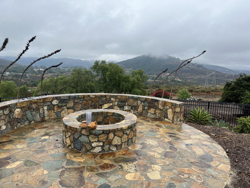 Stratus Rain Gauge location during Hilary Sunday, August 20, 2023 - 9:25 PM - Very heavy rains here since my last reading, I had to do another. Incredible but true we are now up to 2.61" as of 9:20 PM and it is still raining! This is more than San Diego has ever recorded for the whole month of August! Curious to know what they've had today. NWS has not updated their totals, will have to wait until tomorrow. Sunday, August 20, 2023 - 7:51 PM - The NWS nailed their rain predictions. More than I expected based on the rapid deterioration of the storm yesterday. However the coastal winds so far have not lived up to forecasted levels. The highest hourly recorded gust at SD Airport has been just 32 MPH. Will be interesting to see what the weather history says about this storm. Did a Tropical Storm hit San Diego? I took my final gauge read for today at 7:35 PM. Now up to 1.66", an epic amount for this time of the year. August's San Diego airport monthly normal was .07 by my spreadsheet! A light rain continues and 10-20 MPH winds. NWS as of 7:01 PM: Carlsbad 1.45", Encinitas 1.00", San Marcos 1.33", Escondido 1.53", San Diego 1.06", La Mesa 1.38", Ramona 1.46", Julian 3.21". Mt. Laguna 6.82" now passed by Mt. San Jacinto with 8.52". The deserts are getting soaked with Borrego Springs at 1.72", Agua Caliente at 1.33" and Palm Springs 2.78"! Sunday, August 20, 2023 - 4:49 PM - We've had at least an hour of rather heavy rain, our total as of 4:38 PM now 1.32" ! NWS has not updated their totals. The "eye" of the rain distribution appears to be at the border. Rain is much lighter and the winds have shifted from the SSW to ESE and picked up a bit maybe 10 MPH, nowhere near tropical storm strength! Oh, NWS just updated their totals, for 24 hours. As of 4:32 PM: Carlsbad 1.25", Encinitas .82", San Marcos 1.14", Escondido 1.29", San Diego .86", La Mesa 1.13", Ramona 1.20", Julian 2.97". Mt. Laguna 6.29" (!). Sunday, August 20, 2023 - 3:03 PM - Rain picking up, winds very light. As of 3:00 PM .76" here! NWS 12 hour figures as of 2:01 PM: Carlsbad .72", Encinitas .43", San Marcos .56", Escondido .50", San Diego .52", La Mesa .51", Ramona .30", Julian 2.07" (!). Mt. Laguna still way out front, now 4.73". San Diego now having the wettest August since 1977. Center of storm circulation near Ensenda. Sunday, August 20, 2023 - 2:01 PM - Rain continuing, winds remain light. As of 1:50 PM here now .61". NWS 12 hour figures as of 12:31 PM: Carlsbad .58", Encinitas .36", San Marcos .46", Escondido .37", San Diego .46", La Mesa .39", Ramona .23", Julian 1.28" (!). Mt. Laguna still way out front, now 4.11". Sunday, August 20, 2023 - 11:59 AM - The center of the remnants of Hilary, still listed as a tropical storm with winds of 65 MPH as of 11:00 AM is approaching. Rainfall here has been mostly light with some moderate periods. As of 7:45 AM I measured .26", at 10:45 AM .34" and just now at 11:55 AM .45". NWS 12 hour figures as of 11:30 AM: Carlsbad .43", Encinitas .31", San Marcos .34", Escondido .32", San Diego .34", La Mesa .32", Ramona .21", Julian .72". Heavier rain has arrived in the mountains with Mt. Laguna leading the pack with a hefty 2.76". The deserts have not received substantial rains as of 11:30 AM. Locally winds have been fairly light, in the 10-15 MPH range with gusts to 20. Rains and winds are still projected to ramp up this afternoon into early evening, we'll get close to minimal tropical storm strength in the lower elevations. Maybe. My hat off to the weather forecasters. On August 14, low pressure wasn't even formed and the models were sending a significant storm this way! 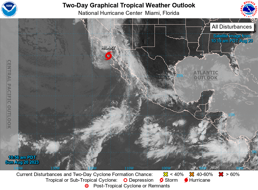 Saturday, August 19, 2023 - 1:10 PM - The eye has now filled in. Forecast track now east of Tecate well away from the coastal side of the mountains! Very unlikely, IMO, that tropical storm conditions will be experienced here. Will be a ton of rain on the east side of the mountains and the deserts. The forecast still has rain here tomorrow, but the numbers are coming down. Saturday, August 19, 2023 - 9:11 AM - Storm is falling apart on the left side. Don't have time for pictures now, will update later. Friday, August 18, 2023 - 8:27 PM - Tropical Storm WARNING for San Diego! Hilary has begun to weaken with winds at 130 MPH, the minimum for a category 4 storm. The track did move back west this afternoon and is about unchanged with this evening's update. The track center goes up just east of Escondido! Wowza! The local forecast hasn't been updated since 3:31 PM, the NWS is calling for 2-3" of rain along the coast. Winds still look to be barely gale force. 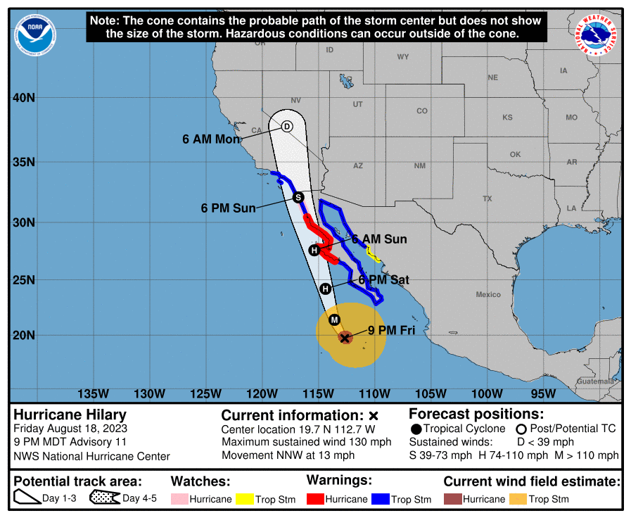 Friday, August 18, 2023 - 9:18 AM - Tropical Storm Watch for San Diego! Hilary now 145 MPH, a category 4, probably its peak strengh. The track remains east of here (entering the U.S. near Tecate). Normally storms east of here will dump their rain in the desert and east side of the mountains. This storm is big enough that coastal areas are still projected to receive 2" or more. We'll see. 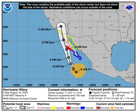 From the NHC as of 8 AM PDT Thursday, August 17, 2023 - 8:17 PM - NHC has now moved the storm somewhat to the east again. Now tracking Tecate north to slightly west Julian. Chances of tropical storm winds in San Diego have decreased. Still we are in the 2-4" of rain zone. Current winds as of 8 PM 125 MPH, forecasted to peak at 150 MPH before rapid weakening. Thursday, August 17, 2023 - 5:23 PM - Hillary is now a major hurricane with winds "near" 120 MPH. The track has shifted a touch back to the west with the average track going right along outside San Diego Bay! As arrival approaches, the variation in the forecast track decreases. Right now certainly looks like this is going to be quite and experience. Loose items need to be secured! The NWS San Diego Area Forecast Discussion is now predicting 2 to 2.5 inches of rain at the coast! 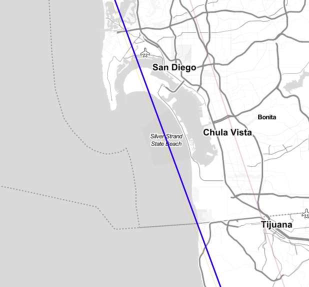 From https://www.cyclocane.com/ spahgetti plot zoom in The blue track is from the National Hurricane Center as of 5PM Pacific Daylight Time Thursday, August 17, 2023 - 11:22 AM - Hillary is now a 105 MPH hurricane and predicted to continue rapidly intensity into a major hurricane (111+ MPH). A large storm is headed this way! I could spend all day posting pictures here, there is no point, I don't have the resources, plenty of websites are providing comprehensive data! https://www.cyclocane.com/ is one of my favorites as is NWS's hurricane.gov. The cluster of paths have shifted a bit to the east and massive amounts of rain are now predicted for the deserts and mountains. Remains to be seen what we will get. At least an inch and gale force winds are likely. 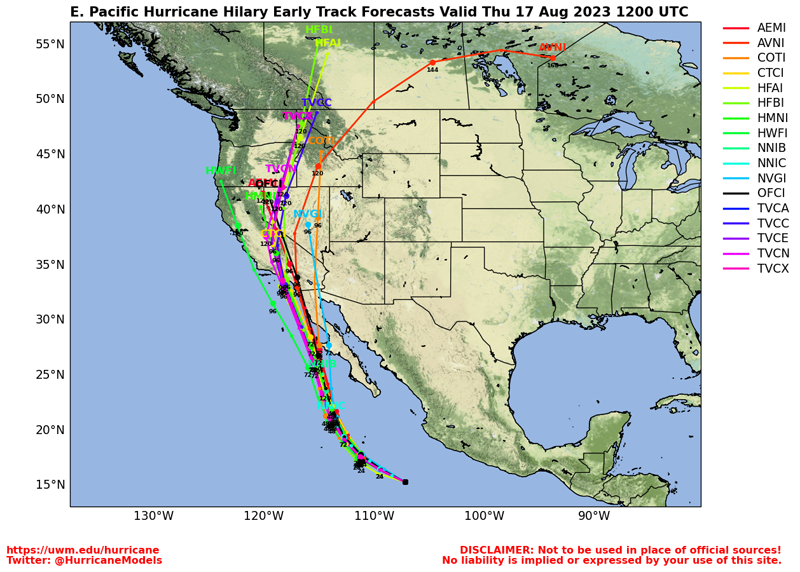 Various forecast tracts as of 8/17/23 12:00 UT Wednesday, August 16, 2023 - 7:09 PM - No significant updates on Hilary, still on track. Looking pretty good for gale force winds on Sunday or Monday. Meanwhile there has been monsoonal activity in SD County. Yesterday Julian received .33", nothing in my other spots I track. Today a bit rain in east county but nothing in Julian. Northeast of here NWS is showing .77" for Big Bear Lake Dam. Wednesday, August 16, 2023 - 9:20 AM - Introducing Hilary. Right now the combined track has the center coming right over us Monday as a tropical strom! Some chance, IMO the track could be adjusted to the east as it has in the past. But maybe not.  National Hurricane Center - 8 AM PDT August 16, 2023 Tuesday, August 15, 2023 - 8:58 PM - The computer models are coming into better agreement that a tropical storm will form and head this way! Still way too early to put numbers on this, particulary the wind and rain. NWS has already put up possible rain of .5 to 1" west of the moutains. The storm will have peaked before it gets in this area. Not just a twinkle in computer eyes... a low pressure is forming. Will continue to monitor. Monday, August 14, 2023 - 8:36 AM - Had a couple trace days last week, one day w/ a couple rain drops and the other with enough to hear it, a strong trace. Of note is that a couple hurricane models (GFS and NAVGEM) suggest there could be a strong tropical storm near here off the coast of Baja a week from now. Currently just a twinkle in computer eyes. Will monitor! Tuesday, August 1, 2023 - 9:38 AM - Trace of rain yesterday as monsoonal moisture from AZ swept west and was squeezed out by the mountains east of here. Last night a band of rain dropped .15"(!)" on Encinitas, but just a trace here. Yesterday Ramona .02", Julian .01". Last night Carlsbad .07", Encinitas .15", See the rain section for my usual monthly update. Tuesday, July 25, 2023 - 4:04 PM - It's about time. Monsoonal clouds over the San Diego mountains! By the way, a couple days ago we had a few scattered large raindrops a couple times during the day. Barely a trace. 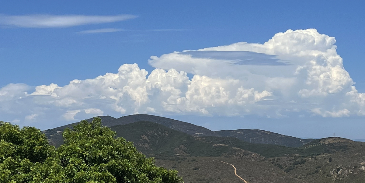 Looking east from Elfin Forest. Today at 2:39 PM Wednesday, July 19, 2023 - 9:09 PM - One of my long term goals here has been to obtain and present Sea Ice data for the Antarctic. I finally have it and for the last couple days have worked with the large data set to develop a chart in the same general format as the one for the Artic Sea Ice. I will be updating this Environment section, dropping "Energy Storage" as I have not been keeping up with that, and adding an Antartic Sea Ice section. Wednesday, July 5, 2023 - 9:12 AM - For the second day in a row the daily average global temperature has set a new record since recording began in 1979. The previous record was 62.46 degrees set on August 16, 2015. On Monday the record was broken with 62.62 degrees, then yesterday smashed with 62.92 degrees. Converted from Celsius. See https://climatereanalyzer.org/clim/t2_daily Wednesday, June 14, 2023 - 11:08 AM - Fog and drizzle this morning: .01" in the gauge. NWS posted again later last Monday, adding .01" to Carlsbad and Ramona. Monday, June 12, 2023 - 10:32 AM - My annual post of methane levels has been delayed as the 2022 data is STILL not out. Previously has been out in March or April. However I read elsewhere that NOAA reported an increase of 14 parts per billion although I did not see a reference to the measuring site. I've decided to use this figure and have updated my charts accordingly and posted them here. See Methane Levels Monday, June 12, 2023 - 8:39 AM - Over the weekend with had several periods of light rain and drizzle, by Saturday morning .06" and ending with .10" total by mid-day Sunday. NWS 2 days totals as of 6:47 AM today: Carlsbad .06", Encinitas .09", San Marcos .04", Escondido .02", San Diego .03", La Mesa .16", Ramona .03", Julian .23". Still a chance of showers this morning then it looks like that's it for the week. Where's Summer? Monday, June 5, 2023 - 4:35 PM - Catching up. On Friday June 2 we had .02" of fog/drizzle. No NWS figures posted. This morning NWS posted figures for the last 12 hours as of 7 AM today. Nothing for the locations I post here. Also nothing here. Thursday, June 1, 2023 - 9:30 AM - Now able to access NWS figures. Since my last post no more dizzle here, nothing in the gauge. NWS 12 hour figures for May 30 9:00 AM: All reported zero except Ramona with .06". NWS 24 hour figures for May 31 9:00 AM: Carlsbad .00", Encinitas .00", San Marcos .00", Escondido .12" (!), San Diego .00", La Mesa .00", Ramona .07", Julian .13". And yes, the first 5 months of this year have been on average the coldest first five months in 52 years! And now, make room for June Gloom. Tuesday, May 30, 2023 - 4:32 PM - More drizzle overnight, another .02" in the gauge. I get a "Could not connect : An error has occurred" when trying to access NWS figures. We've received .17" since the deep May Gray started generating measurable precip on May 22. By the way, May looks to add to the streak of below normal temperatures for every month this year. We are on track for the coldest first five months in 52 years! Monday, May 29, 2023 - 12:52 PM - Just checked the gauge, .06" (was .03" around 7AM) with overnight and morning heavy drizzle and a few drops. Latest NWS figures for 12 hours ended 11:05 AM: Carlsbad .02", Encinitas .01", San Marcos .00", Escondido .05", San Diego .00", La Mesa .00", Ramona .00", Julian .01". Our place on a ridge not far inland appears to be in an ideal spot to pick up measurable water from coastal drizzle as our numbers have been fairly consistant in being more than nearby locations. Still receiving light drizzle. This morning we went to OB dog beach, much less wetness there. Sunday, May 28, 2023 - 11:12 AM - May Gray back in force with .02" fog and drizzle overnight. No figures from NWS. Wednesday, May 24, 2023 - 9:27 PM - Yet again thick fog and drizzle, another .04" in the gauge last night. Cloud heights were better this afternoon with more solar energy reaching the solar panels. The NWS finally decided to post totals, but just for the last 24 hours ending at 2:01 PM this afternoon. Just three of "my" stations had measureable rain - San Marcos .02", Escondido .02", Ramona .01". Tuesday, May 23, 2023 - 12:03 PM - Again very thick fog and drizzle, .04" in the gauge; yesterday's total was .03". Monday, May 22, 2023 - 7:25 AM - May Gray everyday! This morning very thick fog and drizzle, .02" in the gauge. The coastal clouds have kept the unusual monsoon activity out of view. The date for the prior entry here corrected from May 19 to May 10. Wednesday, May 10, 2023 - 3:51 PM - A blob of rain movd from north to south through the county early this morning, nothing here. Later the barest of a trace. No NWS totals. However the California Nevada River Forecast Center precipitation map for SW CA shows 24 hour totals as of 3 PM for some locales: Carlsbad .00", Encinitas .00", San Marcos n/a, Escondido .01", San Diego trace, La Mesa .05", Ramona .01", Julian .09". Saturday, May 6, 2023 - 11:14 AM - Yesterday's scattered showers added .03" here bringing the May 4-5 total to .17". NWS 2 day totals as of 1:25 PM yesterday: Carlsbad .38", Encinitas .18", San Marcos .14", Escondido .25", San Diego .07", La Mesa .16", Ramona .39", Julian .30". Thursday, May 4, 2023 - 6:43 PM - Over night light rain dropped .09' in the gauge and a morning line of showers .05" more for a total of .14". NWS 24 hour totals as of 12:17 PM: Carlsbad .31", Encinitas .06", San Marcos .09", Escondido .35", San Diego .09", La Mesa .16", Ramona .32", Julian .19". There a chance of more showers early tomorrow. Wednesday, May 3, 2023 - 3:31 PM - More light overnight showers, another .03" in the gauge. No posts from the NWS since April 18. Tuesday, May 2, 2023 - 9:05 AM - Had some light showers last night, .03" in the gauge. No posts from the NWS. Monday, May 1, 2023 - 9:00 PM - Some rain in the forecast for later this week, particulay Thursday. It's been 18 days since we've had measurable rain, will be nice to get one more dose before the dry season ramps up. Saturday, April 22, 2023 -11:11 AM - Earlier this week we had some fog and very light drizzle for a couple days of trace. The NWS did post 24 hour figures on April 18 at 9:17AM: San Diego .02" (!), everybody else zero. I've overhauled the Time Lapse Lichen Project page with higher resolution pictures. The webpage address has changed, so you may have to reload to get it.Sunday, April 16, 2023 - 9:02 PM - 20 years ago today I started the Time Lapse Lichen Project. I'm currently working on replacing all the images with higher resolution imagery from my archives as computer screen resolutions are far better than when I started the project. Tomorrow I'll take pictures for the 2023 entry and post that soon afterwards. Later this year I'll publish a series of images within a Time Lapse Moss Project. Thursday, April 13, 2023 -7:05 PM - No additional rain since my .30". Incredible but true it appears I had the highest reading in San Diego County as of NWS's 9:17 AM report! Highest in coastal area: Las Flores .21", highest in valleys: Lower Oat Flats .29", highest in mountains: "Palomar CRS" .23", nothing in the deserts. Here are the regular NWS 12 hour totals as of 9:17 AM: Carlsbad .20", Encinitas .14", San Marcos .11", Escondido .14", San Diego .10", La Mesa .08", Ramona .07", Julian .09". Thursday, April 13, 2023 - 8:55 AM - Light rain most of last night. Gauge as of 8:45 AM has .30" way more than predicted! Nothing from NWS. Wednesday, April 12, 2023 - 7:47 PM - We've had dense fog three mornings running, and the barest of a few scattered drops this afternoon, put it down as a trace. Perhaps three days of trace mounting to .01" in the gauge, but "officially" a trace each day. No NWS updates since the March 31 post. Still waiting for Methane data. Friday, March 31, 2023 - 6:04 PM - No additional rain last night, but NWS did post 3 days totals as of 11:19 AM this morning: Carlsbad .63" (+.12"), Encinitas .49" (unchanged), San Marcos .66" (+.02"), Escondido 1.08" (+.01"), San Diego .44" (+.03"), La Mesa .80" (+.05"), Ramona 1.04" (+.18"), Julian 2.02" (+.58"! and snow). I'll be updating the SD Rain page shortly. Thursday, March 30, 2023 - 6:32 PM ;- A couple more showers brought the gauge to .45". The low has moved south of here off the coast, looks like the rain is over. Gauge emptied. Storm total here now .83". NWS 2 day totals as of 2:48 PM today: Carlsbad .51" (+.09"), Encinitas .49" (+.07"), San Marcos .64" (+.06"), Escondido 1.07" (+.10"), San Diego .41" (+.03"), La Mesa .75" (+.11"), Ramona .86" (+.17"), Julian 1.44" (+.71"! and snow). Thursday, March 30, 2023 - 11:21 AM - Scattered showers with some imbedded very heavy showers has dropped .40" rain since the last post as of 11:12 AM. Storm total here now .78". NWS 2 day totals as of 9:18 AM today: Carlsbad .52" (+.28"), Encinitas .42" (+.15"), San Marcos .58" (+.33"), Escondido .97" (+.67"!), San Diego .38" (+.18"), La Mesa .64" (+.26"), Ramona .69" (+.33"), Julian .73" (+.04" and snow). Wednesday, March 29, 2023 - 8:02 PM - No addtional rain here, storm total remains at .38". NWS 24 hour totals as of 5:47 PM: Carlsbad .24" (unchanged), Encinitas .27" (+.02"), San Marcos .25" (+.03"), Escondido .30" (+.08"), San Diego .20" (+.13"), La Mesa .38" (+.14"), Ramona .36" (+.20"), Julian .69" (+.54"!). The second phase with "shower" rain still on track for later this evening and tomorrow. Wednesday, March 29, 2023 - 4:03 PM - The "stratiform" rain band arrived here around 8AM this morning and has now passed. Gauge recorded .38" as of 3:55 PM. Emptied. NWS 12 hour totals as of 1:46 PM: Carlsbad .24", Encinitas .25", San Marcos .22", Escondido .22", San Diego .07", La Mesa .24", Ramona .16", Julian .15". Saturday, March 25, 2023 - 10:03 AM - NWS did post another 5 day update yesterday morning at 5:06 AM (no addtional rain here): All unchanged except Escondido 2.70" (+.01") , Julian 4.52" (+.16"). Still talk of rain next Wednesday with various solutions. Thursday, March 23, 2023 - 7:12 PM - While the forecast called for another 1/4" from showers today, nothing here. My 5 day storm total remains at 2.21". March now comes to 6.66" and the year to date 18.55"!!! NWS posted new 5 day totals as of 4:36 PM: Carlsbad 1.89" (+.12"), Encinitas 1.78" (+.03"), San Marcos 1.70" (+.14"), Escondido 2.69" (+.16"), San Diego 1.34" (+.08"), La Mesa 1.90" (+.18"), Ramona 2.65" (+.18"), Julian 4.36" (+.29"). NWS currently says that the next storm may be here late Tuesday into Wednesday. No numbers or probability. Thursday, March 23, 2023 - 8:47 AM - The drought is over! Locally. This week's Drought Monitor report has western San Diego County as "none", for the first time in quite some time. Early this morning we had 2 more very heavy showers from the green blobs on the radar: .31" since my last post in the gauge at 6:30 AM bringing the 5 day storm total to 2.21". NWS posted 5 day totals as of 5:06 AM, before the most recent downpour: Carlsbad 1.77", Encinitas 1.75", San Marcos 1.56", Escondido 2.53", San Diego 1.26", La Mesa 1.72", Ramona 2.47", Julian 4.07". Showers are still in the forecast until this evening. Wednesday, March 22, 2023 - 6:29 PM - Just a couple spritzes today as of 6:20 PM adding .02", bringing the 4 day total here to 1.90". Gauge emptied. NWS posted 4 day totals as of 5:50 PM: Carlsbad 1.69", Encinitas 1.68", San Marcos 1.50", Escondido 2.27", San Diego 1.23", La Mesa 1.70", Ramona 2.24", Julian 3.73". Showers are still in the forecast for tonight and tomorrow morning. Wednesday, March 22, 2023 - 7:59 AM - A heavy band of rain fell early yesterday evening dropping .19" followed by scattered showers overnight with a particularly intense shower at 5:30 this morning with small hail adding another .17" bringing the third wave total to .36" and 3 day storm total to 1.88". Some of the hail may have bounced out of the gauge. NWS posted 3 day totals as of 5:04 AM: Carlsbad 1.60", Encinitas 1.66", San Marcos 1.41", Escondido 2.09", San Diego 1.23", La Mesa 1.70", Ramona 2.13", Julian 3.47" (!) 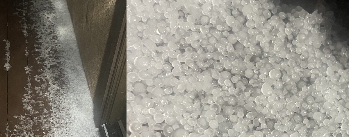 Drift of hail this morning, hailed for about 3 minutes Tuesday, March 21, 2023 - 5:19 PM - The morning wave of rain ended here around 11:30, final total here 1.21" with 2 day total at 1.52". A large area of rain is now approaching, the third wave. NWS posted 2 day totals as of 1.49 PM, getting the first two waves of rain: Carlsbad 1.34", Encinitas 1.45", San Marcos 1.24", Escondido 1.66", San Diego 1.00", La Mesa 1.21", Ramona 1.43", Julian 2.12". Tuesday, March 21, 2023 - 11:05 AM - As of 10:55 AM 1.15" rain here, 2 day total 1.46". Very windy now, light to moderate rain. NWS has posted 2 day totals as of 9:18 AM: Carlsbad 1.05", Encinitas 1.24", San Marcos 1.05", Escondido 1.21", San Diego .74", La Mesa .78", Ramona .91", Julian 1.26". Tuesday, March 21, 2023 - 9:22 AM - The forecasted atmospheric river arrived this morning, with heavy rain here! What a year! .72" new rain as of 7:40 AM and .97" as of 9:06 AM. Winds have picked up as the cold front approaches. Monday, March 20, 2023 - 9:17 PM - Just a trace here since my last post. NWS posted 24 hour figures as of 4:47 PM: Carlsbad .19", Encinitas .36", San Marcos .18", Escondido .16", San Diego .17", La Mesa .15", Ramona .09", Julian .44". Monday, March 20, 2023 - 2:05 PM - Drizzle ended a couple hours ago with lifting fog but no sun. .31" final read for this phase, gauge emptied! No NWS totals since 5:17 AM. Monday, March 20, 2023 - 8:35 AM -Thick fog, drizzle here, light rain earlier. .30" in a gauge as of 8:36 AM more than predicted! The ground is so saturdated. NWS posted 24 hour figures as of 5:17 AM: Carlsbad .18", Encinitas .34", San Marcos .16", Escondido .14", San Diego .13", La Mesa .13", Ramona .11", Julian .37". Big storm with strong winds still on track for tomorrow, with 1.5 to 2" predicted for the coast, more in the mountains. Wow! Sunday, March 19, 2023 - 8:44 PM - Raining again. We had several very light sprinkles during daytime, with trace amounts. A couple hours or so ago a steady light rain developed and is continuing. Just now .08" in the gauge. No NWS totals posted and they did not do final totals for the previous storm as rain did fall after their last post of 5:45 PM March 15. NWS is currently predicting another atmospheric river peaking on Tuesday afternoon/evening with event totals of 1.5 to 2.5" along the coast! Thursday, March 16, 2023 - 12:22 / 1:29 PM - I've been updating and rearranging the graphics at the top and bottom of these environment pages. Please select "reload" or similar from your browser to get the latest graphics and code if you are experiencing strange linking! The "Temperature" graphic is a partial photo of a neat old mercury thermometer I have. The Arctic Sea Ice picture is from a picture I took long ago from near Tierra del Fuego, oops, someday I'll get to the Arctic. Still waiting for 2022 methane data. Thursday, March 16, 2023 - 10:45 AM - As of 9:40 AM .12" more in the gauge thanks to drizzly fog and scatter showers last night bringing our storm total 2.88". Still murky here and no more drizzle. The NWS has not updated since yesterday's note. Talk of another storm next Tuesday. Still early for full confidence. Wednesday, March 15, 2023 - 6:06 PM - As of 5:55 PM .13" more in the gauge bringing our total is 2.76". Thick fog here with light mist. NWS just posted 2 day figures as of 5:45 PM so again comparables are there: Carlsbad 2.73" (+.05"), Encinitas 2.21" (+.03"), San Marcos 2.55", (+.03") Escondido 2.75" (+.13"), San Diego 1.05" (+.03"), La Mesa 1.52" (+.12"), Ramona 1.90" (+.11"), Julian 2.44" (+.64"!) I found an interesting link with average annual rain lines for San Diego County. The airport has about 10" per year, our place somewhere between 14-15"! I had no idea there was this much difference. See San Diego County rain map. Guess there is no point in "dogging" SD Airport!Wednesday, March 15, 2023 - 9:34 AM - RAIN, RAIN, RAIN, RAIN, RAIN! Did I say RAIN? Glad to be back after whirlwind visiting relatives in Philadelphia, New York, and Boston! (First trip there since Covid). OK, last night at 8:30 PM there was .16" in the gauge. Didn't empy it. This morning at about 7:15 AM 2.29" in the gauge, emptied it. Then at 9:15 AM after yet more heavy rain, another .34" didn't empty it. So the latest storm total is 2.63" in well under 24 hours. I'm quite sure that is the most I've experienced within 24 hours in at least 10 years! Light rain still falling. NWS just posted 2 day figures as of 9:19 AM so comparables are there: Carlsbad 2.68", Encinitas 2.18", San Marcos 2.52", Escondido 2.60", San Diego 1.02" (yep the dog), La Mesa 1.40", Ramona 1.79", Julian 1.80". So some of the locales near me (Carlsbad, San Macros and Escondido almost exactly the same!) Palomar Observatory leading with 4.55". Tuesday, March 14 2023 - 9:02 PM - I've been away for the past four days, now back escaping a major nor'easter in Boston! I'll deal with the last storm here and focus on the current storm tomorrow. I had my gauge independantly monitored. We had 1.01" here March 10-11. NWS 2-day totals for this period as of 6:03 PM March 11 were: Carlsbad 1.14", Encinitas 1.15", San Marcos 1.11", Escondido 1.09", San Diego .88", La Mesa .84", Ramona .75", Julian 1.07". The current storm is projected to dump 1.25 to 2.5" along the coast and more in the mountains, rain is progress with .16" here as of 30 mintues or so ago. Wednesday, March 1 2023 - 8:27 PM - No change here, NWS posted 3 day totals as of 6:45 PM with no changes except La Mesa 1.04" (+.05"), Ramona 1.23" (+.02") and the return of Julian at 2.62". Brrrrr. Wednesday, March 1 2023 - 6:10 PM - Extremely windy this afternoon with no measurable increase in the .56" figure and .73" 2-day total. NWS 2 day figures as of 1:33 PM: Carlsbad 1.07" (+.04"), Encinitas .38" (no change), San Marcos .60" (+.02"), Escondido 1.14" (+.13"), San Diego .22" (+.10"), La Mesa .99" (+.14"), Ramona 1.21" (+.13"). Wednesday, March 1 2023 - 11:21 AM - This weather is keeping me busy! Rain began again last night, heavy at times, and has now turned into showers with brief downpours and winds gusting over 40 MPH. First of all I found out that in the first wave of rain posted yesterday that Julian received .56" and I have posted this to yesterday's entry. For the current storm, the NWS is combining figures with yesterday as a 2 day total and continuing to leave out Julian, so no more NWS Julian totals until the NWS resumes including Julian in their totals. My gauge has .56" new rain, 2 day total .73". NWS 2 day figures as of 9:48 AM: Carlsbad 1.03" (+.90"), Encinitas .38" (+.27)", San Marcos .58" (+.40"), Escondido 1.01" (+.76"), San Diego .12" (+.11" this chronic underdog getting just plain weird), La Mesa .85" (+.75"), Ramona 1.06" (+.87"). CA/NV river center is saying Julian has received 2.18" in the last 24 hours as of 11 AM. I'll be posting monthly figures in the Rain section soon. Tuesday, February 28 2023 - 5:03 PM - Several rain cells passed over us last night and this morning, .17" in the gauge after today's clearing. NWS post 24 hour figures as of 10:02 AM: Carlsbad .13", Encinitas .11", San Marcos .18", Escondido .25", San Diego .01" (yep the laggard yet again) , La Mesa .10", Ramona .19", Julian .56". Sunday, February 26 2023 - 6:35 PM - No additional rain here, 5 day total remains at 2.80". NWS updated 5 day totals again today at 10:51 AM: Carlsbad 3.31" (+.15"), Encinitas 2.15" (+.02"), San Marcos 2.13" (+.04"), Escondido 2.93" (+.10"), San Diego 1.27" (+.07"), La Mesa 2.23" (+.09"), Ramona 2.77" (+.07"), Julian 2.46" (unchanged). Sunday, February 26 2023 - 10:05 AM - A strong band late evening and a brief one early morning brought the 5 day total here to 2.80". NWS 5 day total as of 1:12 AM: Carlsbad 3.16" (+.38"), Encinitas 2.13" (+.18"), San Marcos 2.09" (+.23"), Escondido 2.83" (+.43"), Laggard San Diego 1.20" (+.13"), La Mesa 2.14" (+.27"), Ramona 2.70" (+.41"), Julian 2.46" (+.22" but with snow). Saturday, February 25 2023 - 7:52 PM - Around 4:30 PM we had another burst of heavy rain and a few light showers afterwards. Total for the day 2.02" and 2.68" for the 4 day period. NWS hasn't posted to reflect the last wave of rain, will check in tomorrow. Saturday, February 25 2023 - 1:01 PM - The steady rain is over, having showers now. The low is just off the coast and satellite shows wrap around moisture in progress, showers will continue. .27" more rain here as of 12:20, bringing today's total to 1.82" and the 4 day total to an epic 2.48". Coincidentally the NWS posted at the same time as my read at 12:20 PM: Carlsbad 2.78" (+.66"), Encinitas 1.95" (+.58"), San Marcos 1.86" (+.47"), Escondido 2.41" (+.43"), San Diego 1.07" (+.48"), La Mesa 1.87" (+.65"), Ramona 2.19" (+.61"), Julian 2.24" (+.13" but with snow). Saturday, February 25 2023 - 9:50 AM - Steady moderate with some heavy rain here, another .47" at of 9:40 AM! Our 4 day total now 2.21". Looks like the back end of the swath of rain is about 2 hours away . NWS 4 day totals as of 8:35 AM: Carlsbad 2.12" (+.40"), Encinitas 1.37" (+.34"), San Marcos 1.39" (+.25"), Escondido 1.98" (+.38"), San Diego .59" (+.23"), La Mesa 1.22" (+.32"), Ramona 1.58" (+.24"), Julian 2.11" (+.12" but with snow). Bear Mountain Snow Summit 57" of snow! Saturday, February 25 2023 - 7:25 AM - Patience grasshopper! Heavy rains arrived here with the frontal passage which occurred around 4:20 AM. As of 7:10 AM 1.08" of new rain here, bringing our 4 day total to 1.74". NWS 4 day totals as of 6:20 AM: Carlsbad 1.72" (+.93"), Encinitas 1.03" (+.83"), San Marcos 1.14" (+.69"), Escondido 1.60" (+.63"), San Diego .36" (+.19"), La Mesa .90" (+.25"), Ramona 1.33" (+.17"), Julian 1.99" (+1.03"). The NWS figures will certainly increase as they were 50 minutes before my reading and much more to come! NWS snow figures haven't been updated. Friday, February 24 2023 - 8:27 PM - OK. Feeling the need to say it. Where's the storm? Leading edge stuck all day in the LA / Irvine area, nothing here except the stalled advanced winds. In the early afternoon discussion, coastal rain was pared back from 2-3" to 1.5-2.5". Hmmm. There is a big storm out there, Bear Mountain Snow Summit reporting 45" of snow as of 5:19 PM! Friday, February 24 2023 - 9:02 AM - .13" overnight here, bringing the 3 day total to .66". NWS 3 day totals as of 8:40 AM: Carlsbad .79" (+.20"), Encinitas .20" (+.01"), San Marcos .45" (+.10"), Escondido .97" (+.14"), San Diego .17" (+.07"), La Mesa .65" (no change), Ramona 1.16" (+.24), Julian .96" (+.08"). The onset of the storm has been pushed back, still calling for 2-3" of rain along the coast before it is over Sunday. Thursday, February 23 2023 - 8:28 PM - As of about 5 PM my gauge was at .43" up .08" from this morning's .35". The NWS posted "2 day" totals as of 6:03 PM, my comparable I think includes the prior .10" or .53". Carlsbad .59" (+.24"), Encinitas .19" (+.04"), San Marcos .35" (+.04"), Escondido .83" (+.08"), San Diego .10" (no change for the laggard), La Mesa .65" (+.10), Ramona .92" (+.43!), Julian .88" (+.09") but Julian has 10" of snow! Hensaw Dam 2.12" of water, Big Bear Snow Summit 37" snow and the big storm hasn't even started! Thursday, February 23 2023 - 10:21 AM - Double header post here: Yesterday morning my gauge read .10" up .01" from previous reading. The comparable NWS totals posted as of 8:30 AM yesterday: Carlsbad .03", Encinitas .04", San Marcos .02", Escondido .05", San Diego .02", La Mesa .08", Ramona .08", Julian .44" We had a period of fairly heavy rain this morning, .35" new rain in the gauge as of 8:15 AM (rain had stopped, although we've had new showers since then). The NWS posted totals as of 8:03 AM, but they are 2 day totals, so they include the above totals: Carlsbad .35", Encinitas .15", San Marcos .31", Escondido .75" (!), San Diego .10" (laggard yet again), La Mesa .54", Ramona .49", Julian .79". Our comparable then is .45". Julian is receiving a lot of snow already. Huge amounts of rain and snow predicted for late Friday into the weekend.Tuesday, February 21 2023 - 8:34 PM - Very light showers this afternoon, a steadier band went through in the past hour: .09" in the gauge. Been breezy but nothing special. No precipitation summary posted by the NWS. Monday, February 20 2023 - 9:23 AM - Yesterday afternoon we received a trace of scattered raindrops from a closed low meandering north to the west of Baja. No precipitation summary posted by the NWS. The 24 hour map at the CA River Forecast Center does show a trace at the SD Airport and at Ramona. Meanwhile a major windstorm is predicted for tomorrow night! A cold rainy pattern could last into the weekend with over 2" of rain total! Lot of snow predicted for the mountains including Julian. I was here in January 1988 when a storm hit SD stronger than any since as far as I know. Trees downs, a dead seal in the living room of a flooded Mission Bay home thanks to massive tides. The NWS says that storm set a record "west wind" gust of 55 MPH at the airport and that this record could tied! Wednesday, February 15 2023 - 9:25 PM - Late yesterday a brief burst of rain added .06", bring our event total to .07". NWS figures as of 10:05 AM today: Carlsbad .01" (unchanged), Encinitas .00" (unchanged), San Marcos .02" (+.02"), Escondido .06" (+.04"), San Diego .04" (unchanged), La Mesa .07" (+.02"), Ramona .17" (+.16"!), Julian .70" (+.38"!). I discovered that the main Arctic Sea Ice graphic wasn't showing up. Error was there for 1 1/2 months, does anyone care? Meanwhile I replaced the micro chart for the San Diego Sea Levels graphic to a photo I took 13 years ago, I'll gradually add more graphics. Meanwhile I'm still waiting for 2022 Methane data. Tuesday, February 14 2023 - 4:47 PM - Cold and dreary all day with some very light rain and drizzle. .01" in the gauge as of 3:30 PM. NWS figures as of 3:37 PM: Carlsbad .01", Encinitas .00", San Marcos .00", Escondido .02", San Diego .04", La Mesa .05", Ramona .01", Julian .32" (!). Monday, February 13 2023 - 10:27 AM - Yesterday evening I was in Escondido and it was pouring rain, and when I got back to home the ground was dry! Rain soon caught up with us. This morning .24" storm total in the gauge. There was more rain to the south. NWS figures as of 5:03 AM: Carlsbad .21", Encinitas .20", San Marcos .21", Escondido .33", San Diego .45", La Mesa .52", Ramona .41", Julian .10". Tuesday, February 7 2023 - 9:29 AM - Over the weekend, on Sunday, we had a trace of drizzle / light rain. The NWS posted totals, Ramona Airport scored .01", the other locales nothing measurable. Tuesday, January 31 2023 - 5:51 PM - Clear today, no additional rain last night, final storm total here remains at .63". The NWS 2 day totals as of 5:03 AM today: Carlsbad .69" (no change), Encinitas .66" (no change), San Marcos .56" (+.02"), Escondido .77" (no change), San Diego .34" (+.05"), La Mesa .43" (+.05"), Ramona .63" (no change), Julian 1.12" (+.42!). San Diego Sea Level data for the year is in, I'll be updating it tonight. Edit: Now updated. Also updated the Nitrous Oxide Levels chart for the first time in two years. Only the Methane Levels chart remains to be updated - data not yet released for 2022. Monday, January 30 2023 - 6:55 PM - Light showers continued in the morning then steady and heavier rain started around 1:30 and continued for about an hour. As of 5:30 the gauge was up to .63" with no rain since then. The NWS 2 day totals as of 5:33 PM: Carlsbad .69", Encinitas .66", San Marcos .54", Escondido .77", San Diego .29" (the laggard yet again), La Mesa .38", Ramona .63", Julian .70". Some snow is falling in Julian now. Monday, January 30 2023 - 8:43 AM - Low pressure heading south off the coast is bringing rain with an easterly component. Winds have been from the northeast here. We had some drizzle yesterday morning and light rain later with the gauge at .09" by late evening. As of 8:21 AM the total reached .30". The NWS 2 day totals as of 5:18 AM: Carlsbad .30", Encinitas .25", San Marcos .22", Escondido .05", San Diego .09", La Mesa .11", Ramona .19", Julian .40". Snow levels are predicted to get as low as 2500 feet! Friday, January 20 2023 - 10:09 AM - I was near downtown San Diego last night, there was surprisingly heavy rain for 10-15 minutes. At our gauge, .07". The NWS 12 hour totals as of 4:00 AM: Carlsbad .08", Encinitas .07", San Marcos .11", Escondido .00" (!), San Diego .17" (the coastal winner!), La Mesa .04", Ramona .08", Julian .20" with some snow. Looks like we have at least a week of rainfree weather ahead of us. Tuesday, January 17 2023 - 8:58 AM - Couple sprinkles overnight, final gauge read 2.29", 3 day total 4.41". The NWS 3 day totals as of 6:50 AM: Carlsbad 3.99" (+.07"), Encinitas 3.85" (+.02"), San Marcos 3.82" (+.03"), Escondido 5.59" (+.20"), San Diego 2.77" (+.12"), La Mesa 4.49" (+.09"), Ramona 4.96" (+.22"), Julian 7.71" (+.47" with some snow). No new atmospheric rivers in the forecast! Quite a few state reservoirs are back to normal levels for this time of the year, Lake Mead has barely budged from its very low level. Monday, January 16 2023 - 8:20 PM - No change here, some very light drizzle ths evening, gauge remains at 2.27". The NWS did make one more post as of 1:49 PM: Carlsbad 3.92" (+.01), Encinitas 3.83" (no change), San Marcos 3.79" (no change), Escondido 5.39" (+.01"), San Diego 2.65" (+.08"), La Mesa 4.40" (+.01"), Ramona 4.74" (+.04"), Julian 7.24" (+.38"). Monday, January 16 2023 - 12:04 PM - The rained ended here about 40 minutes ago (showers to come). At 11:30 AM my gauge was at 2.27" for a 2 day total of 4. 39"! Coincidentally the NWS posted 2 day totals at 11:33 AM: Carlsbad 3.91", Encinitas 3.83", San Marcos 3.79", Escondido 5.38", San Diego 2.57", La Mesa 4.39", Ramona 4.70", Julian 6.86"! Both the Escondido Creek and the San Diego River have flooded in low lying areas. Palomar Observatory led the totals at 11.28"!!! I'll do one more post here today late this evening. Monday, January 16 2023 - 8:30 AM - Just a quick note that heavy rain passed through here, gauge is up to 2.15" for this storm passing yesterday's 2.12"! Monday, January 16 2023 - 7:27 AM - Heavy rain last night! Getting personal with water leaking into a partially underground room. 7 AM reading 1.79" in the gauge since mid-day yesterday, 2 day total now 3.91", still raining. The NWS posted totals as of 5:33 AM, those figures here with differentials from the first storm posted by the NWS at 5:10 AM yesterday to compare with my 1.79": Carlsbad 3.66" (+1.74"), Encinitas 3.44" (+1.92"), San Marcos 3.27" (+1.62"), Escondido 4.81" (+2.28"), San Diego 2.27" (+1.51"), La Mesa 3.93" (+2.55!"), Ramona 3.89" (+1.41"), Julian 5.83 (+2.32"). Rain is forecasted to continue, more showery, into tomorrow. Totals will approach those during the epic rains of April 2020. Sunday, January 15 2023 - 8:12 PM - Light afternoon rain turned moderate and steady this evening. Just checked the gauge, we have .43" of rain so far today, 2 day total now 2.55". The NWS continues combine their figures, last updated 6:33 PM, I'm showing their numbers 6:33PM numbers with differentials since their 5:10 AM report: Carlsbad 2.08" (+.16"), Encinitas 1.78" (+.26"), San Marcos 1.82" (+.17"), Escondido 2.87" (+.34"), San Diego 1.00" (+.24"), La Mesa 1.91" (+.53"), Ramona 2.67" (+.29"), Julian 4.06 (+.55"). Sunday, January 15 2023 - 11:48 AM - Showers, some quite heavy, continued into late evening last night. This morning at 7:00 AM 2.12" here! Only very light showers / drizzle since then. NWS storm figures as of 5:10 AM: Carlsbad 1.92", Encinitas 1.52", San Marcos 1.65", Escondido 2.53", San Diego .76" (trailing the pack, again), La Mesa 1.38" , Ramona 2.48", Julian 3.51" (a huge increase - the storm "wash up" on the moutains). I've emptied my gauge this morning in preparation for the current system expected to end sometime Tuesday. Saturday, January 14 2023 - 8:40PM - My gauge as of 8:20PM is up to 1.4"! Moderate rain continues to fall. NWS has posted figures as of 8:00 PM: Carlsbad 1.37", Encinitas 1.10", San Marcos 1.27", Escondido 1.60", San Diego .54", La Mesa .86", Ramona 1.22", Julian 1.44". Saturday, January 14 2023 - 7:09PM - Well on the backside of first storm, a couple more hours perhaps of light rain. My gauge as of 6:55PM is up to 1.27"!: NWS has posted figures as of 6:01 PM: Carlsbad 1.26", Encinitas 1.00", San Marcos 1.15", Escondido 1.41", San Diego .35", La Mesa .48", Ramona .71", Julian .69". San Diego Airport's consistently low recent figures are what will into my rainfall page... we know we are getting more rain than their recent figures! Saturday, January 14 2023 - 4:58 PM - Rain! Looks like the peak of the first of two storms is upon us locally with fairly heavy rain in progress. .81" in the gauge as of 4:45 PM. NWS has posted figures as of 3:46 PM about an hour before my reading, obviously these figures will go up particularly to east: Carlsbad .41", Encinitas .24", San Marcos .32", Escondido .46", San Diego .02", La Mesa .05", Ramona .12", Julian .14".  Vivid ring around the sun yesterday afternoon (wide angle shot) - called it a portent of the storm! Thursday, January 12, 2023 - 9:50 PM - Carbon Dioxide Levels updated. Monday, January 9, 2023 - 7:23 PM - Skies slightly cleared to the west around sunset, no addtional rain here. Our total remains at .75". Looks like sunny weather for the next few days and then weekend rain as the storm track shift further south into Socal. NWS figures as of 4:49 PM: Carlsbad .73" (+.10"), Encinitas .40" (+.04"), Escondido .75" (+.09") San Diego .20" (+.16"), La Mesa .33" (+.22"), Ramona .50" (+.23"), Julian 1.50" (+.90"!!!). Monday, January 9 2023 - 3:20 PM - Excellent squall line - dumped .31" bringing total to .64" then light rain after than brought our total to .75". No rain falling now. NWS figures as of 2:04 PM: Carlsbad .63" (+.33"), Encinitas .36" (+.24"), Escondido .66" (+.30") San Diego .04" (+.01"), La Mesa .11" (+.01"), Ramona .27" (+.15"), Julian .60" (+.39"). To the north, much higher amount, the local leader being Middle Lytle Creek in the San Bernardino Mountains with 7.15". A squal line is just entering NW San Diego County now. Monday, January 9, 2023 - 11:50 AM - California's historically massive rains continue, some areas well to the north have received over a foot of rain in the last 24 hours! San Diego county is amongst the driest places, still we are getting rain. Just checked my gauge, .33" here. NWS posted "3 day" figures as of 9:04 AM (we had about .22" at that time): Carlsbad .30", Encinitas .12", Escondido .36", San Diego .03" (suffering the tail again), La Mesa .10", Ramona .12", Julian .21". To the north, much higher amount, the local leader being Middle Lytle Creek in the San Bernardino Mountains with 7.15". A squall line is just entering NW San Diego County now. Monday, January 9, 2023 - 9:03 PM - Where is the big storm which was to hit tonight and into tomorrow? Central and northern California were inundated yet again... but... the current storm's tail made it down as far as Los Angeles and stopped short of Irvine. Doesn't look like it will make it here. What's left for here is to look for instability spotty rains tomorrow. Still talk of another storm this Saturday or Sunday. Friday, January 6, 2023 - 9:06 PM - The NWS posted 2-day hour totals as of 10:03 AM today to get the straggler showers from yesterday evening (no change in my gauge): Carlsbad .36" (+.07"), Encinitas .47" (+.07"), Escondido .74" (+.13"), San Diego .24" (+.02"), La Mesa .52" (+.21") , Ramona .46" (+.10"), Julian .86" (+.14"). Not sure what the NWS is doing here, as all locations increased but nothing here. By jumping the time period to 2 days but moving the timestamp forward by only one half day, they are grabbing some older precip. Shrug. Thursday, January 5, 2023 - 9:29 PM - OK one more time! No further rain here, total remains at .43". The NWS has posted 24 hour totals as of 6:02 PM : Carlsbad .29" (+.01"), Encinitas .40" (+.01"), Escondido .61" (+.04"), San Diego .22" (+.01"), La Mesa .31" (+.02") , Ramona .48" (+.02"), Julian .72" (+.17"). Still a few scattered showers in the county. Since December 27, we've had here .80", 1.82", .52" and now .43". Grand total 3.57"! Since December 1, 4.65". Since September 7.15". Thursday, January 5, 2023 - 1:50 PM - .24" more has fallen here since my last post, the total for today is .43". The sun is trying to come out! NWS 12 hour totals as of 1:16 PM: Carlsbad .28", Encinitas .39", Escondido .57", San Diego .21", La Mesa .29", Ramona .36", Julian .55". Thursday, January 5, 2023 - 9:51 AM - A strong wave moved through here @ 3:45 AM with high winds and heavy rains lasting 5-10 minutes. .09" here from the squall and .10" from this morning's stready rain bringing the total for the new storm to .19" here. The NWS never did post rains for yesterday. They have posted 4 times already today, 5 AM for 6 hours, 6:15 AM for 12 hours, 8:01 AM for 12 hours and 9 AM for 12 hours. So the NWS totals for 9:00 AM should be comparable as the rains recently paused here. Carlsbad .14", Encinitas .19", Escondido .21", San Diego .01" (suffering the tail) , La Mesa .04", Ramona .08", Julian .07". Wednesday, January 4, 2023 - 3:30 PM -The drizzle and light rain ended a few hours ago, .17" total since last evening, .52" in the last two days. No figures from the NWS since last evening. Forecast for the coming storm calls for .5" to 1" along the coast, more inland, and more to the north. Wednesday, January 4, 2023 - 8:18 AM - Drizzle and light rain continues with .07" since last evening . The NWS posted figures at 9:31 PM yesterday but for just the previous 12 hours, so my NWS figures here are combining with the previous 12 hour report to compare with the .35" total I posted yesterday evening after the rain break: Carlsbad .23" (+.15"), Encinitas .42" (+.23"), Escondido .40" (+.29"), San Diego .27" (+.09"), La Mesa .13" (+.07"), Ramona .28" (+.15), Julian .34" (.19"). Now a major storm has begun in northern and centeral California and it remains to be seen how the NWS will group the ongoing rain. For the time being I'll count my .07" as part of the forerunning rain from the on coming storm, but will adjust according to what the NWS does. Tuesday, January 3, 2023 - 8:42 PM - Drizzle and light rain pretty much all day up to a couple hours ago. Rain total up to .35" since yesterday afternoon. The NWS has not posted figures since this morning. Tuesday, January 3, 2023 - 9:27 AM - Light rain last night has brought the total "storm" amount here to .11" as of around 7AM. NWS 12 hour figures as of 6:30 AM: Carlsbad .08", Encinitas .19", Escondido .11", San Diego .18", La Mesa .06", Ramona .13", Julian .15". Monday, January 2, 2023 - 9:21 PM - So far the "next storm" has been a slow starter. Light swatches of rain off the coast breaking up and dissipating as they move inland. Do have .03" in the gauge NWS no totals posted so far. Monday, January 2, 2023 - 7:25 AM - Final storm total here 1.82"! The NWS has posted 3-day storm totals as of 5:05 AM: Carlsbad 1.80", Encinitas 1.71", Escondido 2.63" (!), San Diego 1.06", La Mesa 1.39", Ramona 3.29" (!!), Julian 5.42" (!!!). Certainly local reservoirs must be very happy. By the way Lake Cuyamaca received 5.34". Also of note, yesterday afternoon was particularly windy here. The Elfin Forest SDGE weather station reported peak winds of 28 mph and a peak gust of 41 mph at 2:20 PM. Sunday, January 1, 2023 - 9:52 PM - I've updated the Arctic Sea Ice chart for 2022 in addtion to Rain and Temperature. Meanwhile we have received an additional .16" in showers since my last post. I be posting an update tomorrow morning. Sunday, January 1, 2023 - 1:36 PM - Happy New Year and what a way to start it! The 4th rainstorm of the season hit here full force right around midnight. Including the .02" posted yesterday leading up to the storm, 1.60" in the gauge! NWS has posted 2 day totals as of 8:03 AM: Carlsbad 1.49", Encinitas 1.60", Escondido 1.85", San Diego 1.03", La Mesa 1.26", Ramona 1.61", Julian 2.00". Only .02" of San Diego's rain fell in 2022. I will be posting monthly and annual rain totals on my rain page (as usual) shortly and later this afternoon, annual temperature data, with commentary on both. Saturday, December 31, 2022 - 8:40 - The 4th rainstorm of the season approaches! Currently reaching Los Angeles. So far just some drizzle and very light rain here, .02" in the gauge. NWS has posted 12 hour totals as of 4PM: Carlsbad .02", Encinitas .02", Escondido .01", San Diego .01", La Mesa .01", Ramona .00", Julian .02". I was hoping the current low figure for the year 2022 would get a nice bump today, but instead will start off January. Friday, December 30, 2022 - 8:29 PM - I have been away at Big Bear Lake for the past few days and will now get caught up here! For the nice rainstorm of December 27-28 we had .80" in our Elfin Forest gauge. NWS 2 day storm totals as of 4:48 PM Wednesday December 28: Carlsbad .75", Encinitas .77", Escondido .81", San Diego .62", La Mesa .77", Ramona .79", Julian .89". Overall a rather uniform coverage! Today thick low clouds covered most of the county particularly piling up against the mountains - we encountered some light drizzle on the return trip. Just a trace here. The NWS has posted 24 hour figures as of 4:47 PM: Zero for my list except Ramona .03" and Julian .09". The fourth storm of the season is approaching and is expected to hit late tomorrow with .75 to 1.5" along the coast! We'll see how much of that can be added to the below normal total for 2022. Wednesday, December 14, 2022 - 9:24 AM - I was premature in posting "final" storm totals as we had another .02" yesterday morning. True final storm total here 1.07 (+.02"). NWS offical final storm totals as of 2:04 PM yesterday: Carlsbad 1.02" (+.01"), Encinitas .80" (unchanged), Escondido 1.18" (+.01"), San Diego .92" (+.01"), La Mesa .99" (+.07"), Ramona 1.27" (+.01"), Julian 2.43" (+.77"). No rain in the forecast. Monday, December 12, 2022 - 8:13 PM - Final storm totals. Here, unchanged at 1.05". NWS storm totals as of 12:33 PM today: Carlsbad 1.01" (unchanged), Encinitas .80" (+.01"), Escondido 1.17" (+.04"), San Diego .91" (+.06"), La Mesa .92" (+.07"), Ramona 1.26" (+.04"), Julian 1.66" (+.03"). Talk of more rain this next weekend has been "removed". Monday, December 12, 2022 - 11:58 AM - Late yesterday a light shower, then this morning, lightning and thunder with a short period of heavy rain, bringing our total to .99", then a couple hours later a strong line of cells broke up and we received .06" bringing our current storm total to 1.05". Very nice. NWS storm totals as of 10:03 AM today: Carlsbad 1.01", Encinitas .79", Escondido 1.13", San Diego .85", La Mesa .85", Ramona 1.22", Julian 1.63". A Julian webcame showed heavy snow an hour or so ago, so their water equivalent figure may be higher. Mesa Grande led the county all-rain total with 2.47". Palomar Observatory had 2.35" with snow. Sunday, December 11, 2022 - 4:58 PM - The NWS nailed this one! Light rain became heavier with the passage of the front then persisted for a while before ending mid afternoon. More showers to come! .69" here. NWS figures as of 3.17 PM today: Carlsbad .65", Encinitas .43", Escondido .69", San Diego .45", La Mesa .48", Ramona .58", Julian 1.13". Palomar led the country with 2.28". Thursday, December 8, 2022 - 8:14 PM - Big rain predicted for this Sunday! Forecast numbers are posted showing .75 to 1.5" along the coastal area and windy. Rain gauge ready! Meanwhile I didn't post the light showers which occurred this past Tuesday. The NSW posted 3 days totals as of 5.04 AM December 7. We had just .01" additional for a total of .02". NWS totals: Carlsbad .01" (+.01"), Encinitas .03" (+.02"), Escondido .03" (+.03"), San Diego .01" (+.01"), La Mesa .02" (+.02"), Ramona .07" (+.07"), Julian a hefty .18" (+.09"). Monday, December 5, 2022 - 7:53 PM - Received a short period of light rain this morning. .01" in the gauge. The gauge had been knocked askew so maybe we had .02": NWS 24 hour totals as of 7:02 AM: Carlsbad .00", Encinitas .01", Escondido .00", San Diego .00", La Mesa .00", Ramona .00", Julian a hefty .09". Getting a little sprinkle now from the next system, a trace so far. Thursday, December 1 , 2022 - 11:13 AM - Brrr! Just completed the coldest November in 20 years, San Diego Airport averaging 58.9 degrees, 3.8 degrees below normal Wednesday, November 9, 2022 - 4:29 PM - NWS did a final update of their figures for 3 days as of 10:19 AM: Carlsbad 1.19", Encinitas 1.39", Escondido 2.09", San Diego 1.00", La Mesa 1.61", Ramona 1.84", Julian 4.31. My total remains the same 1.54". Wednesday, November 9, 2022 - 9:59 AM - The epic early November rainstorm is over! Total here 1.54". NWS figures for 3 days as of 5:04 AM: Carlsbad 1.18", Encinitas 1.39", Escondido 2.09", San Diego .96", La Mesa 1.59", Ramona 1.83", Julian 4.22 (!). Palomar Observatoy led SD Mountains with 6.71". Otay Mountain led SD valleys with 3.72". Brown Field led the coastal areas with 2.28". In general, the coastal areas were in the 1's, with a few laggards like San Diego Airport below 1", valleys in the 2's, and mountains in the 3's with northern area much higher and southern areas lower. The deserts had well below 1". Weather enthusiast in Crest reported 3.3"! Tuesday, November 8, 2022 - 9:41 PM - More waves have appeared and it keeps on raining! As of 9:30 our storm total is up to a very hefty 1.36". NWS figures for 2 days as of 8 PM: Carlsbad .96", Encinitas 1.17", Escondido 1.73", San Diego .83", La Mesa 1.24", Ramona 1.49", Julian 3.01" (!). Palomar Observatoy leads SD Mountains with 5.57". Otay Mountain leads SD valleys with 2.98". Brown Field leads the coastal areas with 1.80". Tuesday, November 8, 2022 - 1:08 PM - First wave is done, total now .69" (including the .03" yesterday morning), happy with this! NWS figures for 2 days as of 12:03 PM: Carlsbad .38", Encinitas .29", Escondido .73", San Diego .16", La Mesa .11", Ramona .50", Julian .57". Tuesday, November 8, 2022 - 12:01 PM Last evening we received .11" (beyond the .03" yesterday morning). The storm itself has two main fronts, the first is almost past us, still continuing. Total as of 11:55 AM .40" including the .11" of yesterday evening. WS figures for 24 hours as of 11:17 AM: Carlsbad .27", Encinitas .16", Escondido .54", San Diego .12", La Mesa .09", Ramona .34", Julian .43". Monday, November 7, 2022 - 4:56 PM - The advertised big storm approaches! So far several periods of spotty drizzle or very light rain here mixed with some sun. .03" here as of 4 PM. NWS figures as of 1:46 PM: Carlsbad .00", Encinitas .00", Escondido .00", San Diego .00", La Mesa .00", Ramona .00", Julian .04". San Bernadino County mountains have much higher figures. The forecast which had been saying 1" to 1 3/4" for the coast and inland valleys has divided the areas with the coast 3/4" to 1 1/4" and the valleys 1" to 2". Thursday, November 3, 2022 - 7:49 PM - It got quite windy here late last night, with light showers. This morning a couple small but stronger cells made a direct hit, one with graupel (small soft hail). This second collective event brought .17" here for a 2 day total of .28". The NWS posted 2-day totals as of 12:03 PM today. What I'm doing here is subtracting yesterday's totals to get comparable figures to my today's .17": Carlsbad .03", Encinitas .02", Escondido .01", San Diego .00", La Mesa .01", Ramona .25", Julian .77" (!). Some east county areas must have received more showers after 12:03 PM, I'll post an update if the NWS provides new figures. There is discussion of another Pacific storm early to mid next week. Too early for numbers. Wednesday, November 2, 2022 - 3:07 PM - Light rain this morning, more predicted for tonight. .11" here. NWS storm totals as of 12:02 PM today: Carlsbad .04", Encintas .12", Escondido .08", San Diego .07", La Mesa .09", Ramona .05", Julian .12". Oceanside led the coastal areas with .25". Monday, October 24, 2022 - 10:32 AM - Light but steady rain fell here late Saturday into early Sunday morning. I was in the L.A. area but the trusty rain gage measured the total: .18" quite a bit more than the closer areas I monitor. NWS storm totals as of 1:47 PM October 23: Carlsbad .03", Encinitas .07", Escondido .12", San Diego .06", La Mesa .13", Ramona .26", Julian .53". Tuesday, October 18, 2022 - 11:44 AM - Final totals for the weekend rain, per NWS 1:18 PM October 16: Carlsbad .01", Encintias .00", Escondido .06", San Diego .02", La Mesa .10", Ramona .45", Julian 1.10" (!). Had .03" here. Saturday, October 15, 2022 - 5:05 PM - Raining! So far most of the SD country rain is to the east and gets hung up on the hill east of Escondido. Still some is making it here. The east-to-west flow reverses the normal situation with the east side of the hills and mountains getting the bulk of the rain and the coastal plane the new desert! However, we do get to feast on cloud formations not normally seen here. Earlier this afternoon I saw what may have been my first roll cloud! By the way another .01" of drizzle fell later yesterday, some of the locals also received .01". 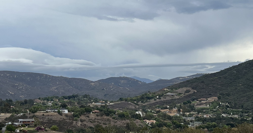 Roll Cloud and other interesting phenomena - today 3:28 PM Friday, October 14, 2022 - 11:45 AM - Yesterday morning .03" of heavy drizzle was in my gauge. Checking now, the total is up to .06". NWS has not posted totals for yesterday or so far today. Tuesday, October 11, 2022 - 7:30 PM - The strange weather of October continues. Some thunderstorms developed over the mountains and moved into northwest San Diego County by evening. One cell moved from just north of Escondido and headed to Oceanside. A few large raindrops fell here for a trace. Lighting was observed with thunder. The NWS has not posted totals. The California Nevada River Forceast Center map shows 24 hr totals for Carlsbad trace, Encinitas .01", Escondido .02", San Diego trace, La Mesa .00", Ramona .03", Julian .09" as of 7PM. 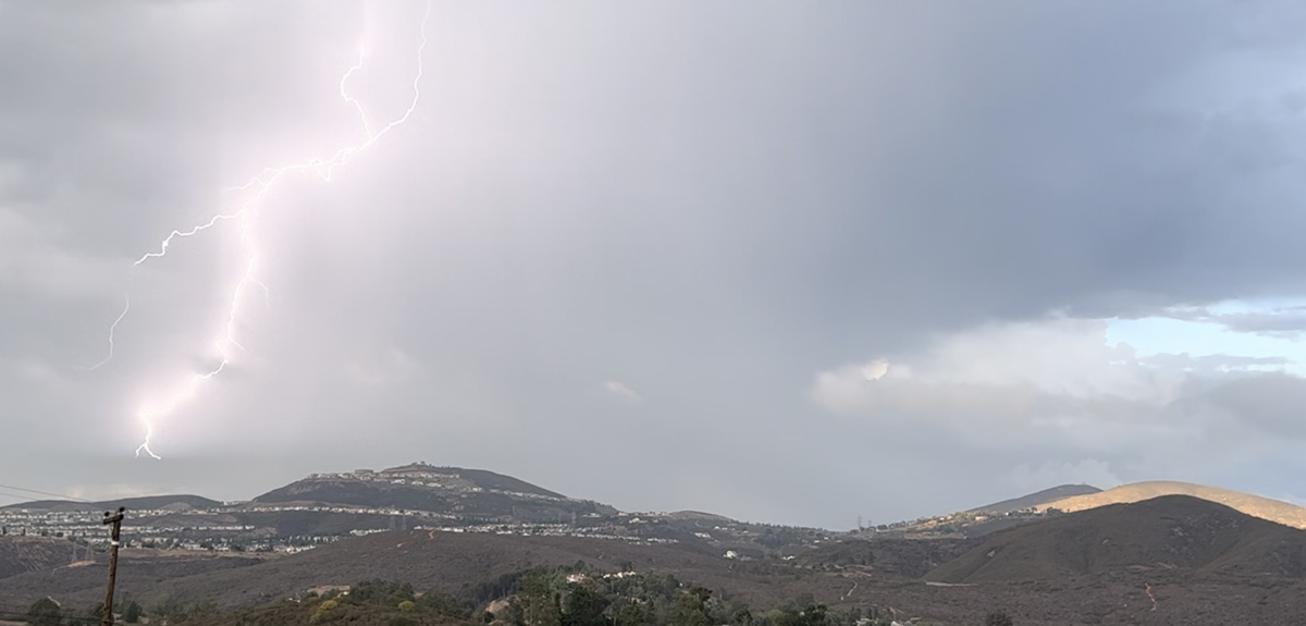 Lighting observed looking northeast at 5:18 PM Saturday, October 1, 2022 - 11:10 AM - Rather late season thunderstorms developed over the mountains on September 25 and again on the 28th. Nothing fell in the cities I post here. Tuesday, September 13, 2022 - 9:24 AM - Again strong thunderstorms developed over the county mountain spine, but more to the east side with tendency to drift further east as they moved to the north. A trace of rain here. NWS storm totals as of 11:30 PM yesterday: Carlsbad .00", Encinitas .00", San Marcos .01", Escondido .00", San Diego .00", La Mesa .00", Ramona .01", Julian 39". Mt Laguna led the county with .98". Monday, September 12, 2022 - 8:14 AM - Yesterday strong thunderstorm developed over the county mountain spine mostly on the west side. They drifted west and fell apart before reaching us. We did receive .02". NWS storm totals as of 9:31 PM yesterday: Carlsbad .00", Encinitas .00", San Marcos .00", Escondido .00", San Diego .00", La Mesa .00", Ramona .67", Julian 00". Echo Dell and Descanso led the county each with .96" Saturday, September 10, 2022 - 11:40 AM - Light showers overnight has brought the storm total here to .19" (+.05"). NWS storm totals as of 9:02 AM: Carlsbad .20" (+.05"), Encinitas .17" (+.07"), San Marcos .18" (+.04"), Escondido .25" (+.14"), San Diego .65" (+.04), La Mesa .48" (+.08"), Ramona .22" (+.09"), Julian 3.68" (+1.23"!). Mt. Laguna led the pack with 5.10 (+.18)" Friday, September 9, 2022 - 8:56 PM - Other than a few raindrops, nothing more here. Some areas received a lot! Total here remains at .14". NWS totals as of 7:01 PM: Carlsbad .15" (+.03"), Encinitas .10" (+.01"), San Marcos .14" (unchanged), Escondido .11" (+.01"), San Diego .61" (+.51"!!!), La Mesa .40" (+.29"), Ramona .13" (+.07"), Julian 2.45" (+2.11"!!!!!). Mt. Laguna led the pack with 4.92" Friday, September 9, 2022 - 1:25 PM - I didn't get a lot of sleep last night as strong winds arrived around 2-2:30 AM. That said, Tropical Storm Kay apparently weakened faster than predicted as instead of rain and wind intensifying here as today progressed, things got calmer. Locally, the hills and mountains east of here scraped off the rain as predicted, bringing much lighter amounts here. I looked at my gauge around 12:15 PM, the latest NWS figures are as of 12:16 PM! We received .14" here. NWS totals as of 12:16 PM: Carlsbad .12", Encinitas .10", San Marcos .14", Escondido .11", San Diego .10", La Mesa .11", Ramona .06", Julian 34". Wednesday, September 7, 2022 - 7:50 AM - All eyes on Hurricane Kay! Tracking NW off Cabo San Lucas. Normally these storms turn west and fade over cold waters long before reaching this far north. This one has a large wind field and will be much closer! Already the forecast calls for wind gusts of up to 45 MPH on Friday and plenty of rain on the eastern slopes of the county mountains over the weekend. Hopefully will get some here, odds are currently 70%. Friday, September 2, 2022 - 5:04 PM - Currently in a long duration heatwave. A storm popped up in the Mt. Palomar region this afternoon and moved southwest. Thought there might be a shower here! But it fell apart as it approached north of Escondido and dissipated by the time it reached the 15. 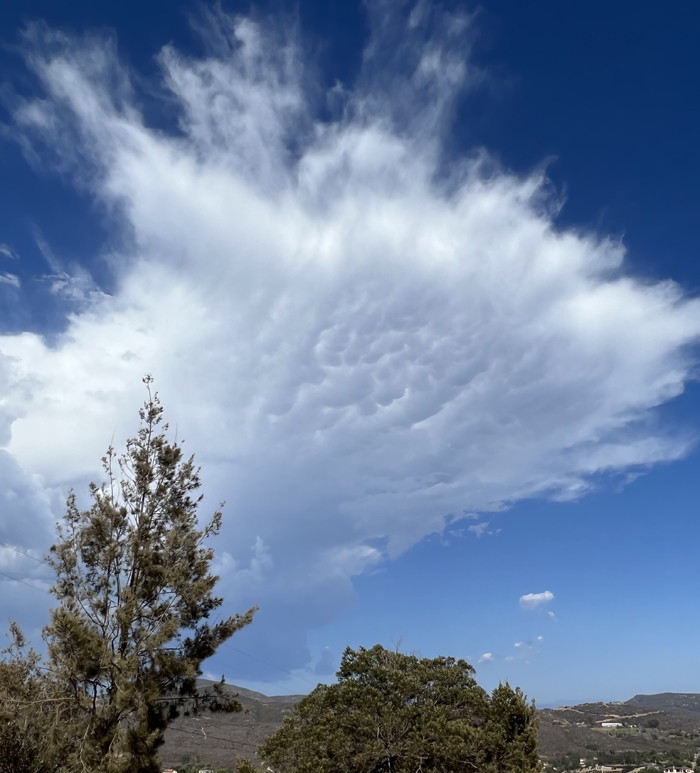 Storm cell with some mamatus Friday, August 26, 2022 - 3:29 PM - Had impressive days of monsoons in the mountains yesterday and the day before. On the 24th Julian picked up .57", nothing in the other local areas. Monday, August 15, 2022 - 9:18 AM - This year's monsoon season is aready the best in years! However nothing here or the locations I track. Yesterday a large cell formed east of Julian and certainly dumped a lot of rain, but the NWS has posted no rain totals since the 13th. 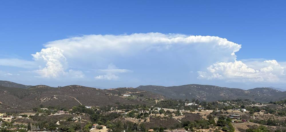 Storm east of Julian around 3:20 PM yesterday Tuesday, August 9, 2022 - 9:42 AM - Total here from yesterday's remnant rain, just .01". NWS totals as of 6:45 PM yesterday: All zeros except Julian with .38". Mt. Laguna crushed it with 1.35"!!! The active monsoonal pattern continues. Monday, August 8, 2022 - 8:26 PM - Rain! Well the first drops here in months! A very large thunderstorm developed in SW Imperial County and sprawled towards us. Evetually drops made it here, been going for about 15 minutes, remains to be seen how much. Sky is clear to the northwest. 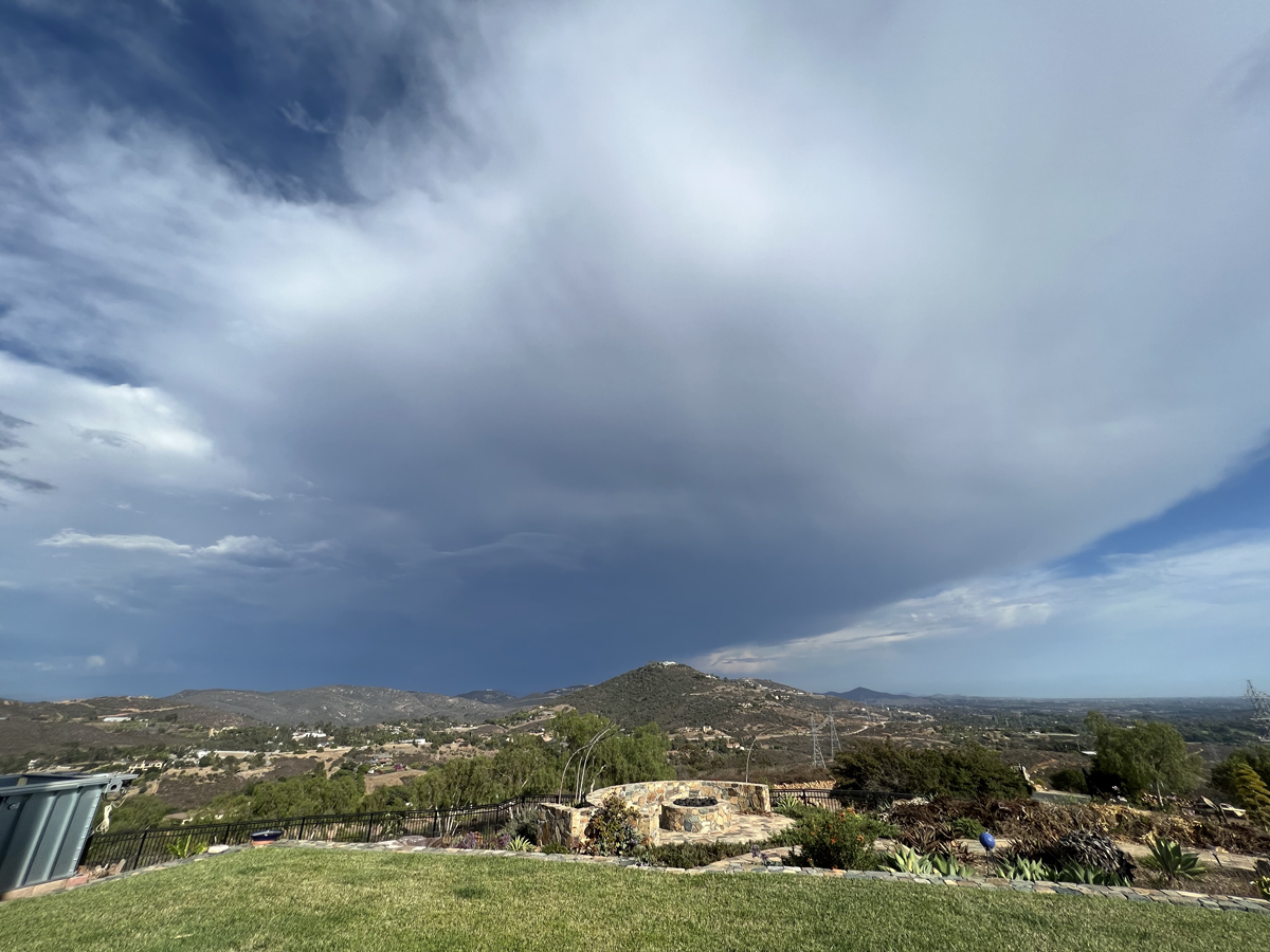 Imperial storm around 5:30 PM today Saturday, June 25, 2022 - 2:17 PM - The first monsoonal flow of the season arrived on Tuesday June 21, we observed several lightning flash around 6:40 PM to the south. A few raindrops were observed in Olivenhain on the 22nd. Drier air has moved in since then. NWS did post figures on June 22 at 5:46 PM: Carlsbad .01", Encinitas .00" , San Marcos .00", Escondido .07" & .01" (two stations)", San Diego trace, La Mesa .00", Ramona .00", Julian 00". Poway led inland areas with .17", in the deserts Coyote Creek had .57"! Saturday, May 21, 2022 - 10:44 AM - Yesterday morning a few hours of drizzle, .03" here. NWS totals as of 1:46 PM yesterday: Carlsbad .01", Encinitas .02" , San Marcos .01", Escondido .00", San Diego .01", La Mesa .00", Ramona .00", Julian 00". Tuesday, April 26, 2022 - 9:40 AM - I have updated the Time Lapse Lichen project with this year's picture. The photo was taken on April 16. The lichen continued the very slow rebound in place since the 2011 disaster. Friday, April 22, 2022 - 9:16 AM - Early morning showers preceeding and with a weak frontal passage dropped just .07" here. NWS totals as of 8:25 AM: Carlsbad .03", Encinitas .11" , San Marcos .12", Escondido .11", San Diego .00" (surprising as Fashon Valley received .32"), La Mesa .25", Ramona .34", Julian .56"! Saturday, April 9, 2022 - 9:59 AM - Yesterday's high at San Diego Airport was 95 degrees breaking the record by 8 degrees! Admittedly the prior record was a bit on the soft side. Escondido 102. Sunday, April 3, 2022 - 9:25 PM - We had a period of light drizzle yesterday and nothing today. Total just a trace: .00". 2 day NWS totals as of 9:46 AM: Carlsbad .00", Encinitas .00" , San Marcos .00", Escondido .00", San Diego .00", La Mesa .06", Ramona .00", Julian 0.01". Granite Hills had the most with .13", followed by El Cajon with .12". Tuesday, March 29, 2022 - 6:15 PM - Rain came in several waves yesterday. The first in the afternoon dropped. 34". The second and thirds ones with the third one being the heaviest dropped .52", bringing the total to .86", a very nice storm! NWS storm totals as of 11:16 AM: Carlsbad .95", Encinitas .60" , San Marcos .76", Escondido .78", San Diego .69", La Mesa .44", Ramona .85", Julian 1.40". Lake Cuyamaca had the most with 2.69! Thursday, March 24, 2022 - 7:57 PM - Methane Levels data is out. The level in the atmosphere made record jump last year. We are so much going in the wrong direction! Sunday, March 20, 2022 - 10:34 AM - Trough passed through last night. .23" here. NWS storm totals as of 8:30 AM: Carlsbad .21", Encinitas .16" , San Marcos .18", Escondido .20", San Diego .29"(the chronic laggard does well!), La Mesa .29", Ramona .28", Julian .16". Looks like the last of the showers are done locally. Looks like after this coming week's dry spell, the Pacific coastal high breaks down. Rain on the 28th? Friday, March 4, 2022 - 3:14 PM - Entry time corrected on previous entry. No rain here since this morning's post, final total stays at .98". NWS storm totals as of 10:00 AM: Carlsbad .54", Encinitas 1.28" , San Marcos .98", Escondido .74", San Diego .62", La Mesa .80", Ramona .62", Julian .37". Friday, March 4, 2022 - 9:24 AM - Direct hit by thunderstorm! Lots of heavy rain, lightning and thunder after 2AM. Our early morning total of .66" compared favorably with two nearby stations: Encintas .89" and San Marcos .60", the two leaders of the county, posted @ 4:35 AM. Then a curving band of rain associated with the closed low passing just to the south of here dumped more rain, some of it heavy. By nine AM the sun was out. Our storm total was an extremely appreciated .98". NWS storm totals as of 7:45 AM: Carlsbad .48", Encinitas 1.19" (still leading the county), San Marcos .78", Escondido .56", San Diego .22", La Mesa .71", Ramona .25", Julian .30". I'll have another update later today. Wednesday, February 23, 2022 - 6:06 PM - By yesterday evening we have a storm total of .28" and the final read today was .44" including some graupel for a few minutes. NWS storm totals as of 12:31 PM: Carlsbad 0.23", Encinitas .28", San Marcos .40", Escondido .53", San Diego .48", La Mesa .68", Ramona .95", Julian 1.03" (with 3" of snow). Tuesday, February 22, 2022 - 3:00 PM - Had a trace of rain yesterday and today so far just .01". Showers all around but mostly missing us and piling into the mountains , cold and windy . NWS totals as of 1:01 PM: Carlsbad 0.01", Encinitas .01", San Marcos .01", Escondido .00", San Diego .00", La Mesa .04", Ramona .05", Julian .29". Will be including Julian from now on. Wednesday, February 16, 2022 - 6:00 PM - Just minutes after yesterday's post a brief heavy shower went through here with BB size hail. .07" brought the storm total here to .18", some of the hail may have bounced out of the conical gauge opening. NWS totals as of 10:55 AM this morning: Carlsbad 0.03", Encinitas .04", San Marcos .10" , Escondido .26", San Diego .22", La Mesa .17", Ramona .56". Julian .58". Tuesday, February 15, 2022 - 8:23 PM - Morning drizzle and light rain brought .08" here, then some scattered showers this evening .03", for a total of .11". Some areas received much stronger showers. We may receive a little more tonight. NWS totals as of 6:45 PM this evening: Carlsbad 0.01", Encinitas .00" San Marcos .03" , Escondido .12", San Diego .07", La Mesa .05", Ramona .21". Julian had a pretty fat .45". The big story not mentioned here the other day, was the 91 degrees at San Diego Airport on February 13 breaking by one degree the hottest temperature ever recorded in the month of February with records going back to 1875! We had a five day heat wave with incredibly clear skies and occasional farily strong Santa Ana winds. Sunday, January 30, 2022 - 5:58 PM - I updated the chart for San Diego Sea Levels with commentary. Meanwhile a very dry pattern continues with no rain in the forecast for the next ten days. Tuesday, January 18, 2022 - 10:17 AM - Yesterday early afternoon we had a shower with .03" here. Last night shortly after 10PM steady rain and again early morning. .34" more here for a storm total of .37" . 2 day NWS totals as of 6:16 AM this morning: Carlsbad 0.45", Encinitas .14" San Marcos .34" , Escondido .27", San Diego .13", La Mesa .17", Ramona just .03". Brown Field led the coastal strip with .46". Looks like sunny dry weather for the rest of the week. Monday, January 17, 2022 - 9:45 AM - The totals posted here a couple days ago were incorrect, now updated (does anybody read this?). Final NWS totals for the January 15 rain, posted 8:01 PM January 15: Carlsbad 0.04", Encinitas .03" San Marcos .03" , Escondido .02", San Diego .03", La Mesa .02", Ramona .00". Saturday, January 15, 2022 - 1:05 PM - I updated the chart for Carbon Dioxide Levels with commentary. The NWS has posted totals. NWS 12 hour totals as of 12:30 PM (corrected) : Carlsbad 0.04", Encinitas .02" San Marcos .03" , Escondido .02", San Diego .03", La Mesa .01", Ramona .00". Saturday, January 15, 2022 - 10:26 AM - A somewhat unusual narrow arc of light rain is passing through San Diego country from south to north. Looks to be over here, .04" in the rain gauge. NWS has not posted any figures. Had a trace here a couple days ago, just a few drops. Sunday, January 2, 2022 - 11:28 PM - Last night we had rather gusty cold Santa Ana winds here. I was looking at the Carbon Dioxide source data and see that it is 3 months behind so it may be a long time before I post a chart for 2021. Saturday, January 1, 2022 - 1:29 PM - Happy New Year! A light sprinkle sometime last night dropped .01" here . NWS 12 hour totals as of yesterday 8:30 PM had zeros for the list I post here. I have finished creatng the charts for 2021 San Diego Temperature, San Diego Rain, and Arctic Sea Ice. I'll be posting these later today with commentary. Thursday, December 30, 2021 - 1:25 PM - The big river of rain has remained north, plowing into Los Angeles. They have received 3.51" in the last 24 hours! Here? Nothing, an epic forecasting fail. Maybe the weakest of a trace here, but zero in the rain gauge since my last post. NWS 24 hour totals as of today, 11:45 AM: Carlsbad 0.13" (unchanged), Encinitas .19" (unchanged), San Marcos .07" (unchanged), Escondido .26" (minus .01"), San Diego .17" (minus .01"), La Mesa .04" (unchanged), Ramona .05" (minus .01"). Wednesday, December 29, 2021 - 8:27 PM - Since the last post .11" more in the gauge, with scattered showers during the day, giving me a 24 hour total of .19". NWS 12 hour totals as of today, 7:45 PM: Carlsbad 0.13", Encinitas .19", San Marcos .07" , Escondido .27", San Diego .17", La Mesa .04", Ramona .06". The storm has been dialed back a bit since yesterday evening, still quite a bit more rain should arrive, although mainly north of us in the L.A. Area. Wednesday, December 29, 2021- 12:44 PM - I've been at Big Bear Lake for the past few days, witnessed two snowfalls of about 4" and 5"! Huge storm predicted there for late today and toorrow, could get 2 feet of snow! Returned late yesterday. Rain here in Elfin Forest since my final read on December 24 was .78" as of late yesterday and then another .08" overnight. So since December 14th we've had 3.38". I don't have NWS totals for the early porition of my vacation, the NWS figures here do not compare with my recent total. NWS 2 day totals as of December 28, 6:18 PM: Carlsbad 0.19", Encinitas .20" San Marcos .21" , Escondido .43", San Diego .09" (again the laggard), La Mesa .33", Ramona .55". Friday, December 24, 2021 - 1:48 PM - Final read here for this storm 1.09" (+.03). NWS storm totals as of 1:01 PM: Carlsbad 1.27" (+.04), Encinitas .99" (+.06), San Marcos 1.07" (+.13), Escondido 1.50" (+.14), San Diego .82" (unchanged, once again the laggard), La Mesa 1.36" (+.03), Ramona 1.68" (+.10). Big Bear Dam was lowered by .08 to 7.10", Palomar Observator +.24 to 6.50". Friday, December 24, 2021 12:17 PM - Heavy rain squalls last night into early morning. 1.06" of rain here so far as of a few minutes ago. NWS storm totals as of 9:16 AM: Carlsbad 1.23", Encinitas .93", San Marcos .94", Escondido 1.36", San Diego .82", La Mesa 1.33", Ramona 1.58". The numbers in the mountains are incredible, for example, Big Bear Dam 7.18", Palomar Observatory 6.26". A string of storms will be coming. Thursday, December 23, 2021 - 12:22 PM - The intense low pressure modelled for the 22nd back on the 14th didn't materialize, but the general outlook continued to show low pressure systems clockwising around the Pacific High towards us. And now an Atmospheric River is at hand, with 1.5-2.5" of rain predicted for the coastal area and 3-6" for the San Bernardino Mountains. More to follow with the Christmas weekend looking good for some snow in the mountains and the one predicted for year-end looking less likely though possible. I'll keep track of the rain until early tomorrow, then check in later. Saturday, December 18, 2021 - 12:53 PM - Late Thursday evening into early yesterday morning we had some showers, .06" in the rain gauge. NWS storm totals as of 4:15 AM yesterday December 17th : Carlsbad .04", Encinitas .05", San Marcos .00", Escondido .02", San Diego .00", La Mesa .06", Ramona .03". Tuesday, December 14, 2021 - 7:50 PM - Final figure here unchanged @ 1.43". NWS storm totals as of 5:01 PM: Carlsbad 1.28" (+.02), Encinitas 1.05" (unchanged), San Marcos 1.07" (+.03"), Escondido 1.76" (+.14), San Diego .98" (+.02) , La Mesa 1.32" (+.13), Ramona 1.53" (+.22). More sky than clouds now, bright moon. Tuesday, December 14, 2021 - 3:57 PM - Excellent storm, lived up to forecast. Very strong winds here, knocked a bunch of things over. As of 3:45 PM 1.43" here in Elfin Forest. NWS storm totals as of 3:01 PM: Carlsbad 1.26", Encinitas 1.05", San Marcos 1.04", Escondido 1.62", San Diego .96" (trailing as usual) , La Mesa 1.19", Ramona 1.31". Radar showing just a few showers off the coast. Tuesday, December 14, 2021 - 10:00 AM - The storm is upon us! Trace late yesterday, .04" overnight, .15" in the last hour, totalling .19" so far. The NWS has backed off a little, the low pressure has been filling in and moving quickly. The GFS model is showing an intense low off the northern coast of California in the December 21-22 period, will see if this develops, still a long ways out. Sunday, December 12, 2021 - 3:38 PM - Looking forward to the big rain event predicted for this Tuesday! Friday, December 10, 2021 - 9:44 AM - Late yesterday evening (around 11 PM) a very brief but moderate shower dropped .03" more here, bringing the gauge to .19". The NWS hasn't updated for that, their totals are as of 8:31 PM. Changes: Escondido .13" (+.01"), La Mesa .30" (+.07"), Ramona .23" (+.04"). Thursday, December 9, 2021 - 7:14 PM - Finally some "real" rain. .16" here (.01 early morning, .09 in the first wave of the front and .06 in the second wave). NWS totals as of 4:46 PM: Carlsbad .14", Encinitas .04", San Marcos .09", Escondido .12", San Diego .11", La Mesa .23", Ramona .19". Some areas received surpising amounts, particularly Miramar with .42" and San Ysidro .32". Mountains had more... Julian .80", Lake Cuyamaca .99". Wednesday, December 8, 2021 - 11:30 AM - Yesterday we had just a touch of light rain, the first since October 26th. .01" here. NWS totals as of 3PM yesterday: Carlsbad .00", Encinitas .00", San Marcos .00", Escondido .01", San Diego .00", La Mesa .01", Ramona .04". That big high pressure off the west coast is less impressive now, opening up the possibility of real rain. Tuesday, October 26, 2021 - 11:58 AM - Overnight showers brought the storm total here to .43". As for the NWS totals I'm now including Carlsbad in the group. NWS totals as of 3:30 AM today: Carlsbad .34", Encinitas .33", San Marcos .21", Escondido .34", San Diego .21", La Mesa .35", Ramona .23". Our total for the month is 1.45"! Awesome for October. The hope is La Niña doesn't torpedo November... the next week looks dry. Monday, October 25, 2021 - 8:48 PM - The rapidly fading tail of the big storm off the NW coast passed through as predicted. We received a bonus prefrontal burst of rain from a very small cell, dropping .18" then .23" more from the front, bringing our storm total to .41". The NWS has not updated their totals since 5:30 PM, will post here anyway. NWS storm totals as of 5:30 PM today: Encinitas .01", San Marcos .03", Escondido . 03", San Diego .02", La Mesa .00", Ramona .05". Locally, Carlsbad Airport led with .23". The San Bernardino County mountains received in excess of 1". Upstate, figures of 4-5" were common with some locales receiving more than 10"! Sunday, October 24, 2021 - 9:24 AM - Drizzle yesterday totaled .02" here. NWS storm totals as of 1:01 PM yesterday: Encinitas .00", San Marcos .02", Escondido . 00", San Diego .00", La Mesa .00", Ramona .00". Oceanside led the coastal areas with .03". Meanwhile the deep low off the NW coast is approaching the NW as predicted, the models were quite good. Current forcast is we'll get some of the tail with less than 1/2 inch of rain. The storm will fill in and dissipate and center will not cross into the states, alough a piece of the energy is likely to lead to a nor'easter later in the week.  Forecast for tomorrow one week later Tuesday, October 19, 2021 - 10:44 AM - Had a little drizzle and very light rain yesterday morning. Just .01" here. NWS storm totals as of 2:31 PM yesterday: Encinitas .00", San Marcos .00", Escondido . 00", San Diego .00", La Mesa .00", Ramona .01". Some of the mountain stations received over .10". Sunday, October 17, 2021 - 11:25 AM - A bunch of weather models are predicting a string of storms for the Pacific Northwest, including northern California. Hopefully the track will move south. Not in the forecast at this time. Here is the GFS pressure model for roughly one week from today. That big pesky high pressure off the CA coast is still there, but squeezed to the south a bit.
 Rain coming to the Pacific Northwest Friday, October 8, 2021 - 8:29 PM - Final NWS storm totals as of 12 Noon: Encinitas .34", San Marcos .31", Escondido . 30", San Diego .16", La Mesa .20", Ramona .19". Total here remained unchange at .43" Friday, October 8, 2021 - 11:55 AM - Another excellent rare October rain, this time of the winter trough variety. .43" total here, mostly before 8 AM. NWS storm totals as of 8 AM: Encinitas .33", San Marcos .30", Escondido . 27", San Diego .15", La Mesa .20", Ramona .15". Tuesday, October 5, 2021 - 12:30 PM - Woke up at around midnight and again around 2 AM with heavy rain! Following by strong wind. Storm total here .56" includes the .16" received yesterday eveing . NWS storm totals as of 5 AM: Encinitas .61", San Marcos .50", Escondido .60", San Diego .64", La Mesa .63", Ramona .48". Remarkedly uniform. Cut off lows can be great! The Adobe Dreamweaver editor ate my lightning photos I posted yesterday! Here's one:  Lightning strikes Monday, October 4, 2021 - 8:22 PM - Direct hit by an excellent thunderstorm. Moved from south to north while drifting west. Plenty of lightning and thunder. Precipitation start out as marble sized hail and quickly turned to heavy rain which lasted 5-10 minutes. .16" in the gauge, some of the hail probably bounced out. NWS quickly posted totals as of 7:31 PM: Encinitas .00" (they must have received some afterwards), San Marcos .09". Escondido .10", San Diego .00", La Mesa .08", Ramona .00". El Cajon received .25". Tuesday, September 28, 2021 - 8:15 PM - I'm getting pretty far behind here, now catching up. The final NWS totals for the September 24 rain as of 7:15 PM: Encinitas .00", San Marcos .08", Escondido .00", San Diego .50", La Mesa .53" (down from .89" no explanation given), Ramona .04". On September 25-26, we had .02" of fog / drizzle, then yesterday, September 27 we had another .04" of drizzle and even light marine layer rain. The NWS had no figures for the areas I post here as of 9:30 PM September 25. For 11:15 AM September 27, NWS totals:Encinitas .04", San Marcos .00", Escondido .00", San Diego .00", La Mesa .00", Ramona .01". La Jolla was the county leader with .07". Friday, September 24, 2021 - 6:26 PM - A "cutoff low" formed southeast of here, bringing in tons of instability and showers. Bittersweet for me as we received just .04" from a morning shower (see picture) and we missed all of the afternoon fireworks. San Diego received a coastal bulls-eye. NWS totals as of 5:15 PM: Encinitas .00", San Marcos .01", Escondido .00", San Diego .48" (!), La Mesa .89" (!!), Ramona .03". Boucher Hill led the county with 1.92"!  Approaching morning shower Friday, September 10, 2021 - 4:41 PM - A Yesterday a small thunderstorm formed near Chula Vista and move north northwest towards Encinitas. I captured some excellent lightning photos and will post here when I get a chance to process them. I felt one (!) raindrop here. Carlsbad received .01", none of the other sites I follow recorded anything. I heard a report of some heavy rain in the Solana Beach area. La Jolla received .11" and Del Mar .05". The storm produced one of the best lightning shows I've ever seen! Tuesday, August 31, 2021 - 9:27 AM - A slowly north moving convergence zone with inputs from the NE and S brought .04" of rain here w/ lighting and thunder to the east. NWS total not yet posted. Yesterday, storms were well to the east. Yesterday's NWS totals as of 6:30 PM: Nothing in the locales I follow here. Mt. Woodson had .13", Alipine .05", Puerta La Cruz led the mountains with .78" Sunday, August 29, 2021 - 8:05 PM - NWS totals as of 4:00 PM: Encinitas .00", San Marcos .00", Escondido .03", San Diego .00", La Mesa .00", Ramona .06". Barona led the county with 1.31"! Sunday, August 29, 2021 - 4:23 PM - Lighting, thunder, wind and a few large raindrops from monsoonal storms from the east. So far a trace. Monday, August 23, 2021 - 9:34 PM - Bit behind here. On Saturday August 21 we had .05" of mostly drizzle and a little light rain. NWS totals as of 4:10 PM Saturday: Encinitas .07", San Marcos .00", Escondido .03", San Diego .00" (trace), La Mesa .00", Ramona .06". On Sunday August 22 we had .02" of drizzle. The NWS did not post totals. San Diego airport had nothing.Friday, August 20, 2021 - 10:35 AM - A trace of drizzle here Wednesday and yesterday. NWS totals for 2 days as of yesterday morning show Carlsbad with .01", nothing in the other locations I post here. Wednesday, August 11, 2021 - 12:42 PM - In the wee hours of this morning, a surge of thunderstorms from Arizona invaded San Diego county. Quite a few places along the mountains received rain, Julian .62". San Diego Airport lucked out and was struck by a small cell. Here in Elfin Forest just a trace. NWS totals as of 5:05 AM: Encinitas .00", San Marcos .00", Escondido .00", San Diego .23" (!), La Mesa .00", Ramona .00". Sunday, August 1, 2021 - 9:06 AM - Nice monson clouds to the east the past few days. No rain here. Finally updating the July 26 figures: Total here was .10". NWS totals as of 5:00 PM 7/26: Encinitas .06", San Marcos .06", Escondido .11", San Diego .00", La Mesa .00", Ramona .10". Monday, July 26, 2021 - 7:15 AM - There has been a lot of excellent monsoonal weather over AZ and NM, with some eventually spilling into San Diego County. Yesterday nice clouds to the east and we had just two traces of rain here, Descanso area received over 2" in a rather isolated event. No figures from the locals I track here. This morning rain! As of about 6:15 AM here .09" a repeat of last week although no lighting or thunder.NWS totals as of 6:00 AM: Encinitas .06", San Marcos .06", Escondido .10", San Diego .00", La Mesa .00", Ramona .10". Monday, July 19, 2021 - 8:40 AM -Final total here for yesterday .09". NWS 24 hour totals as of 10:32 PM yesterday has Encinitas @ .07", the rest unchanged. Big Bear City 1.60"!! Sunday, July 18, 2021 - 12:02 PM - Lightning, Thunder, Rain! Around 4:15 AM I was awakened by thunder as a line of small cells approached from the southwest, intensifying as they moved towards Oceanside. Final total here .09". NWS totals as of 8:45 AM:Encinitas .06", San Marcos .06", Escondido .03", San Diego .00", La Mesa .00", Ramona .00". Dozens of lightning flashes and some loud thunder during the storm, but very little if any wind. Oceanside ended up with .23", the leader was Rincon Springs with .44". I'm using a new version of Adobe Dreamweaver - it is so much more clunky, typing is frankly a pain in the butt, plus the spell checker doesn't work!Plus the program no longer does drag and drop of images! Have to hand-code.  Shower to the east on Friday, July 16, 2021 - No rain totals, if any, were available Wednesday, June 30, 2021 - 9:56 PM - The forecast of thunderstorms today with locally heavy rains, predicted a few days ago, was a massive fail. Virtually nothing, a few cumulus today over the mountain ridges, small t-storms over northern Baja. 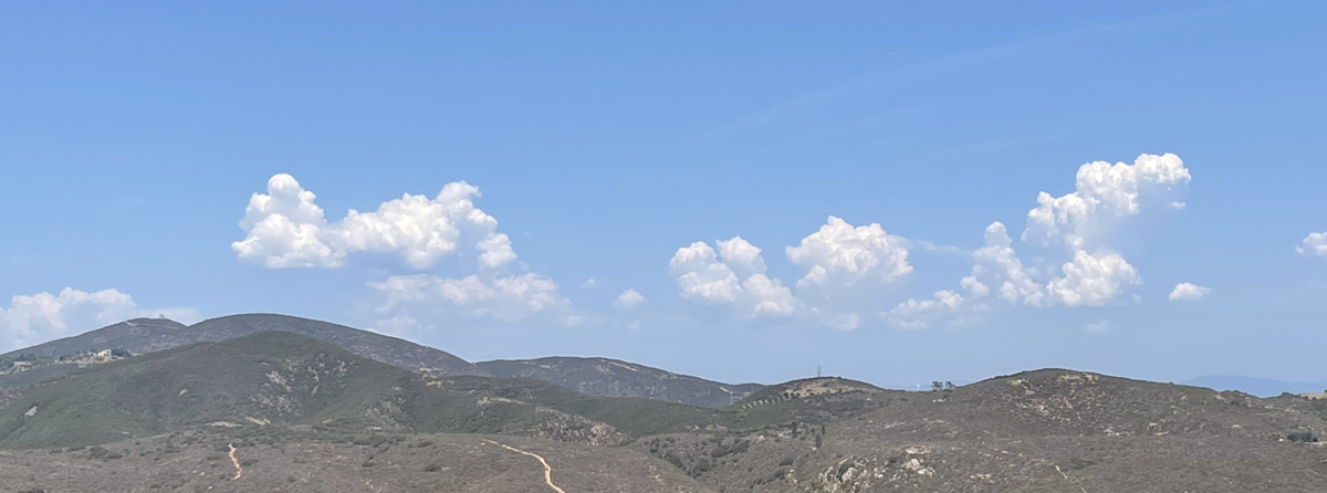 Failed Monsoonal rains - June 30, 2021 looking east from Elfin Forest I posted the seasonal rain chart update at San Diego Rain - just 4.51" these past 12 months at the San Diego Airport. Five of the 10 driest seasonal totals have occurred in the last 20 years of 160 years of weather data. Wednesday, June 23, 2021 - 12:27 PM - Yesterday we had a few raindrops around 2:25 PM for a scant trace of rain. This morning around 4 AM a shower loud enough to wake me passed through followed by just a few scattered raindrops. The system came up from the south, the remnants of a tropical depression. Total here about .025" or officially .02". Some areas in the county received quite a bit more! NWS totals as of 11:01 AM: Encinitas .00", San Marcos .01", Escondido .01", San Diego .01", La Mesa .06", Ramona .00". Smuggler's Gulch in the Tijuana river area received .20". Monday, June 7, 2021 - 8:32 PM - Thick June Gloom today, patchy drizzle and one short period of light rain: .02" here. No totals provided by NWS. The SD Area 24 hours Observed Precipitation Map as of 8 PM shows Encinitas with .01" and SD Airport with a trace. Monday, May 17, 2021 - 9:03 AM - More May Gray with some drizzle, another .03" here. NWS totals for the past 2 day as of 5:02 AM: Encinitas .02", San Marcos .11", Escondido .01", San Diego .04", La Mesa .00", Ramona .00", Julian .07". Will include Julian in the list from now on to get some SD County mountain perspective. Sunday, May 16, 2021 - 4:58 PM - Just a touch more drizzle bringing the total to .03" plus the missing part. NWS totals as of 12:31 PM: Encinitas .00", San Marcos .10", Escondido .01", San Diego .04", La Mesa .00", Ramona .00". Oceanside leads SD County with .28". More of the same forecasted through tomorrow. Sunday, May 16, 2021 - 11:43 AM - More May Gray drizzle and some light rain. Around 8:15 AM it rained for a couple minutes loud enough to hear it. After it stopped I went to check the gauge, disaster! I was interrupted from cleaning the overflow container yesterday and forgot about it, the components were lying on the ground. I did find a bucket, guessing from that, we received .02-.05". Just now the drizzle stopped and the clouds have lifted, about .025" in the gauge since about 8:20 AM. So overall I'd say at least .05" here this morning. NWS totals as of 9 AM: Encinitas .00", San Marcos .07", Escondido .00", San Diego .00", La Mesa .00", Ramona .00". So nearby San Marcos bears witness with the highest total in SD county as of the 9 AM list. Orange and San Bernardino counties had more. Saturday May 15, 2021 - 12:06 PM - May Gray drizzle early morning wetting the ground, .01" in the gauge. NWS has not posted any totals and nothing showing anywhere on the NWS SD area precipitation map at https://www.cnrfc.noaa.gov/precipMaps.php?group=san&hour=24&synoptic=0. Sunday, May 2, 2021 - 4:26 PM - Drizzle and very light rain off and on most of the morning into the afternoon. Just over .05" in the gauge. NWS 24 hour totals as of 1:47 PM: Encinitas .01", San Marcos .01", Escondido .00", San Diego .01", La Mesa .03", Ramona .00". Miramar Lake took top honors with .10". Tuesday, April 27, 2021 - 8:57 AM - No rain fell overnight even though .1 to .25" was predicted. Yesterday .10" in the gauge, just under .05" by early yesterday morning and a little over .05" later in the morning. All of the rain was of the heavy drizzle / light rain variety. NWS 2 days totals as of 5:02 AM: Encinitas .10", San Marcos .04", Escondido .09", San Diego .05", La Mesa .07", Ramona .10". Del Mar led the SD coastal areas with .32", elsewhere Mt. Woodson .32", Lake Cuyamaca .51". Still might get a shower today. Then heat! Friday, April 23, 2021 - 11:06 AM - Yesterday morning deep marine layer and some drizzle / fine rain, .05" in the gauge. Last night another .03" bringing the total to .08". The NWS has posted totals but for overlapping short periods and no overall totals. Doing the best I can, the overall totals since 9 PM Wednesday evening: Encinitas .02" (again!), San Marcos .05", Escondido .00", San Diego .02", La Mesa .04", Ramona .10". Meanwhile the forecasted Monday rain event is still on, numbers have been posted : 1/4 to 1/3 inch for the coastal area, 1/2 to 3/4 inland with snow in the mountains. NWS notes that forecasted figures have "trended lower", sigh. Wednesday, April 21, 2021 - 4:42 PM - Trace of mist this morning. The NWS posted 12 hour totals as of 10 AM. Encinitas .02", the other stations zip, a repeat of April 14. No other area in SD county exceeded .02". NWS has been discussing significant rain next Monday or Monday night. Not all models agree. Hope! Wednesday, April 14, 2021 - 1:25 PM - I have updated the Time Lapse Lichen project with this year's picture. The photo was taken on March 28. There was no update last year due to Covid-19. The lichen rebounded a bit from two years ago. This project is now 18 years old, perhaps one of the longest running lichen growth documentations in the world! Wednesday, April 14, 2021 - 12:02 PM - Marine layer mist added about 1/2 of .01", last night, has to be counted as a trace. The NWS did post 24 hour totals as of 3:00 AM today. Encinitas came in with .02", the other stations zip. Lower Oak Flats still led the county, now with .15". Tuesday, April 13, 2021 - 1:25 PM - A deep marine layer this morning brought heavy drizzle bordering on light rain. 03" in the rain gauge. The NWS has posted totals as of 1:01 PM today, none of the stations I post here recorded anything. The highest total in SD county: .07" at Lower Oat Flats. Wednesday, April 7, 2021 - 2:52 PM - Methane data for 2020 is out. Page updated today. The levels jumped again last year to a new record. Last year, thanks to the Covid-19 pandemic I was not able to update the Time Lapse Lichen project as I was not able to access the lichen location. Last week I finally got to my secret location and took photos for the 2021 year. I hope to update the page this week. Meanwhile, there is no rain in the forecast. I've been hoping for one more good rainfall before the dry season is fully upon us. Friday, March 26, 2021 - 10:07 AM - Light showers passed through here yesterday afternoon and evening. Total here .08". Final NWS storm totals as of 9:16 AM today: Encinitas .01", San Marcos .04", Escondido .09", San Diego .04", La Mesa .24", Ramona .10". Again much higher amounts fell inland with Julian getting .67" and Lake Cuyamaca leading with 1.07". Wednesday, March 24, 2021 - 11:06 AM - Early yesterday morning just a touch of rain here. .005" in the gauge, have to call it a trace. Final NWS storm totals as of 9:16 PM yesterday: Encinitas .00", San Marcos .00", Escondido .00", San Diego .00", La Mesa .01", Ramona .00". So La Mesa is the only one with a figure. The mountains received real rain, Descanso .37", Pine Valley .24" for example. Tuesday, March 16, 2021 - 7:05 PM - A few showers passed over late evening and last night bringing the final storm total here to .30". Final NWS storm totals as of 10:02 AM today: Encinitas .22" (unchanged), San Marcos .20" (+.03"), Escondido .25" (+.07"), San Diego .18" (+.01"), La Mesa .24" (+.03"), Ramona .28 (+.16"). Monday, March 15, 2021 - 3:35 PM - More Rain! Frontal system went through, rain started mid-morning and ended early afternoon. Follow-up showers possible. Current total here: .28". Winds picked up with the frontal passage, feels cold and raw. Kudos for a rather accurate forecast from NWS! NWS storm totals as of 3:01 PM today: Encinitas .22", San Marcos .17", Escondido .18", San Diego .17", La Mesa .21", Ramona .12". So we are leading the local pack. Saturday, March 13, 2021 - 9:54 AM - No rain here last night. Final total here .94". NWS storm totals as of 9:03 AM today: Encinitas .75" (unchanged), San Marcos .78" (+.01"), Escondido 1.24" (unchanged), San Diego .67" (unchanged), La Mesa .87" (unchanged), Ramona 1.14" (+.06"). Oceanside takes the coastal prize with 1.27". Palomar Mountain received 23.5" of snow! Friday, March 12, 2021 - 5:45 PM - Last night .03" fell here bringing the storm total to .94". Yesterday was a complete bust here after early morning and today nothing except for that .03" we had last night. NWS storm totals as of 1:19 PM today: Encinitas .75" (+.01"), San Marcos .77" (+.02"), Escondido 1.24" (unchanged), San Diego .67" (unchanged), La Mesa .87" (+.04"), Ramona 1.08" (+.04"). The last couple days has been an epic cloud fest! Super clear air with instability producing cumulus practically turning into cumulonimbus with anvil heads! Plus to the east, snow is visible!
Thursday, March 11, 2021 - 11:00 AM - Had at least one heavy shower last night; this wave of showers ended early morning. Gauge now at .91" (+.51)! NWS storm totals as of 9:17 AM: Encinitas .74" (+.47"), San Marcos .75" (+.50"), Escondido 1.24" (+.75"), San Diego .67" (+.53"), La Mesa .83" (+.48"), Ramona 1.04" (+.76"). Showery pattern on a break now, last wave predicted for late this afternoon and night with some wrap around moisture for tomorrow. Wednesday, March 10, 2021 - 4:31 PM - Been just a few widely scattered hit and mostly miss showers since morning. Total as of 4:20 PM .40" (+.03). NWS storm totals as of 2:32 PM: Encinitas .27" (+.02"), San Marcos .25" (+.01"), Escondido .49" (+.01"), San Diego .14" (+.02"), La Mesa .25" (+.04"), Ramona .28" (unchanged). Showery pattern to continue. Wednesday, March 10, 2021 - 8:36 AM - Rain! Heavy shower went through early morning. Total as of 8:05 AM .37". NWS storm totals as of 8 AM: Encinitas .25", San Marcos .24", Escondido .48", San Diego .12", La Mesa .21", Ramona .28". Showery pattern to continue. Tuesday, March 9, 2021 - 9:41 AM - Overnight March 7-8, .01" fell here, either in drizzle or a very light shower. NWS did not post storm totals. The predicted rain for this week is still on track - a slow moving system, 1" predicted for SD Country coasts, more in the mountains. My gauge is ready! Thursday, March 4, 2021 - 9:57 AM - Another .02" fell overnight bringing my storm total to .91". NWS storm totals as of 9:01 AM: Encinitas .61", San Marcos .99", Escondido .65", San Diego .58", La Mesa .95", Ramona .70". Only a slight chance of showers in the official forecast for the coming week due to forecast model conflict, some models say more rain next Tuesday-Wednesday. Hope hope as February was very dry (just .17" here and .10" at SD Airport) and the dry season will be well under way by the end of April. Wednesday, March 3, 2021 - 8:41 PM - After being way behind areas to the south, we lucked out and had a persistent micro atmospheric river center covered us for several hours mid to late afternoon and early evening. Final total here .89"! Yay! Still a few small showers offshore. NWS storm totals as of 6:46 PM: Encinitas .56", San Marcos .82", Escondido .58", San Diego .57", La Mesa .93", Ramona .58". Still waiting for the Methane data for 2020. Wednesday, March 3, 2021 - 12:54 PM - A nice band of rain came ashore mid morning. Unfortunately we got ripped as a gap developed which gave us early sun while dark clouds moved to our north and south. So far .06" in the gauge. NWS storm totals (going back to their old list of locations) as of 11:15 AM: Encinitas .04", San Marcos .03", Escondido .04", San Diego .07", La Mesa .10", Ramona .00". Tuesday, February 16, 2021 - 6:20 PM - Light rain passed through here last night, didn't hear it. Had .06" in the gauge at 6 AM this morning, no follow-up showers. The NWS now has many more stations in the rainfall list. For Escondido, for example, there is a "1.5 SW Escondido", "Escondido 1", "Escondido North", "Escondido 4" and "Escondido 5". So what I'll do is post the range for a given city. NWS storm totals as of 10:28 AM: Encinitas .02-.06", Elfin Forest (no data, looks like this location not carried any more), San Marcos .05-.08", Escondido .03-.06", San Diego .06-.16", La Mesa .14-.16", Ramona .07-.17". Friday, February 12, 2021 - 2:24 PM - First rain of February. Drizzle and light rain early this morning dropped .05" here, and then a trailing cold front and brief squall in the late morning dropped .06" more giving us a storm total of .11". NWS storm totals as of 1:01 PM: Encinitas .04", Elfin Forest (no data, zero?), San Marcos Land Fill .07", Escondido .19", SD Airport .03", La Mesa .14-.16", Ramona .19". Saturday, January 30, 2021 - 9:55 AM - Sky clear and sunny this morning. Another .01" snuck in sometime after late afternoon yesterday, final storm total here 1.19". Total here for the month (assuming .7" for the first of the three recent storms) 2.46". My season total now 4.29". NWS storm totals as of 8:03 PM yesterday evening: Encinitas .99", Elfin Forest .82", San Marcos Land Fill .96", Escondido 1.46", SD Airport 1.03", La Mesa 1.22", Ramona .88". That's it for January, will update the monthly file over on the Rain page shortly. Friday, January 29, 2021 - 5:06 PM - Two more showers passed through both adding to the total here, the first .10" and the second .16", storm total now 1.18", within the forecast! Friday, January 29, 2021 - 8:09 AM - I have updated the annual charts for San Diego Sea Levels for 2020 with added commentary. Friday, January 29, 2021 -7:44 AM - The heralded "atmospheric river" passed through last night, starting around 11:15 PM and ending around 4 AM. It narrowed and weakened, I think a bit more than predicted, by the time it reached San Diego County, but still dropped much needed rainfall. Received .92" here, the wettest storm of the season! January has turned out to be a good month with over 2" here, all in the past week. NWS storm totals as of 7:01 AM this morning: Encinitas .79", Elfin Forest .67", San Marcos Land Fill .75", Escondido 1.10", SD Airport .73", La Mesa .80", Ramona .62". Again, lots of snow in the mountains, building the winter pack. Tuesday, January 26, 2021 - 8:28 AM - Overnight .06" more in the range gauge, storm total here .58". Skies now clear and sunny, a few scattered cloud bands to the southwest. Yesterday was one of stormiest I can recall in terms of frequent hail, gale force winds and penetrating cold! NWS storm totals as of 4:02 AM this morning: Encinitas .23", Elfin Forest .46", San Marcos Land Fill .40", Escondido .96", SD Airport .30", La Mesa .44", Ramona 1.50 (!!)". Lots of snow in the mountains, building the winter pack: Big Bear / Lake Arrowhead both exceeded a foot. Happily the third storm of the series is still on track with 1" predicted for the coast areas and more inland. The storm will be warmer and will melt the lower elevations snows. Monday, January 25, 2021 - 10:09 PM - During the afternoon another .02" fell here as the strong winds continued. This evening three more cells went through each one with more hail and very strong winds, and one with some lightning and thunder! The first two also had BB sized hail, the third one had heavier small pea sized hail. .18" more in the gauge bringing the storm total here to .52". Will post NWS figures tomorrow, they haven't been updated for a while.
Monday, January 25, 2021 - 10:03 AM - Around 9PM yesterday evening a brief shower went through, with about 1/2 minute of BB sized hail. Then from 3-4 AM today heavy rain squalls followed by very strong winds with likely gale force guests, winds continuing. Thought I'd see an inch in the gauge but due to the brevity of the squalls, total here early morning .31" and just .01" since then bringing storm total here to .32". NWS storm totals as of 8:46 AM this morning: Encinitas .16", Elfin Forest .31", San Marcos Land Fill .16", Escondido .38", SD Airport .20", La Mesa .39", Ramona .80 (!)". Sunday, January 24, 2021 - 9:30AM - At least three more bands of showers passed here since the last post, with an additional .36" of rain. Total here for sure .64" and I'm guessing .06" more from yesterday morning's tilted gauge problem for a total of .7". Excellent start to the current wet spell! This coming Monday and Thursday will bring more. NWS storm totals as of 8:17 AM this morning: Encinitas .47", Elfin Forest .64", San Marcos Land Fill .56", Escondido .59", SD Airport .46", La Mesa .55", Ramona .68". Saturday, January 23, 2021 - 1:08 PM - Rain! Showers last night and early morning. Found that my rain gauge was not vertical having be skewed by the recent strong winds. 0.19" in the gauge, guessing we got closer to .25". Then mid morning (after fixing the gauge), a short heavy band of rain went through adding another .09" . Right now it looks like a heavier band is approaching! Wednesday, January 20, 2021 - 8:16 PM - I have updated the annual charts for Nitrous Oxide Levels for 2020 with added commentary. In weather news, the last couple days here have been very, very windy with east winds as a closed low passed inland to the south of here. We had just a couple drops of rain yesterday for a trace, nothing today. Also, January 15 turned out to be extraordinarily warm reaching 93 degrees here. San Diego airport at 88 broke their record for January 15 by 6 degrees! It's possible San Diego airport tied their all time high for January. Friday, January 15, 2021 - 8:24 AM - I have updated the annual charts for Carbon Dioxide Levels for 2020 with added commentary. Saturday, January 2, 2021 - 9:52 AM - I have updated the annual charts for San Diego Rain and Arctic Sea Ice for 2020 with added commentary for the sea ice. Friday, January 1, 2021 - 10:07 PM - I have updated the annual chart for San Diego Temperature for 2020 with added commentary. Temperature and Arctic Sea Ice will be updated tomorrow. Friday, January 1, 2021 - 8:52 AM - Happy New Year! First of all here are the delayed stats for the recent rain. We had .84" total thanks to a few more showers during the final night. NWS storm totals were San Diego Airport .71", Encinitas .44", San Marcos .58", Escondido .85", La Mesa .88". Pine Hills lead the pack with 2.71"! Mountain resorts had well over a foot of snow! I'll be posting the year end charts for Rain and Temperature later today and others as data becomes available. Monday, December 28, 2020 - 8:44 PM - The tail end of the storm passed through in the past hour with another nice squall with similar amount as the opening squall, total now .61". Will post final totals tomorrow. Should be enough to resume the greening initiated by the early November storm. Moon out now. Monday, December 28, 2020 - 5:07 PM - A very nice strong but brief squall went through here between 2:30 and 3 AM - early morning gauge reading: .30". One good flash following by thunder! We've had almost nothing since then, a reading a few minutes ago show .31" storm total. A contact in the L.A. reported heavy showers with thunder and lighting, well over an inch there. Storm totals via NWS as of 4:02 PM: Encinitas .18", San Marcos .26", Escondido .35", SD Airport .32", La Mesa .39". San Diego mountains generally had over 1 inch and snow peaks 8-12". There are more showers off the coast, hoping for more here - we really need it! Friday, December 25, 2020 - 9:34 AM - An upper air trough passed through yesterday, with virga and scattered big drop rain showers. 03" here in Elfin Forest. The third strong Santa Ana in the past month blew through here the previous night. The first of the three one was the strongest, we didn't have power here for about 36 hours and the winds stripped leaves from trees and shrubs and knocked down several branches.
Monday, November 9, 2020 - 1:56 PM - I was premature in calling yesterday's .72" as the final read. I emptied the gage last evening, this morning there was .16" more! So the total here is .88". NWS figures as of 10:03 AM today: Encinitas .52", San Marcos Landfill .67", Escondido .77". Other readings: SD Airport .26", La Mesa .74". Lake Cuyamaca still the champion at 3.98". Big Bear Snow Summit: 18"! Next storm forecasted to pass north of here this weekend, small brush by possible. Sunday, November 8, 2020 - 9:24 PM - Final rain gauge read here: .72", nothing since late afternoon. Been very windy, with temps around 56 feels frigid! NWS figures as of 5:03 PM: Encinitas .46", San Marcos Landfill .50", Escondido .69". Other readings: SD Airport .26", La Mesa .72" (same as us). Lake Cuyamaca still the champion at 3.51"! Sunday, November 8, 2020 - 10:07 AM - By late yesterday afternoon another shower brought the total here to exactly .50" and this morning's read was exactly .60". Nothing in the last couple hours. More showers expected today and ending this evening although the air is a lot more stable than yesterday. Nearby totals at of 9:02 AM per the NWS: Encinitas .40", San Marcos Landfill .44" and Escondido .58". SD Airport just .14", La Mesa .62". Lake Cuyamaca leads the pack with a super impressive 2.7"! Snow has fallen in the mountains with Arrowbear leading at 10", Big Bear Village 5", the snow readings are as of 7PM yesterday evening. So... we are off to a great start for this year's rainy season and thankfully a lowered fire danger. Saturday, November 7, 2020 - 3:44 PM - Another brief but vigorous shower / squall went through, increasing the storm total here from .35" to .45". Saturday, November 7, 2020 - 7:52 AM - Wonderful rain! A couple brief rather heavy showers passed through this morning. Just checked the gauge, .34" already. Monday October 26, 2020 - 8:32 AM - The third and last shower yesterday was very light, bringing the gauge to .07" for the storm total here in western Elfin Forest. The NWS totals for the nearby areas: Encinitas also .07", Escondido .05". Other locations: SD Airport .12", La Mesa doesn't list, zero? Top two spots: Palomar .86" and Lake Cuyamaca .65". This coming week will be dry with fairly strong Santa Ana to the north today and tomorrow. Sunday, October 25, 2020 - 2:49 PM - Rain!!! A nice shower moved in from the west, the center moving just south of us, but close enough to "dump" .05" of rain, bringing the gauge to just over .06". Another shower band is approaching.
Sunday, October 25, 2020 - 10:58 AM - Rain!!! Well just over .01" from a light shower this morning. Still, the rainy season approaches. First rain in 17 weeks! Sunday, September 6, 2020 - 9:52 PM - Today the heat wave set records all over the place. Here we reached 104 and stayed there for 2 or 3 hours. Yesterday San Diego failed to break the record of 97, and today did, hitting 100. The most impressive temperature record, in my opinion, was Escondido hitting 115, the highest temperature ever recorded there going back to 1893 and breaking the day's record by 11 degrees. The "Valley Fire" in south county passed 5,000 acres, the smoke has been visible for the last couple days. To the north, as distant plume of the El Dorado fire in San Bernardino county was also visible. Also of note, the Arctic Sea Ice has retreated to its second lowest level since records began in 1979. I will update the graph after the data is in early next year. Sunday, September 6, 2020 - 8:03 AM - Yesterday's high here in Elfin Forest was 103! This morning at 8 AM it is 88, yesterday at 8 AM it was 78. Whoa. Going to be another scorcher. Saturday, September 5, 2020 - 10:39 AM - Heatwave! Record heat forecast for a wide area of Southern California. There will be just a little cooling along the coast. San Diego Airport record for this date 97, will be close there. 110 or higher predicted for inland valleys. Currently here in Elfin Forest 91. Wednesday, September 2, 2020 - 10:13 AM - We closed the sale of our house in Bankers Hill! So I no longer have a rain gauge there. Finally back to one house and a simpler life. My main (and only) rain gauge location is in Elfin Forest from now on. I will be adding an advertisement to these environmental pages for Edible San Diego, a weekly digital local foodie magazine published by my wife, Katie Stokes. The digital e-zine is usually published on Tuesday. The publication is also published quarterly as a print magazine. We need subscribers! And of course, advertisers. Wednesday, July 1, 2020 - 10:23 AM - Final total for Monday's rain: .26". SD Airport .08", Encinitas .10", Escondido .11", La Mesa .15". I will be posting the annual rain chart update for the July-June season and monthly rain total later today. Monday, June 29, 2020 - 8:13 AM - Rain! On Saturday another bout of fog and drizzle, another .02" no figures from NWS. Today "heavy" drizzle and bona-fide light rain. .22" in the gauge as of a few minutes ago!!! NWS has just posted updated figures. As of 8:01 which is nearly the exact time I took my reading: SD Airport .05", Encinitas .10", Escondido .11", La Mesa .00". NWS has Sylvan Meadows leading all areas with .20", but I vouch for .22" here on our little ridge in Elfin Forest! Thursday, June 25, 2020 - 10:23 AM - Updates here have been delayed due to some remodeling and disconnected computer. We've had several days of morning fog and drizzle at Elfin Forest: Last Saturday .02", yesterday .02" and this morning a touch more than .01". No totals are present on the NWS site. Saturday, June 6, 2020 - 9:19 PM - Had some early morning mist maybe very light rain again, .02" total. NWS rain totals as of 9:00 AM: SD Airport .06", Encinitas .00", Escondido .02", La Mesa .16"! Drier warmer weather is now in front of us. Friday, June 5, 2020 - 8:46 PM - This morning the ground was quite wet from heavy marine layer drizzle or maybe very light rain. Checked our Elfin Forest gauge: .04"! NWS rain totals as of 8:45 AM: SD Airport .00", Encinitas .00", Escondido .01", La Mesa .00". Vista led the coastal totals with .07". May get something similar tonight. Tuesday, May 19, 2020 - 9:51 AM - Light rain shower late last night, .03" in the Elfin Forest gauge. NWS posted totals as of 5:01 AM: SD Airport, Encinitas, Escondido, La Mesa all nothing .00". Inland mountains a whole lot more: Julian .47", Lake Cuyamaca .60"! Wednesday, May 13, 2020 - 9:12 AM - Some showers last night, .05" in the Elfin Forest gauge! Not bad as there was nothing in the forecast a few day ago. NWS has now posted totals as of 5:01 AM: SD Airport .02", Encinitas .00", Escondido .02", La Mesa .00". Inland mountains had more, for example Julian .23". Tuesday, May 12, 2020 - 7:43 PM - I forgot to post on May 9 (edit - corrected from May 10) had "heavy" drizzle in the morning, .04" in the rain gauge! None of the other locations I track here reported anything. About an hour ago, with low marine layer coming in, we had a sudden total unexpected shower with fairly large raindrops, but lasted just a couple minutes, about .005", officially a trace. Wednesday, April 30, 2020 - 8:48 AM - Covid-19 Stay At Home day 43. Third foggy morning in a row with each morning thicker than the previous. .01" in the gauge from collective dew drop drippings, no rain here, nothing posted at NWS since April 18. We did have a rather warm spell and SD Airport tied record high readings three days running: April 24, 83 degrees tied 1995, April 25, 83 degrees tied 1992, April 26, 88 degrees tied 2004. SD did set new records for highest minimum: April 24, 63 degrees broke 1981 62, April 25, 63 degrees tied 1992, April 26, 64 degrees broke 1992 63. Wednesday, April 22, 2020 - 9:23 AM - First warm spell of the season is upon us. More rain in April is unlikely. Added a bit more commentary in the analysis section of the Methane Levels page. Meanwhile my normal period for the annual observing and updating of my Time Lapse Lichen project has come and gone, thanks to COVID-19. Maybe in May. Saturday, April 18, 2020 - 11:51 AM - Methane Levels page updated. Saturday, April 18, 2020 - 9:36 AM - Light showers overnight, .08" as of about 8 AM in our Elfin Forest rain gauge. NWS storm totals as of 7AM: SD Airport .03", Encinitas .03", Escondido .01", La Mesa .03". Carlsbad Airport had .14", so our reading is not a fluke. Will now start working on the Methane charts. Friday, April 17, 2020 - 9:17 PM - The 2019 data for my Methane Levels page is in. I'll update the page tomorrow. I have processed the 2019 data and am saddened to say that a new record yearly average was set, and the increase was the biggest in 28 years. Monday, April 13, 2020 - 6:27 PM - NWS posted "storm" totals as of 4:16 PM. SD Airport .06" (an increase of .03" from my post), Encinitas .10" (no change), Escondido .05" (no change), La Mesa .07" (an increase of .01"). I received a reading from my Bankers Hill gauge: .33", some of that may have been residual from last Friday. Pretty gloomy all day - looking forward to some sunny days! Monday, April 13, 2020 - 9:30 AM - Corrected yesterday's time stamp to AM instead of PM. Around 10:30 PM last night we had a short moderate shower then around 2-3 AM a heavy enough shower to wake me up. Local radar was inexplicably blank in both cases, maybe down? A reading of my Elfin Forest gauge this morning: .14"! NWS has not posted totals since Saturday. Looking at the CA / NV river forecast map https://www.cnrfc.noaa.gov/precipMaps.php?group=san&hour=24&synoptic=0 shows 24 hour most recent precipitation: SD Airport .03", Encinitas .10", Escondido .05", La Mesa .06". Interestingly Point Loma has .21". Sunday, April 12, 2020 - 10:55 AM - Cloudy, thick marine layer, a few tiny drops, a trace of a trace. SD Airport April month to date, 3.59" already the third wettest April going back to 1852. There was 3.71" in 1988 and 5.37" in 1926. Brings the winter total at the airport to 13.41", the wettest for a whole season since 2004. Friday, April 10, 2020 - 10:55 PM - No further rain here in Elfin Forest, storm total set at 6.68". NWS storm totals released at 9:02 PM: SD Airport 3.50" (no change), Encinitas 7.40" (an increase of .10"), Escondido 5.30" (no change), La Mesa 4.80" (no change). The NWS also issued 24 hours totals as of 10:40 PM: SD Airport 2.01", Encinitas 4.61" the highest of all stations covered by the local NWS office, Escondido 2.98", La Mesa 2.25". Here we had over 3" in this 24 hour period. For all those who contacted me at SD John Weather Notes recently, thank you. Friday, April 10, 2020 - 7:21 PM - OK not "late evening". The rains have finally stopped, the "eye" of the storm is visible offshore with far off clouds moving south and closer ones moving north! Another .50" here, storm total 6.68". NWS storm totals as of 5:47 PM: SD Airport 3.50" (a decrease (??? just reading what is posted, double checked) of .03"), Encinitas 7.30" (an increase of 1.62" !! and taking the lead), Escondido 5.30" (an increase of .35"), La Mesa 4.80" (an increase of 37"). Clearly that band near the coast must have clobbered some records! I also received an update from our Bankers Hill gauge: 3.4" since the Tuesday morning @ 10:30. Figure a storm total in the low to mid 4 inch range. Friday, April 10, 2020 - 2:40 PM - NWS just updated their storm totals (previously were as of 10 PM). As of 2:15 PM: SD Airport 3:53" (an increase of just .27"), Encinitas 5.68" (an increase of .60"), Escondido 4.95" (an increase of .47"), La Mesa 4.43" (an increase of .36"). So here at our Elfin Forest location we are getting slammed by the band which is moving over us along the spine of the band instead of a quick passover. My next update will be late this evening. Friday, April 10, 2020 - 2:28 PM 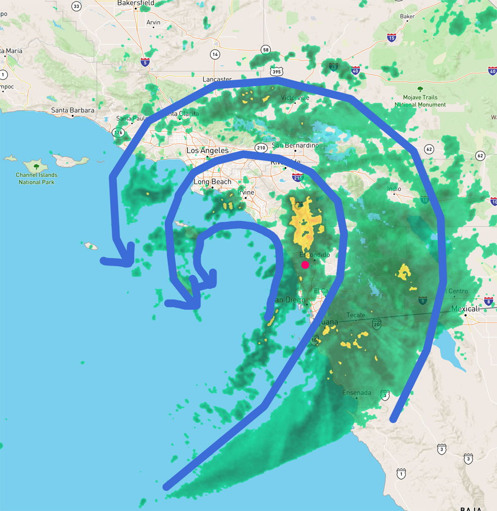 Red dot rough location of my Elfin Forest rain gauge - storm moving slowly east / southeast "If it keeps on raining, levee's going to break" Friday, April 10, 2020 - 2 PM - Incredible but true... since the last reading we have just over .75" in the gauge! So, this historic storm has a local total of 6.18". Another band formed after what I thought was the "last one" and intensified. The center of the circulation is right off the coast. Maybe we'll get some more wrap-around? No NWS storm total update. Friday, April 10, 2020 - 10:40 AM - Just took a new reading: .56" more in less than two hours. So that's 2.19" since yesterday evening's post and about 2.5" in the last 24 hours (more than 2" in SD within 24 hours is very unusual). Storm total now 5.43"!! The NWS has updated their storm totals as of 10 AM: SD Airport 3:26" (an increase of .73"), Encinitas 5.08" (an increase of 1.48"), Escondido 4.46" (an increase of 1.36"), La Mesa 4.07" (an increase of 1.07"). Just one more small blob of rain to go here after the current wave which is lightening up now. Friday, April 10, 2020 - 8:45 AM - Wow, Wow, WOW! Just took at reading of my Elfin Forest gauge. 1.63" since yesterday's read! Been raining hard and still coming down. Looks like one or two more bands will pass through and then we will be done. Rain storm (going back to last Sunday night) total here 4.87"!!! Saw a picture of Escondido Creek flooding Harmony Grove Road, there must be flooding elsewhere in the county, for sure. Quite epic for San Diego, particularly in April as the normal for the whole month is something like 0.77" at the airport. For the season we are well above normal (Nov, Dec, Mar, Apr super wet, Jan, Feb dry), the airport is probably about 3" above normal now for the season. NWS storm totals are a stale, latest post is as of 4:02 AM, we've had a lot in the 4+ hour since then. Anyway: SD Airport 2.60" (an increase of 1.04"), Encinitas 3.60" (an increase of .77"), Escondido 3.10" (an increase of .67"), La Mesa 3.00" (an increase of .45"). Thursday, April 9, 2020 - 9:16 PM - It took a LONG time for that large slow moving counter clockwise blob of rain to reach us... and now some stronger bands are approaching. My Elfin Forest gauge has added .31" since this morning's post, the reading taken just moments ago. Storm total now 3.24"! NWS storm totals as of 8:47 PM: SD Airport 1.56" (an increase of .09"), Encinitas 2.83" (an increase of .40"), Escondido 2.43" (an increase of .34"), La Mesa 2.55" (an increase of .16"). There are some very impressive figures in the San Bernardino mountains, the leader is Lytle Creek RAWS with 9.02". Thursday, April 9, 2020 - 9:07 AM - .19" here since the last post, bringing storm total to 2.91". A very large solid surge of rain appears to be approaching from the NW, wrap around moisture from the closed low. Going to get weeding in before the rain approaches. NWS storm totals as of 5:02 AM: SD Airport 1.47"' (an increase of .09"), Encinitas 2.43" (an increase of .38"), Escondido 2.09" (an increase of .05"), La Mesa 2.39" (an increase of .04"). Next post not until late this evening. Wednesday, April 8, 2020 - 5:13 PM - Just a few sprinkles here, Elfin Forest total now 2.72"; current activity has moved well to the east. NWS totals as of 3:47 PM: SD Airport 1.38" (an increase of .01"), Encinitas 2.05"(an increase of .08"), Escondido 2.04" (and increase of .12"), La Mesa 2.35" (no change). RAWS stands for Remote Automated Weather Station. They are operated by the Forest Service and the Bureau of Land Management. Wednesday, April 8, 2020 - 11:34 AM - End of current showers, .37" additional, Elfin Forest gauge total now 2.70". Wednesday, April 8, 2020 - 10:52 AM - Heavy rain and BB sized hail! Wednesday, April 8, 2020 - 9:14 AM - Woke up around 2AM, heavy shower was in progress. Elfin Forest reading as of about 8:30 AM, .19" additional, bringing storm total to 2.33". NWS totals as of 7:02 AM: SD Airport 1.37" (an increase of .21"), Encinitas 1.97" (an increase of .07"), Escondido 1.92" (an increase .32"), La Mesa 2.35" (an increase of .43"). Also of note was that yesterday afternoon it was very windy here. I'm now thinking I want to set up a full scale weather station here. Stay tuned although won't happen right away. This morning's forecast as of 8:28 AM calls for "around 1 inch along the coast" for the remainder of this stormy period. Tuesday, April 7, 2020 - 9:17 PM - Received a report from the Bankers Hill gauge 1.24" - this reading was taken around 10:30 AM. However there may have been .20-.30" in there from before. As for Elfin Forest, we had some light rain showers, coming in at .13" by late afternoon, bringing the storm total to 2.14". NWS storm total figures as of 7PM: SD Airport 1.16" (an increase of .37"), Encinitas 1.90" (an increase of .41"), Escondido 1.60" (an increase .36"), La Mesa 1.92" (an increase of .20") so yesterday Elfin Forest was the champ, today less than the others. San Bernardino station Lytle Creek RAWS is the overall champ with 6.54". Anyone know what "RAWS" stands for? Yesterday night's forecast called for 1.5-2" additional rain along the coast; that figure is now 0.6-1.25" along the coast. Tuesday, April 7, 2020 - 9:33 AM - The extended segment of rain ended late last night. An early morning read of my Elfin Forest gauge showed 2.01"! Having light drizzle now. I'm attempting to get a read on my Bankers Hill gauge. NWS storm totals as of 8:01 AM: SD Airport .79", Encinitas 1.49", Escondido 1.24", La Mesa 1.72"(!). The NWS SD discussion is still calling for 1.5-2" of additional rain along the coast before this is all over late Thursday! Occasionally I receive a request for daily rain data. I don't maintain daily records as they are available via the NWS. Go to https://w2.weather.gov/climate/index.php?wfo=sgx and you will see something like this which is easy to navigate:  Monday, April 6, 2020 - 10:28 PM - Heavy rain! Latest Elfin Forest reading now 1.68" for the storm. Radar indicating an end for this spell within a couple hours. NWS Totals as of 9:10 PM: SD Airport .53", Encinitas 1.18", Escondido .67", La Mesa still missing. La Mesa 24 hours ending 10 PM just .18" (https://www.cnrfc.noaa.gov/images/countyPrecipMaps/sandiego_24HRprecip.png) This map as of 10 PM shows SD Airport .61", Encinitas 1.42", Escondido .79. My Elfin Forest gauge is rocking! Only Palomar Observatory 2.35" and Birch Hill 2.27" have more. Monday, April 6, 2020 - 8:41 PM - Rain! Took a while to get going, didn't start in earnest not including the 2 AM heavy show until around mid afternoon. By ~6:30 PM .64" and just now 1.02" at mu Elfin Forest gauge with a good steady rain! The main rain has been north and west of here with meager amounts in SE SD county. The latest NWS storm total figures are as of 7:08 PM, so are a bit stale compared to my reading: SD Airport .35", Encinitas .69", Escondido .38", La Mesa is not shown, but on the 8PM SD County map is showing just .11". Up north in the San Bernardino area 3+ and 4+ inch readings are common. Monday, April 6, 2020 - 9:39 AM - Covid-19 Stay At Home day 19. Woke up @2AM thanks to a rather heavy shower. Checked the Elfin Forest gauge a few minutes ago: .28", nice! I don't think there has been any rain since then although a drizzle has just started and radar is showing an impressive band approaching crossing Irvine. NWS storm totals as of 8:47 AM: SD Airport .22", Encinitas .17", Escondido .14", La Mesa a measly .03". Sunday, April 5, 2020 - 8:22 PM - The forecast for heavy rains is still very much on track as of the 1:11 PM NWS forecast: Coast/Valley: 1.50-2.75 inches. Urban and small stream flooding will be a concern for all of these areas. Current radar shows the main bands west of L.A. now reaching the Channel Islands. Several more people have contacted me saying they occasionally check in here. Thank you. Will keep this going! Friday, April 3, 2020 - 10:27 PM - The NWS weather discussion for San Diego is full of rain talk! Normal rain for the month of April in San Diego is about 0.7". Here is the latest as of 8:26 PM: Total precipitation next week should range from 1.5 to 2.5 inches coast and valleys. 2.5 to 3.5 inches in the mountains but amounts up to 6 inches in the San Gabriel and San Bernardino County mountains. The rain is to come in two swatches: Monday afternoon and Wednesday morning. I'll be monitoring my Elfin Forest gauge and I'll see what I can do to have someone monitor the San Diego (Bankers Hill) gauge. Friday, March 27, 2020 - 8:32 AM - Hits or miss showers passed through last night, mostly miss here. Received a report of hail in Bankers Hill. Just .02" in my Elfin Forest gauge. NWS figures as of 4 Thursday, March 26, 2020 - 10:45 AM - Thank you Lynn, Jessica, Valerie and Neil for writing! I'll keep this going! Last night at Elfin Forest we had a couple strong but fairly short showers go through. This morning's gauge reading: .25".... so we break 5" for the month at 5.01! Everything is so.... green. Spent the last three days of this pandemic-stay-at-home weeding as I'm trying to eliminate the thistle infestation of open areas before they go to seed. Back to weather.... NWS figures as of 7:01 AM: SD Airport .04" again in the dog house, Encinitas .08", Escondido .39" (so once again we come in the middle of Enci & Esco), La Mesa .10". More showers on the way tonight. Meanwhile I still haven't received Methane Levels... time to starting bugging for them. Monday, March 23, 2020 - 2:13 PM - I was able to obtain a Bankers Hill gauge reading: .31", that would be since about noon on March 18. SD Airport received .22" since then so the reading is in the same ballpark. Monday, March 23, 2020 - 10:23 AM - Rain last night and early morning, exactly .50" in my Elfin Forest rain gauge, bringing the March total to 4.76"! NWS totals through 8AM: SD Airport .09", Encinitas .48", Escondido .53", La Mesa .23". Again the Encinitas / Elfin Forest / Escondido band did better than southern SD county. Carlsbad, Del Mar and Oceanside all had more than 1/2". Saturday, March 21, 2020 - 8:45 PM - Yesterday morning, March 20, we had .12" at my Elfin Forest gauge. Brings the March total to 4.26". NWS totals: SD Airport .13", Encinitas .32", Escondido .20", La Mesa .36". Thursday, March 19, 2020 - 9:41 AM - Mid afternoon yesterday my Elfin Forest gauge was at .70". I'm guessing about .40" fell in the March 16-17 overnight and .30" yesterday through mid afternoon. We had very heavy rain showers last night (at least two direct hits from small cells) and although SD Airport showed nothing overnight we had an additional .73"!! So far this month my Elfin Forest gauge has totaled 4.14"!! NWS storm totals for overnight at of 8:30 AM: SD Airport .00" (zero!), Encinitas .23", Escondido .48", La Mesa. 14". The leader is "Goose Valley Raw" at .71". I vouch for my reading .73". As mentioned due to the Covid-19 pandemic, readings at Bankers Hill have been suspended although the gauge is still setup, will read it eventually. Wednesday, March 18, 2020 - 11:32 AM - Showers this morning. My gauges: Bankers Hill .23", Elfin Forest (not available, I'll have a total including yesterday later), NWS gauges as of 10AM: SD Airport .16", Encinitas .13", Elfin Forest (not reported - due to the erratic reporting from this NWS gauge I'm going to discontinue attempting to post it, of course I'll continue to report my own Elfin Forest gauge), Escondido .10", La Mesa .12". The leader is Tierra Del Sol with .32". Due to the Covid-19 pandemic I'm going to be at the Elfin Forest location for at least two weeks. I won't be reporting the Bankers Hill gauge during this time. Will post total when I return. Tuesday, March 17, 2020 - 5:55 PM - Yesterday evening, in Bankers Hill around 10:30 a nice band of rain arrived, with showers lasting a few hours. My gauges: Bankers Hill .36", Elfin Forest (not available). NWS gauges: SD Airport .26", Encinitas .16", Elfin Forest (not reported), Escondido .46", La Mesa .41". Additional rain is predicted for Wednesday into Thursday (1/3" to 2/3") and again Sunday into Monday, no numbers posted. Still waiting for Methane Levels data. Monday, March 16, 2020 - 4:01 PM - There was some additional showers last Friday and into Saturday. I think (misplaced notes) the final total for Bankers Hill was .66", and 1.79" in Elfin Forest. NWS published 5 day totals as of 9:02 Saturday March 14. My gauges for the 5 days: Bankers Hill .97", Elfin Forest 2.80", NWS: SD Airport 1.19", Encinitas 2.76", Elfin Forest (not reported), Escondido 3.49"(!), La Mesa 2.25" Friday, March 13, 2020 - 9:36 AM - Around 8:15 AM a very strong but brief squall with heavy rain pass through Bankers Hill, tossing around patio chairs and knocking down a children's play structure next door. Just checked the gauge here, .26" additional bringing the two day (March 12-13) storm total to Bankers Hill to .57". Also just received a reading from my Elfin Forest gauge, .25" additional bringing the storm total to 1.65". Two day NWS figures as of 9:01 AM: SD Airport .43", Encinitas 1.88", Elfin Forest 1.32", Escondido 2.07", La Mesa 1.19". March has turned into a very, very good month, countering the short falls in January and February, and there is more to come! Thursday, March 12, 2020 - 9:54 PM - Lots of rain!!! Totals for the storm which ended March 11 morning: My gauges: Bankers Hill .57", Elfin Forest a fat 1.01". NWS figures: SD Airport .56", Encinitas .71". Elfin Forest (not reported), Escondido 1.21", La Mesa .63". For today's storm (March 12) through 4PM - My gauges: Bankers Hill just .31", Elfin Forest a very fat 1.41" had some good downpours, NWS figures SD Airport just .26", Encinitas 1.47", Elfin Forest .84", Escondido the leader at 1.64", La Mesa 1.10". So parts of southwest SD county received much less than the Encinitas/Escondido belt. Some light rain is falling now in Bankers Hill will update tomorrow. Tuesday, March 10, 2020 - 10:32 AM - Nice rain last night, no heavy rain so far today. My Bankers Hill gauge: .36". Will have my Elfin Forest reading later this week: NWS figures as of 9:01AM: SD Airport .31", Encinitas .58", Elfin Forest .46", Escondido .71", La Mesa .32". Monday, March 9, 2020 - 5:07 PM - Over this past weekend Saturday and particularly yesterday morning there were light showers. Storm totals: Bankers Hill. 12", Elfin Forest .02", SD Airport .01", Encinitas .21", NWS Elfin Forest .02", Escondido .02", La Mesa .09". "Heavy Rain" is predicted for tomorrow! The figures have been coming down in the past 24 hours, but the forecast still calls for an inch along the coast and up to 3" in the mountains. Much needed. Monday, March 2, 2020 - 7:03 PM - Disappointingly light showers passed through Bankers Hill last night / early this morning. Storm totals: Bankers Hill .03", Elfin Forest .02, SD Airport .01", Encinitas .00", NWS Elfin Forest .06", Escondido .14", La Mesa .14". I heard a first hand report from San Marcos that there was some small hail this afternoon - evidently while skies were mostly clear in the county this afternoon there were a few pockets of high instability. There were much higher storm totals in the San Bernardino Mountains area, City Creek Ranger Station took the prize with 1.22". Sunday, February 23, 2020 - 8:33 PM - First of all, our place up north is not in Olivenhain, rather just over the border in extreme western Elfin Forest. So when I when I mention my northern gauge I'll say "Elfin Forest" and for the NWS Elfin Forest reading I'll say "NWS Elfin Forest". Yesterday up north we had a direct hit by a thunderstorm with lighting, thunder and small hail! Storm totals: Bankers Hill .13", Elfin Forest a fat .54", SD Airport .11", Encinitas .62", NWS Elfin Forest .38", Escondido .38", La Mesa .18". Still waiting for Methane Levels data. Tuesday, February 10, 2020 - 3:44 PM - We had some light rain yesterday afternoon and several nice periods of light to almost moderate rain today. Rather sunny now. Storm totals for Feb 9-10: Bankers Hill .34", SD Airport .27", Encinitas .31", Elfin Forest .34", Escondido .48", La Mesa .41". Of note was a band of rain which move north just off the coast, Point Loma received 1.36" and Mission Beach .66" while just inland Sea World received just .13". Meanwhile, still waiting for Methane Levels data. When I get the data and post it I'll then post all of the graphs as a group on Instagram. Monday, February 3, 2020 - 12:20 PM - Just a trace of rain in Olivenhain, super light drizzle yesterday evening. Bankers Hill 0", SD Airport 0", Encinitas 0", Elfin Forest 0", Escondido wins with a massive .01", La Mesa 0". Meanwhile the San Diego Sea Levels data for the year is now in, will update today, shortly. Monday, January 27, 2020 - 8:36 PM - The figure for Olivenhain for the January 21 event was .35". Meanwhile with no more rain predicted for January, San Diego January will come in quite a bit below normal. Will post towards the end of the month. Tuesday, January 21, 2020 - 2:16 PM - I have updated the annual chart for Nitrous Oxide Levels for 2019 with added commentary. I'm still waiting for end of year figures for Sea Levels and Methane. Tuesday, January 21, 2020 - 1:18 PM - Follow-up bands of rain came through last night and early morning, making it to the ground dumping far more rain than expected! Totals: My gauge at Bankers Hill .31", SD Airport .25", Encinitas .26",Elfin Forest .25", Escondido .37", La Mesa .32". Monday, January 20, 2020 - 11:39 AM - Rain totals for last Friday, January 17: Bankers Hill .20", Olivenhain .15", SD Airport .18", Encinitas .07", Elfin Forest .14", Escondido .20", La Mesa .10". May get a few sprinkle out of the current frontal situation, but radar shows the weak system drying out as it approaches. Friday, January 17, 2020 - 8:234 AM - Frontal rain passage over, had a few nice clumps of rain, .20" total here in Bankers Hill, better than the "less than .10" predicted. Monday, January 13, 2020 - 12:23 PM - Per request I'm now making my San Diego temperature history file available as downloadable text. For more details see San Diego Temperature. Sunday, January 12, 2020 - 8:17 PM - Rain totals for last Thursday, January 9: Bankers Hill .12", Olivenhain .03", SD Airport .05", Encinitas .00", Elfin Forest .01", Escondido .00", La Mesa .00". Tuesday, January 7, 2020 - 6:15 PM - I have updated the annual charts for Carbon Dioxide Levels for 2019 with added commentary. I'm still waiting for end of year figures for Sea Levels, Methane and Nitrous Oxide. Wednesday, January 1, 2020 - 3:27 PM - I have updated the annual charts for San Diego Temperature and Arctic Sea Ice for 2019 with added commentary. I'm still waiting for end of year figures for Sea Levels, Carbon Dioxide, Methane and Nitrous Oxide. The time lapse I posted yesterday has a super interesting sequence for a few seconds around the 14 second mark. The stationary lenticular cloud formed a "curly top" as it was being sheared by winds above the cloud. 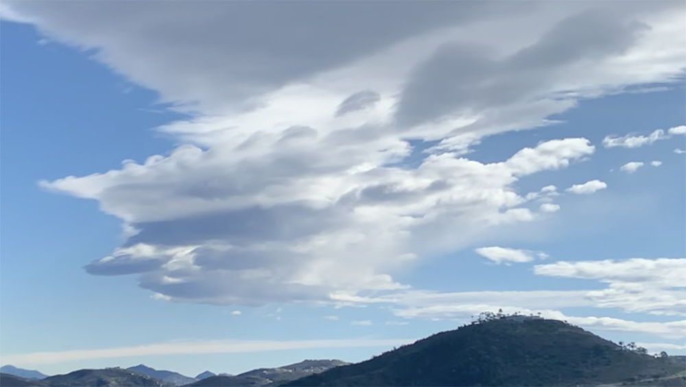 Curly top cloud, December 31, 2019 Tuesday, December 31, 2019 - 8:44 PM - Just a trace in Olivenhain today, and nothing in San Diego nor the other locations I track. I've updated the annual and decade rain fall charts at San Diego Rain. Total for the year at SD Airport came in at 15.28", the most in nine years. My annual rain commentary is on that page. Today there were some super cool lenticular clouds and I posted a time lapse on Instagram at my https://www.instagram.com/johnstokesiii/ account. Monday, December 30, 2019 - 11:48 AM - The third storm of the latest trilogy remains offshore and the situation is looking like there will be nothing in my gauges for the remainder of the year. Tomorrow is almost certain to be sunny. Will update my calendar year rain chart tomorrow or Wednesday at San Diego Rain. As the decade is done, I'll make a final update to the 2010's decade bar too and add commentary on that page. Will also be updating San Diego Temperature and Arctic Sea Ice on Wednesday or Thursday Sunday, December 29, 2019 - 8:00 PM - Olivenhain total for the period December 23-26 was 2.54", gauge checked on December 27nd. Thursday, December 26, 2019 - 7:07 PM - An wonderfully intense rainstorm starting very late last night and ending around daybreak this morning dumped 1.29" of rain here! In the SD county mountains there was heavy snow with I-8 being shutdown. There have been showers since this morning along the coast and more snow inland, but nothing here. NWS 24 hour storm totals as of 4:01 PM: SD Airport 1.28" (almost exactly matching my total), Encinitas 1.32", Elfin Forest 1.44", Escondido 1.63" (leading the inland valley locations), La Mesa 1.12". A storm for next Monday, December 30 is in the forecast with increasing chances, but details are still quite fuzzy. This year is already the second wettest year in the last 21 years! Wednesday, December 25, 2019 - 12:57 PM - Light showers last night from the spotty "in-between-storms" system. Bankers Hill gauge: 04", NWS totals as of 6:45 AM: SD Airport .01", Encinitas .10", Elfin Forest .31", Escondido .29:, La Mesa .12". Again, big storm still on track for late tonight and mainly tomorrow, should be in excess of one inch here. Tuesday, December 24, 2019 - 1:59 PM - Final totals for the Dec 23 (and a bit into Dec 24, 2019) storm: My Bankers Hill gauge: 1.31", NWS totals as of 8:31 AM (no rain here since then): SD Airport 1.34", Encinitas 1.16", Elfin Forest (not shown, sigh), Escondido 1.31", La Mesa .86". Big storm still on track for late Wednesday and mainly Thursday. Monday, December 23, 2019 - 7:50 AM / 9:08 PM - Rain, again! A rather heavy band moved through here (San Diego) in the past couple hours/ Thursday, December 12, 2019 - 7:30 PM - Olivenhain total was .31", gauge checked on December 10th. Monday, December 9, 2019 - 11:05 AM - Final total .27". NWS storm totals as of 5:02 AM today - SD Airport .21", Encinitas .19", Escondido .30", La Mesa .29". I fixed the video link so it starts at the beginning instead of 63 seconds into the video. The video is at https://www.youtube.com/watch?v=pVMQ4ZMs0ug Sunday, December 8, 2019 - 3:28 PM - Last month on November 17, in Olivenhain, the sunset was the most unusual I ever saw - I was, with others, watching the sunset when in what would normally be the final few seconds, the sun seemly "stood still and took forever" to actually set. I was recording the sunset and I captured the whole period. The corrected video link is at https://www.youtube.com/watch?v=pVMQ4ZMs0ug
Sunday, December 8, 2019 - 1:56 PM Saturday, December 7, 2019 - 10:23 AM / 3:00 PM Friday, December 6, 2019 - 9:29 AM - Final storm totals for the December 4-5 storm: Bankers Hill 1.38", Olivenhain 1.18", SD Airport 1.19", Encinitas .89", Escondido 1.55", La Mesa 1.33". A big storm is moving well to the north of us this weekend, light rain is predicted locally. Wednesday, December 4, 2019 - 7:44 AM / 9:04 AM - Sunday, December 1, 2019 - 6:41 PM - I've been away from my computer that has the software for updating this website, but I managed to monitor both gauges in the meantime. What a storm! Up in Olivenhain last Wednesday we received .40" as of 10 PM. The last reading I took on Thursday was at 2.02" storm total - I heard one distant roll of thunder late in the afternoon. Friday morning at 7:45 AM the storm total was at 2.40" and by the end of Friday a few scattered showers brought the final storm total read at 2.53". Meanwhile at Bankers Hill, Katie (my wife) took the first read on Friday morning with storm total of 1.87", and when I returned another .10" had fallen afterwards bringing the final storm total to 1.97". So.... Bankers Hill 1.97", Olivenhain 2.53", SD Airport 1.95" (just about matching Bankers Hill), Encinitas 2.69", Escondido 2.55" and La Mesa 2.14". November ended the streak of dry months in excellent fashion, well above normal. Looks like .5-1" coming up this Wednesday, gauges ready!
Monday, November 25, 2019 - 8:04 PM - The November 19-21 rainstorm dropped exactly 1.50" in my Olivenhain gauge. NWS has been advertising a huge storm for the second half of this week. The projected rain figures have been in a slow decline, but still are at a fat 1.5 to 2" for the coast / valleys (down from original figure of something like 3-4"). Gauges are ready. Thursday, November 21, 2019 - 4:05 PM - Rain ended early morning after some strong showers. Final storm total here at Bankers Hill .86", a great start to the rainy season. NWS storm totals for the other areas I track here as of 10:47 AM: SD Airport .77", Encinitas .88", Escondido 2.40", La Mesa 1.28". Henshaw Dam led the county with 4.69". My guess for my Olivenhain gauge is somewhere between 1.25 and 1.5". I'll get a reading tomorrow and post it by the end of the weekend. Wednesday, November 20, 2019 - 8:24 PM - Rain continued today but with wide variations, not the monolithic soaking rain I was hoping for with coastal areas coming in well under forecast. As of 8:15 PM our Bankers Hill gauge showed .46", .35" since yesterday evening's read. I won't get to the Olivenhain gauge for a few days. The NWS has been much better this year in updating their "Storm Totals" page, with frequent updates, I thank them for that. As of 7:32 PM, storm totals are SD Airport .42", Encinitas .49", Escondido an even fatter 2.09"and La Mesa .84". Valley Center continues to lead, now with a super impressive 4.31". Tuesday, November 19, 2019 - 7:43 PM - Rain! As of about 6 PM our Olivenhain gauge picked up .62" way more than I was expecting from the southern storm (I was expecting zero!) - a band wound around the center bringing plenty! In our Bankers Hill gauge, as about about 7:30 PM, only .11". The NWS storm totals as of 6:35 PM have SD Airport .10, Encinitas .10 (shows the narrowness of the band), Escondido a fat 1.06" and La Mesa .25". The leader is Valley Center with 2.17". The storm from the northwest is still to come! Monday, November 18, 2019 - 2:44 PM - The NWS has been predicting the first winter storm of the season during this past week and the time is quickly approaching. Southern San Diego county will first get brushed with the remnants of tropical storm Raymond on Tuesday, then a normal frontal system will move through on Wednesday. Yesterday the projected coastal amounts increased to between 1 and 1 1/4" today downgraded to between 1/2 to 1". Hopes remain high. Meanwhile I purchase a gauge for Olivenhain like the one in Bankers Hill and set it up after taking this picture: 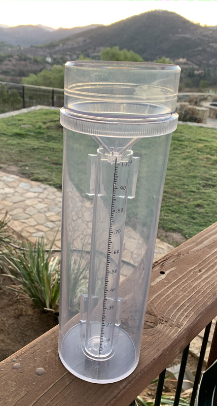 Monday, September 30, 2019 - 3:15 PM - The final Olivenhain rainfall measurement for September 28-29 periods was about 5/16" of an inch (.31"). Today I ordered a new Stratus Precision Rain Gauge for my Olivenhain location, the same as I have here in Bankers Hill. This will replace my vastly inferior gauge currently in Olivenhain. Saturday, September 28, 2019 - 9:26 AM - Rain last night! Unfortunately I didn't make sure the gauge was empty late yesterday and I think water may have been in there from some garden watering activity. There was .28" this morning, but looking at some buckets I'd say the total was around 1/10 inch which would be consistent with the SD airport's .10" as of 8:15 AM this morning. So I go on record as "Missing". I'll have an Olivenhain reading later. Encinitas .05", Escondido .04", La Mesa .15". Friday, September 27, 2019 - 6:42 PM - Some tropical air generated showers to the east a couple days ago - nothing here in Bankers Hill or Olivenhain. Deserts and mountains received nice rain, for example Mt. Laguna .71 over Sept 25-26. Today some drizzle moved into the Olivenhain area from the northwest and intensified to light rain, we received about .05" before I left around 10 AM - very local as I-5 was dry. Nothing in Bankers Hill. SD Airport is showing just .01" this month so far. Wednesday, September 4, 2019 - 5:28 PM - Thunderstorm! A strong thunderstorm formed below the southern boundary of San Diego County along the mountain ridge and moved northward while expanding in size. Rain spread westward as the storm moved north, and into our area in Banker's Hill. The rain started out as scatter big raindrops then a nice downpour for 10 minutes or so shortly after 3 PM. A lot of thunder! Final total .14". Monday, July 1, 2019 -10:08 PM - The 2018-2019 July-June rain season ended up with12.84" at the airport. Nicely above normal. Chart updated at San Diego Rain On June 29 at sunset we had one of the most spectacular sunsets ever with amazing colors thanks to the dissipating upper clouds from the first eastern Pacific tropical storm of the season, plus an upper atmosphere rainbow without any ground rain. The rainbow was visible over a wide area of San Diego country. I captured, in my opinion, one of the best sunset pictures ever!
Friday, June 21, 2019 - 8:57 AM - Summer solstice! Had drizzle last night, a tad over .04" in the rain gauge! The NWS posted figures as of 5AM. Here .04", SD Airport .01", Encinitas .08", Escondido nothing, La Mesa .01". Monday, May 27, 2019 - 9:52 PM - Spent the weekend in Olivenhain. Had about .12" of rain there on Sunday. When I returned there was .15" in my Banker's Hill rain gauge. Don't know the distribution of precip over time. I see the airport had two periods of rain, one on Sunday morning w/ .03" and .05" later in the day. Two day totals: Here .15", SD Airport .08", Encinitas .06", Escondido .13", La Mesa .07". Mountain areas had a lot more, particularly in the San Bernardino area. Wednesday, May 22, 2019 - 4:08 PM - Another brief but heavy shower went through late yesterday afternoon dropping .06", and this afternoon a couple squalls have dropped .09". Yesterday's SD airport figures show .04" and today, matches mine as .09". Looks to be clearing out for now. Yesterday's NWS log shows SD Airport .04", Encinitas .00", Escondido .00", La Mesa .00", so the showers were super local. Figures to include this afternoon's rain haven't been posted. My Bankers Hill total so far this month is now 1.04" Monday, May 20, 2019 - 12:27 PM - A brief but heavy downpour this morning and a couple light showers brought another .12" here. Surprisingly the airport just a couple miles away received just .01" this morning. My two day total is .42". Two day totals as of 12:01 PM today: SD Airport .18" (.02" more since yesterday's 4:30PM total), Encinitas .26" ( .01" more), Escondido .77" (.38" more continuing to lead the pack), La Mesa .60 (.31" more). The forecast is for more of the same mid week and next weekend. Sunday, May 19, 2019 - 5:34 PM - The cooler than normal weather continues with a lot more rain than normal! Today in another frontal pattern we received exactly .30" here in Bankers Hill. The sun is now out. NWS storm totals are now out as of 4:30 PM. Here .30", SD Airport .16", Encinitas .25", Escondido .39", La Mesa .29". The NWS forecast nailed this one. Last Thursday's rain dropped about .12" in Olivenhain. My Bankers Hill total so far this month is now .77" Friday, May 17, 2019 - 8:11 AM - Yesterday received .05" of frontal rain in the Bankers Hill rain gauge, less than hoped. Totals: Here .05", SD Airport a paltry .02", Encinitas .13", Escondido .20", La Mesa .14". More fell in the mountains. Monday, May 13, 2019 - 9:57 PM - Final totals for the three day period ending May 11: Here (Bankers Hill) .38", SD Airport .36", Encinitas .17", Escondido .21", La Mesa .15". My Olivenhain gauge had about .10". Saturday, May 11, 2019 - 2:27 PM - Had some nice rain this morning, moving in from the east as low pressure moved south of here. Picked up .18" more, bringing the 3 day today to .38" and the month of May well above normal (.42" so far versus a whole month normal of about .27"), making up a bit for a dry April. Looking at the hourly SD Airport figures, they received .19" today which should bring their 3 day total to .36". Will check my Olivenhain gauge tomorrow. Friday, May 10, 2019 - 12:45 PM - Yesterday, May 9 we had .09" here at Bankers Hill and so far today .11", the gauge has just over .20" since I last emptied it. Monday, May 6, 2019 - 9:10 PM - Had a few scattered showers this morning; there were reports of brief but heavy showers in other places particularly Del Mar and Solana Beach. Storm totals: Here (Bankers Hill) .04", SD Airport .04", Encinitas .05", Escondido .08", La Mesa nothing. Mission Beach took home the prize with .32". Tuesday, April 30, 2019 - 6:13 PM - Lots of heavy drizzle and a few light showers this morning. .11" additional water, bringing the two day total to .14". Two day totals: Here .14", SD Airport .09", Encinitas .31", Escondido .16", La Mesa .10". May receive some more of the same tonight going into tomorrow morning. Monday, April 29, 2019 - 9:53 PM - Had a few light showers today, first rain in more than 3 weeks. Totals: Here (Bankers Hill) .03", SD Airport .01", Encinitas .16", Escondido .12", La Mesa .04". Could get a few more sprinkles and / or drizzle tonight. Saturday, April 6, 2019 - 9:45 AM - Yesterday morning a light rain band passed through dropping .07". Drizzle later in the day brought the total to .09". Cleared out the gauge yesterday evening. Early this morning another period of light rain, dropping .05". The current forecast is for dry weather up to next Friday. Two day totals as of 5:01 AM: Here (Bankers Hill) .14", SD Airport .07", Encinitas .11", Escondido .11", La Mesa .04". Thursday, April 4, 2019 - 8:07 PM - A few patches of rain today in SD Country, nothing here. Looking like there will be some measurable rain tonight. Wednesday, April 3, 2019 - 5:49 PM - Last night .02" fell in my Bankers Hill gauge. North county had more, mostly in the .05-.15" range. Storm totals: here .02", SD Airport nothing, Encinitas .05, Escondido .05", La Mesa .02". Monday, March 25, 2019 - 9:36 PM - Last Saturday I went to check the Olivenhain rain gauge to see what was there from the March 20 and March 21 squalls. Unfortunately I found the gauge had been crushed to smithereens by a bulldozer on the way to a spot for landscape terracing! I've since set up a new gauge in a safer location. Meanwhile little if any rain is expected for the rest of March. The Banker's hill total since late November is 14.95"; remains to be seen if the we get any more good storms now that this season is winding down. The airport's total since late November is 11.04". Thursday, March 21, 2019 - 8:22 PM - Our place ended up being in almost the perfect location for good rainfall. Today's showers netted .34". There was a thin longitudinal band of showers moving from west to east which soaked a narrow strip of the county after passage of the broader band of rain.
Thursday, March 21, 2019 - 4:02 PM - Another day another narrow line of showers - solid, but not as intense. Will have figures after it has passed. Yesterday's totals: Here at Banker's Hill: .24", SD Airport, .16", Encinitas .08", Escondido .34", La Mesa .09". Wednesday, March 20, 2019 - 3:38 PM - A nice squall line preceded and followed by bright blue sky went through here in the last hour. Three lightning / thunders, a touch of sub pea sized hail, rain total: .24" in about 15 minutes. Monday, March 18, 2019 - 9:25 PM - The Nitrous Oxide Levels data is in and has been posted. This completes the update for the year 2018 data. Tuesday, March 12, 2019 - 8:59 PM - The Olivenhain total for the rains ending March 7 was .33". Last night's rain was more concentrated in south SD county. The Olivenhain gauge recorded .31", while the Bankers Hill gauge had a very impressive .79"! Storm totals: here .79", SD Airport .62", Encinitas .30", Olivenhain .31", Escondido .35", La Mesa .15". Thursday, March 7, 2019 - 8:33 AM - Had .09" of showers overnight bringing the total to .15". The methane date for 2018 in now in and yesterday I updated the Annual Average Methane Levels chart. See Methane Levels. Wednesday, March 6, 2019 - 5:02 PM- The storm predicted for today has been underwhelming locally. So far here: .06" and some of that may have been dew, and as of 4:10 PM elsewhere: SD Airport .01" and that was yesterday afternoon, Encinitas .12", Escondido .25", La Mesa .03". Up north, particularly at the San Bernardino County mountains, the amounts have been copious with some stations getting more the 2". Note: Overnight on Sunday March 3 going into March 4, another .02" fell in the Banker's Hill area. Sunday, March 3, 2019 - 7:05 PM - Final totals: Here (Banker's Hill) .31", My Olivenhain gauge .61", SD Airport .17", Encinitas .41", Escondido .62", La Mesa .33". Predicted amounts for the next storm (mostly Wednesday) having been backed off due to a more northernly track, talk a something very significant a week from tomorrow Monday. Sunday, March 3, 2019 - 12:25 PM - Rain totals for the latest round of rain starting early Saturday: here .31", Olivenhain .61". The totals were progressive higher from south to north. SD Airport just .17", other cities as of 5:46 AM: Encinitas .39", Escondido .61", La Mesa .32". Thursday, February 28, 2019 - 9:25 AM - The U.S. Drought Monitor weekly update came out this morning. Just about all of California is now drought free! First time in years!
Friday, February 22, 2019 - 7:56 AM - Had showers starting late Wednesday, a lot yesterday with a few briefly intense, ending last night. Total here .35" (.03 Wednesday night, .26 through yesterday mid afternoon, .06 afterwards), SD Airport .22", Encinitas .22", Escondido .45", La Mesa .73". Finally, a dry spell is in the forecast, with warmer temperatures. Had ice in the bird bath Tuesday morning, at least the third time this winter. Frost this morning, at least the third time this week. Meanwhile, total rain here since late November 13.1"! Don't have figures for Olivenhain. Monday, February 18, 2019 - 9:14 AM - Overnight showers brought the second shortwave totals to here.16" here, .SD Airport .09", Encinitas .15", Escondido .09", La Mesa .30". Esco's figure declined, probably something to with cutting off the totals as of the beginning of Sunday putting uncertainty on the other figures as totals. Sunday, February 17, 2019 - 10:54 PM - Brief but heavy showers with strong cold winds have buffeted the area. The showers are still on radar to the west. Rain here as of around 9:30 PM: .10", SD Airport .04", readings as of 7:31 PM Encinitas .15", Escondido .10", La Mesa .17". A lot more in the mountains with heavy snows in the higher elevations. Saturday, February 16, 2019 - 4:15 PM - A shortwave last night dropped .09" here, SD Airport .07", Encinitas .10", Escondido .08", La Mesa .10", very consistent figures. The gauge at "SkyRanch" is will be henceforth known as Olivenhain. It had 2.85" in it late this morning. As it is located about half way between Encinitas and Escondido the total is consistent with the other two figures: Encinitas had a two storm total of 2.2" and Escondido 3.4", the average of the two was 2.8". Thursday, February 14, 2019 - 9:04 PM - Final Feb 13-14 storm totals: Here 1.59", SD Airport 1.06" (lowest of the SD country coastal stations), Encinitas 2.10", Escondido 3.32"(!), La Mesa 2.27". Since late November I've recorded 12.40" here, well above normal for a year. Thursday, February 14, 2019 - 1:03 PM - What a storm! Besides heavy rains, particularly in north county and over the mountains, the winds have been impressive, sustained 20-30 MPH with gusts over 40 for the last 10 hours or so. No major damage locally although there are reports of trees down around the county plus stream flooding. As of about 20 minutes ago my gauge recorded 1.25" for the storm. Much higher amounts, as mentioned, to the north and east. I was at Hotel Del Coronado this morning, video at https://www.instagram.com/johnstokesiii/ Wednesday, February 13, 2019 - 4:01 PM - Just took a reading. We've already had just over .25" here at Bankers Hill. Wednesday, February 13, 2019 - 2:04 PM - The rains have begun for what is forecasted to be a storm well in excess of one inch! 2-3" are currently forecasted for the coast and valleys. I won't be around to take measurements tonight, will have an update mid-day tomorrow. Last Sunday we had another .02" at Bankers Hill. I've started to put the day of the week in front of blog dates to help navigate in the future. February 9, 2019 - 5:33 PM - Finally got to the "Sky Ranch" gauge. 1.47" since the February 3 read with probably some evaporation. May have had a couple hundredths today. Had .02" today at Bankers Hill. February 5, 2019 - 8:30 PM - There were showers overnight, some this morning and just a few light ones this afternoon. Since the last measurement, I've recorded .24", bringing the third storm total to 1.31". The NWS hasn't listed third storm totals, rather a 6 day scoreboard. Using that and subtracting the totals I posted here on Feb 3, I get: Third storm / 6 day totals as of 4:02PM today: Here 1.31"/2.77", SD Airport 1.16"/2.50", Encinitas .29"/2.00" (seems really low for the third storm), Escondido .82"/2.80" and La Mesa 1.28"/3.20". There are still a few shows offshore. Saw a rainbow a couple hours ago... Will be interesting to see what the Drought Monitor posts this Thursday, I really can't see us even being "abnormally dry"; last Thursday we were still at February 4, 2019 - 9:12 PM - Showers have continued. My read is now 1.07" since the showers began late yesterday. Five day storm total here at Bankers Hill 2.53". February 4, 2019 - 2:22 PM - A bunch of showers have gone through since late last night. As of 2:10 PM the Bankers Hill gauge has .63" new rain. Airport looking similar, .64" as of 1:51 PM. This .63" puts my since-late-November total to 10.03", easily a normal amount for a year and part of a trans-formative situation for California's chronic dryness. So now I'm contending with 3 foot high dandelions, stinging nettle, mallow and other weeds growing rampantly, particular in neglected areas. February 3, 2019 - 6:08 PM - Final total for the second storm (mostly on February 2) here at Bankers Hill .86". The total since January 31, 1.46". Up at SkyRanch the total for this period was exactly 2". The first and second storm totals for my selected list: Here .60"/.86", SD Airport .62"/.72", Encinitas .81"/.90", Escondido .77"/1.21" and La Mesa 1.08"/.84". My total since late November 2018, 9.46"! February 2, 2019 - 11:43 AM - Getting blustery as the storm approaches. So far scatter light showers which started late yesterday evening. 04" in my Bankers Hill rain gauge, did not empty it. I'll be going to "SkyRanch" soon, will have the storm total for Bankers Hill tomorrow afternoon. I have an Instagram page at https://www.instagram.com/johnstokesiii/ where I've been posting selected charts and occasional cloud pictures. February 1, 2019 - 1:36 PM - The December sea level data arrive later yesterday and I've now updated and posted the 2018 data at San Diego Sea Levels . The average level was virtually the same as last year, while the up trend remains intact. January 31, 2019 - 9:38 PM - Storm totals are in: Here (Bankers Hill .60", SD Airport .62", Encinitas .81", Escondido .77", La Mesa 1.08" (one of the highest readings in the county). Looking forward to the widely anticipated rains this weekend, mostly on Saturday, February 2. January 31, 2019 - 5:19 PM - The first in a new series of storms, with some lighting and thunder at the onset, has dropped .53" here (Bankers Hill) as of about 5 PM. At the airport as of 4:51 PM the total is .57". A few more showers remain to pass through. Been an excellent winter! Meanwhile I'm still waiting for the December sea level data before I can post the 2018 annual update to the San Diego Sea Levels section. January 18, 2019 - 5:22 PM - Wrapping things up for the recent series of storms. Last night I received another .04" and the final read showed another .06" early this morning for .10" additional. That brings the 3rd storm to .31" the same as the second storm and 1.25" for the three. Final five day storm totals nearby areas: SD Airport .85", Encinitas 1.44", Escondido 1.83", La Mesa 1.27". NWS is suggesting there might not be any more rain for the remainder of the month. January 17, 2019 - 8:14 PM - Looks like the third storm is done - very tame here, mostly drizzle or heavy drizzle. North county and counties up the coast a lot more. Total in my Bankers Hill gauge today as of a few minutes ago: .21". Bankers Hill summary: Totals elsewhere in last 24 hours as of 7 PM elsewhere: Airport .09", Encinitas .29", Escondido .35", La Mesa .28". Spots in north country received well more than an inch. California overall very nice figures. Four day totals are super impressive with the mountains receiving 4-6" in a number of spots. As of 4:02 PM: Airport .70", Encinitas 1.30", Escondido 1.75", La Mesa 1.06" January 16, 2019 - 11:59 AM - I received an inquiry a couple days ago about data sources for weather models. I'm sorry I lost the email or can't find it on any social platform. At this time I use very few sources. I read the NWS discussion (includes occasional discussion of the weather models) for San Diego at least once a day at https://www.wrh.noaa.gov/total_forecast/getprod.php?afos=xxxafdsgx&wfo=sgx&version=0&font=120&toggle=dictionary Rolling 24 hour rain totals for SD county are published at https://www.cnrfc.noaa.gov/images/countyPrecipMaps/sandiego_24HRprecip.png Storm total data is published at https://www.wrh.noaa.gov/sgx/display_product.php?sid=SGX&pil=RRM Monthly data can be found at https://w2.weather.gov/climate/index.php?wfo=sgx There are many other links for satellite and radar imagery. January 16, 2019 - 9:48 AM - Bit behind here. Yesterday morning I measured another .12" at the Bankers Hill gauge bringing the first storm total to .63". I then went to "SkyRanch". Up at SkyRanch I'm not sure when I last measured the rain. There was .9" in the gauge as of yesterday afternoon - there must have been days of evaporation compounding things, that gauge needs to be replaced as it has a wide top. This morning there was .56" of new rain. Back in San Diego now, I just measured .31" for the second storm. So the total here for the current series of rains is .94". January 14, 2019 - 7:36 PM - The first of three recently advertised storms is just about done. The NWS backed off their over 1" prediction this morning, lowering it to .5" to 1" along the coast. The rain has stopped here, although there are a few light showers off the coast. Current storm total is .51". The second storm is predicted to go north of us for light, if any, rain here; the outlook for the third storm is less certain, although it looks like we will get something. My total here since the November 29th storm is now 7.17"! Storm totals as of 6:01 PM elsewhere: Airport .41", Encinitas .32", Escondido .65", La Mesa .66". January 13, 2019 - 2:19 PM - A little behind here! Early yesterday morning a nice band rather uniform rain went through San Diego County. Storm totals: Here .32", Airport .43", Encinitas .44", Escondido .64", La Mesa .32". The NWS has been upping the totals for the next storm, scheduled to arrive late Monday, with numbers now advertised as well above 1"! The ground around here is very moist and there have been some small cliff collapses at the man-made cliffs in the Reynard Way area. January 9, 2019 - 2:14 PM - I have updated the annual charts for Carbon Dioxide Levels January 6, 2019 - 12:42 PM - Last night we received a ton of rain! The first wave went through shortly before midnight. Sleep kept me from making an interval measurement run. The second wave was much heavier, very heavy in fact. The airport recorded .52" in the 3:51-4:51 AM hour. This morning I checked the gauge and the 1" tube was completely full! I emptied that and the overflow when poured in added another .43". We received 1.43". The airport had the highest storm total for the coast at .90". When the heavy rain woke me up I checked the radar and a small cell was right over us. For the second time in this rain season it looks like my gauge takes the prize for the most rain (second place was Birch Hill with 1.37")! My less reliable Acu-Rite gauge also recorded 1.37". Rain amounts on a pool cover and some containers confirm the fat rain amounts. Since November 29th of last year, my gauge has indicated 6.34" of rain here. Everything is super green, happy plants everywhere! Storm totals: Here 1.43", Airport .90", Encinitas .46", Escondido .66", La Mesa .71"
January 1, 2019 - The final total for the yesterday's rain here was .19". Airport .24", Encinitas .28, Escondido .07 and La Mesa apparently zero as it didn't show up on the NWS storm total list. I have posted the final airport totals for 2018 at San Diego Rain, the year came in at 7.65". The wonderful December rains bailed out the year from having really low numbers. My yard is still lush! I have updated the annual charts for San Diego Temperature, San Diego Rain, and Arctic Sea Ice for 2018 with added commentary. I'm still waiting for end of year figures for Sea Levels, Carbon Dioxide, Methane and Nitrous Oxide. Monday December 31, 2018 - 3:54 PM - So much for my "virtually certain" about there being no more rain this year after reading the forecast! I measured .04" here. There was .01" at the airport, nothing in Encinitas, .08" in Escondido and .01" in La Mesa. A few showers are still lurking off the coast. Tomorrow I'll update the annual charts for San Diego Rain and San Diego Temperature and other figures as they become available. Friday December 28, 2018 - 9:03 PM. I have now returned from a family vacation at Big Bear. We had about 4" of sleet and thundersnow on Christmas Day! I wasn't able to check the rain gauge here in Bankers Hill until today. .27 inches in the gauge, presumably all on the 25th. San Diego airport received .18 inches. It is virtually certain there will be no more rain here this year. However, I'll wait to update the monthly data and the yearly chart at San Diego Rain until after the year ends. Sunday December 9, 2018 - 8:15 PM. The December 5-6 total for "Sky Ranch" (halfway between Encinitas & Escondido) came in at just 0.90". Friday December 7, 2018 - 2:43 PM. The final storm total here came in at 3.44" including .25" additional last night. Just incredible! Efforts to contain soil erosion were mostly successful, however one spot where the dogs went gopher digging generated a breach in a berm. Adding last week's 1.03" we've had 4.47"! Some totals The previously leading SD University Heights station is not included in the most recent storm summary report.
Thursday December 6, 2018 - 8:42 PM. This storm merits yet another post. .37" more since the last reading. This brings today's total to 2.3" and the storm total to 3.16". The rains are light now although there are still some moderate cells lurking on the radar. Looks like the airport received 1.47" so far today and a storm total of 2.27". We're located not that far away, local terrain must have played a role (upslope valley opening to the south, with the cells moving to the north). Plus we had a direct hit from the thunderstorm which dropped just more than an inch in one hour. I see that at 8:02 PM the NWS posted storm totals for other locations: So my total of 3.16" is the highest in San Diego county? My problematic Acu-Rite gauge which typically records 10 to 15% higher than the analog gauge has been operating recently and it shows 3.68" buttressing the official 3.16" figure. Also we use some kiddie pools to collect rain water and they have about 4" in them, of course their sides are a bit tapered. My area has been such as dog over the past couple years. About time. Yay! Thursday December 6, 2018 - 7:10 PM. Deluge!!!!! A bit over an hour ago the rain gauge was showing .84". Just checked it. Full at 1". Emptied in and poured in the water at the bottom of the larger container. Another .93". Storm total now 2.79". Week's total now 3.83". Thursday December 6, 2018 - 6:13 PM. Huge thunderstorm just passed! Nothing like being outside in darkness, teaming down rain, with super loud thunder crackling just a second or two after the world lights up, followed by a dozen car alarms going off. About 1/2 hour ago today's total reached .84" bringing the storm total to 1.7" and the way the rain continued we should be well past an inch for today. We have a system of berms and swales directing the water down our slope, it was maxed out, so I turned the valve to direct the water to some Eucalyptus trees. Still raining quite hard. Dare I say too much rain! The main show should be over soon, I'll get another read later this evening. The SkyRanch gauge will be read on Saturday and posted here on Sunday. Thursday December 6, 2018 - 8:03 AM. Showers overnight dropped .18" here, bringing my storm total to 1.04". This brings the one week total to 2.05"! Still more to come. Happy camper. Wednesday December 5, 2018 - 7:49 PM. The rain stopped here around 6PM and shortly afterwards I took a reading, .86"! I then emptied the gauge. The NWS posted storm totals as of 5:01 PM and the leader was University Heights with .76" just beating out my .75" reading taken around the same time. So after a seemingly chronic streak of rain-envy, the SD airport did very well and my own gauge did extremely well. Wednesday December 5, 2018 - 5:12 PM. Took a bit longer for the rain band to get going here, but it really cranked up. About 10 minutes ago I measured almost exactly .75" in my Stratus Precision Rain Gauge! A perfect rainstorm for the yard - long periods of light to moderate rain, soaking everything. I'll take another reading after the band passes, probably in an hour or so looking at the radar. Still raining nicely here. The 5PM readings around the county show .70" at the airport (the highest reading on the country map! https://www.cnrfc.noaa.gov/images/countyPrecipMaps/sandiego_24HRprecip.png , .62 at Encinitas, .64 at Escondido and .51 La Mesa. Wednesday December 5, 2018 - 8:02 AM. A band of rain is approaching, just a couple hours away at most. The current coastal rain forecast today through Friday is 1 to 1.5"! Weather models are not in complete agreement and numbers were lowered from the prior forecast. Hopefully the predicted amounts will hold. Certainly going to get some rain this morning!
Sunday December 2, 2018 - 10:46 AM. Friday afternoon .02" fell here bringing the storm total to 1.03". Last night a trace, inland areas received more, generally 1/4". The reading from SkyRanch was 1.26" for the Nov 29-30 storm. The current forecast is talking 1-3" for the coastal strip this coming Thursday, and perhaps another system after that! Friday November 30, 2018 - 7:17 AM. Had some good showers last night, adding .34" here, bringing the storm total here to 1.01". There are still some showers around. Published storm totals as of 4:15 AM: SD Airport 0.74" one of lightest readings in the county excluding the deserts, Encinitas 1.02" and Escondido a very impressive 2.07". La Mesa also impressive at 1.73". I'll get SkyRanch's reading later today, but due to computer logistics won't post it until tomorrow afternoon. San Diego country is going to turn a nice deep green!!! Thursday November 29, 2018 - 3:26 PM. The front has passed, the sun is out with a lot of cumulus. Showers remain in the forecast. My Bankers Hill gauge received another .42" since this morning's reading, a bit less than hoped but still savored, bringing the storm total to .67". The airport had less rain overall, with their storm total as of 3PM at just .53". The two other cities I monitor had more, Encinitas .86 and Escondido .92. The usual pattern of the coastal areas receiving less rain than the mountains and the north receiving more the the south held to tradition with many mountain readings in the 2's. The pre-frontal winds were a lot less than advertised, I doubt we had a gust in excess of 20-25 MPH. Thursday November 29, 2018 - 9:47 AM. The storm is upon us! Early morning rains dropped .24" at the airport and .22" each in Encinitas and Escondido. At my Bankers Hill gauge I measured .25" right in line with the other readings. A strong cold front is on the way per current radar, all areas should receive at least another 1/2". I'll be checking the SkyRanch gauge on Friday. NWS has done a great job with this storm. Wednesday November 28, 2018 - 6:03 PM. Waiting for the rain! Rain gauges at the ready, and the swales of our permaculture system refreshed (silt cleaned out). The hydrology section of the NWS forecast for San Diego issued @ 1:47 PM this afternoon said "Through early Friday, rainfall is expected to range from around one inch near the coast to 2 to 4 inches in the mountains. Isolated rainfall totals of around 5 inches will be possible on favored southwest facing slopes. Around one half inch of rainfall is expected in the high desert areas and one tenth to one quarter inch in the lower deserts." The main rain is to come with the frontal passage late tomorrow morning or early afternoon. Right now there are stars and clouds; radar shows light rain north of LAX. Waiting..... Friday November 23, 2018 - 9:43 AM. I now have a second location with a rain gauge, at a place I call SkyRanch, about one-half way between Encinitas and Escondido. Yesterday, my main gauge in Bankers Hill recorded a very pathetic .01" same as the airport. Most of San Diego county received quite a bit more. SkyRanch recorded a wonderful .46" more than either of the two cities mentioned.
After the rain - November 22, 2018 Saturday October 13, 2018 - 9:59 AM. Another shower, moderate this time with some offshore lighting arrived later yesterday, before midnight, plus a few sprinkles gave us another .23" overnight per this morning's reading, bringing the total here to .65". Encinitas just .15" and Escondido .39". The airport's current 24 hour total is .48". Finally we did well! May be enough to green things up a bit? However, a fairly strong Santa Ana event is forecasted for this Monday and Tuesday. Hopefully the flora won't be too confused. Friday October 12, 2018 - 9:47 PM. THUNDERSTORM!!!!!! Some rain with embedded thunderstorms moved up from the south in the last hour and half. Plenty of distant lighting and thunder and about 10 minutes of fairly heavy rain fell here. Just checked my analog Stratus Precision Rain Gauge with a 10x funnel, .42" and then emptied it. Just a few drops falling now. My Acu-Rite is a total fail, shows zero. Radar show more cells off Baja moving north, may be get some more rain before this is over! The airport is showing .35" in the hour ended @ 8:51 PM. Looks like this is a coastal event so far. Friday October 5, 2018 - 1:32 PM. RAIN!!!!! Well some very light sprinkles passed over San Diego Country last night. The airport took home the prize with .09", and I measured .06", our first rainfall in a long time. Edit: since early May. Last week the remnants of Pacific Hurricane Rosa passed south and east of here bringing altostratus clouds, humidity and dreams of heavy rain. There was a trace amount here, that is I felt two large raindrops while working out side, but nothing remotely near wetting the ground. It's quite rare for Pacific hurricanes to get close to San Diego. But.... the next one in the alphabetical list, Sergio, is up and about and may tease us again. Will be monitored of course. The consensus spaghetti plot has it tracking to the south and east again. Thursday October 4, 2018 - 8:21 AM. Rain showers north of us, Encinitas .63, Palomar Airport .52, Escondido .42. Here, absolutely nothing. Saturday September 1, 2018 - 10:58 AM. The climate data for August is in, August 2018 was the warmest in San Diego history, averaging 78.1 degrees, breaking the old record of 77.4 set in 1983. Much of the record heat owes to very warm ocean surface temperatures which kept the lows of the days well into record levels for a week. Completing the record streak I posted on August 9: I don't think any more records were set in August although there were some more ties for highest low: August 22: 74 (1984), August 23: 74 (1984), August 24: 73 (1984). I don't have access to daily record information prior to August 22. Thursday August 9, 2018 - 9:13 PM - Very warm weather continuing, perhaps convincing people that climate change is real. Ocean temperatures at Scripps Pier has been setting records, yesterday 79.2 peak, very well above the average surface sea temperature in August of 68! Wednesday August 1, 2018 - 10:51 AM - July had some exceptionally warm days here in southern CA with some shockingly high temperatures on July 6 (San Diego 96 breaking the record by 13 degrees, Ramona with an all time high recorded anytime 117). The month averaged 75.2 degrees, 5.1 above normal, this after several months of near normal temperatures. July's 75.2 was the fifth warmest July going back to the 1850's, all five in more recent years: 1981, 1984, 1985, 2006 and now 2018. Saturday June 30, 2018 - 3:30 PM - The July 1 through June 30 rain season is over as far as I'm concerned, no chance of rain for the remainder of the today. This rain season is the second driest since records began in the early 1850's, with just 3.4" for the last 12 months. The 2.99" in the 2001-2002 was the only one drier. Thursday May 17, 2018 - 10:14 AM - This morning the Drought Monitor at http://droughtmonitor.unl.edu/ updated the drought intensity for the San Diego area from "Moderate" to "Severe". The last time San Diego was rated "Severe" was on January 31, 2017. Saturday May 11, 2018 - 1:04 PM - A brief mid-morning shower associated with a thick marine layer "dumped" .01" here, matching the airport. Wednesday May 2, 2018 - 11:20 AM - Showers! Overnight and this morning both my gauge and the airport recorded .11" of rain. The .11" was measured by my Stratus Precision Rain Gauge - see and measure the column of water with your eyeballs. The electro-mechanical Acu-Rite gauge says .26" fell, I'm certain this is wrong, as various buckets and other areas where rain puddled confirm something like .11". I'm no longer going to monitor the Acu-Rite gauge here. There's a chance of "wrap around showers" this afternoon, despite the areas of blue sky. Tuesday May 1, 2018 - 10:32 AM - The airport did get .01" yesterday evening, doubling the month's total to .02", and the seasonal total to 3.28". My rain gauge had about 1/4 of .01", that goes down as a trace. Showers are in the forecast for later today / tonight. Monday April 30, 2018 - 1:54 PM - Looks like we are going to close out April with just .01". Scattered showers could come in late tonight and tomorrow, so it's too early to post .01" as the official figure for April. Assuming just .01" for the month, this will bring the rainy season total to just 3.27", now the 2nd driest since records began in 1852. The record holder is 2000-2001 with just 2.99" inches. That record will stand, there was no rain in May or June 2001. Despite the run of extremely dry weather, the reservoir levels in CA continue to be in excellent shape, due to the heavy rains of the2016-2017 winter and continued storms tracking well north of us this winter. Thursday April 19, 2018 - 1:30 PM - Weak windy system went through this morning. Airport .01", just about all stations had less than .10". My gauge not even .01", about 2/3 of a hundredth! Guess we can call that .01". Sun has already dried the heavy trace out. No rain in the forecast for the next week. Friday April 13, 2018 - 5:03 PM - Last week another storm went to the north, there was some chance of light showers here but no rain came. Yesterday another storm went well to the north, we had a light trace here as correctly predicted, the first raindrops of the month. The dry season is practically upon us, so unless we get some outlier rains between now and June 30, we are looking at one of the driest rainy seasons (July 1 through June 30) since records began. Today I updated my Time Lapsed Lichen section, a project started 15 years ago. See Lichen Project. Sunday March 25, 2018 - 9:31 PM - The 20% chance of showers this weekend came to another ZERO at the airport and little if anything in the rest of the county. Nothing here. Beautiful crisp day today! The rainy season (July through June) total so far is 3.26" at the airport, way below the normal of 8+ inches, the 5th driest since records began in 1852 assuming no more rain this month.... this month of March at the airport so far is .95", and it is very unlikely there will be more given the current forecast of sunny days for the rest of the month. Friday March 23, 2018 - 9:50 AM - Both rain gauges recorded .01" overnight. Storm total .02" here. Airport a trace yesterday, their storm total, ZERO! May get some showers over the weekend, but chances are 20%. The CA reservoirs are in great shape with most of them at 100% or better than normal for this date. Snow pack is below normal. Thursday March 22, 2018 - 9:54 PM - The downgrade trend was not our friend. San Diego NWS had a 100% probability of rain today and the airport's total through 9PM is ZERO! They probably had a trace, and there are still some showers moving to the north and south of the Cone of Dryness which may break through and post a positive number for them. My new totally analog see it with your eyeballs rain gauge had almost exactly .01" in it! (as of a few hours ago). My old electro-mechanical gauge is showing zero. Most of California north of San Diego county received a lot of rain, the atmospheric river struck the state as predicted, just not here! Thursday March 22, 2018 - 9:40 AM - Rain is just off the coast headed this way, finally! Meanwhile another downgrade last night, this time to .4-1"; this morning's forecast isn't out. Judging by the radar, .4" looks quite doable (10:11 AM edit - maybe not, bulk is moving north of us). Yep, the 10AM forecast says "Overall the storm total precipitation amounts have been lowered a bit especially in the southern area" - well that's been going on for two days, now .25-.5" a long ways down from 1-3". Basically the rain activity of the southern tips of troughs are very hard to predict and my experience is they are almost always overestimated at the start. Wednesday March 21, 2018 - 10:02 PM - This morning's upgrade in predicted rain was a head-fake, this afternoon we were back to .5-1" and this figure remains with this evening's forecast. Meanwhile nothing has fallen and the plume is still north of L.A. My rain gauge did arrive today and I have it set up in a preliminary location. Will post a picture after I have it set up in a permanent location. I've updated the 2017 Methane Levels charts. Basically the methane levels data appears to be the same as the preliminary data. The extreme outlier reading of last November 22 was deemed valid and I included that figure when creating the charts, increasing the average for 2017 slightly. This completes the work for 2017. For 2018 so far, Arctic Sea Ice is tracking slightly less than 2017 with the latest figure a record low by small margin, Carbon Dioxide Levels continue at new highs for the date, San Diego Temperature have been cooler so far this year than last year and I think that's true globally, San Diego Sea Levels data is notoriously late, the January figure about 9/10" lower than last year. Wednesday March 21, 2018 - 10:31 AM - The atmospheric river continues to inch south towards us. NWS now saying "about an inch" for the coast, this is an upgrade. Yay! Plus the Thursday rain probability last night was increased from 70% to 100%. Will set up our kiddie pools for rain catchment later today. My new rain gauge is supposed to be delivered today, just in time! Tuesday March 20, 2018 - 10:49 AM - Two more downgrades for the amount of rain here, sigh. Yesterday morning for the SD coast was 1-3", then yesterday afternoon .5-2". Then last night .5-1", and now .25-1.5". The last was a widening of the range, but a drop in the lower amount shows NWS concern that the chances for a miss are increasing. Meanwhile, the official 2017 Methane Levels data came in, will update the chart after I have processed the file. Monday March 19, 2018 - 4:58 PM - Yesterday I ordered a Stratus Precision Rain Gauge, supposedly to NWS standards and accurate to .01". Should arrive tomorrow before the rains start. About those rains. Yes a really nice Pacific storm is out there and the forecast includes a "strong atmospheric river". When these strike San Diego, we easily get an inch or two of rain. The "problem" with this one is that it is predicted to mainly hit central CA then drift down, almost as a front by the time it gets here. This mid morning's forecast hydrology section said 1-3 inches for the San Diego coastal area. Today's 3:03 PM forecast hydrology section says San Diego County (coast & valleys): 0.5-2 inches Upper Deserts: 0.75-2 inches Coachella Valley: 0.25-1.00 inches So the coast has been downgraded. The problem with this type of forecast is the exact location of the river. Years ago when I lived on the East Coast, the winter challenge was predicting the exact location of the rain/snow line, 50 miles make a big difference in a nor'easter! Looks like that is the case with atmospheric rivers, a couple hundred miles is a big determinant. Anyway, anything is welcome. An inch would be great! Saturday March 17, 2018 - 3:29 PM - My weather station lost its connection to the Internet in the early hours of the morning after .05" fell and when I rebooted the antennae the total was reset to zero. I've decided I'm going to get a good old fashion cylinder for measuring rain. Anyway, we had several hours of nice rain here in the early morning hours, probably very similar to what fell at the airport, which received .27". Again we were on the low side compared to other areas in the county, for example Escondido received .66". Another bout of light rain is predicted for late today, and "more significant" rain around Thursday, but of course that far out the signal to noise ratio can be problematic. So far we're muddling along in March, but if we do get the significant rain later next week the month could start looking decent and be the first "above normal" month of the wet season drawing closer to the end. Thursday March 15, 2018 - 10:15 PM Still waiting for the official 2017 Methane Levels. Sunday March 11, 2018 - 10:11 PM - Returned today from a three-day trip to the Monterey CA / Big Sur area, beautiful! Saturday saw .43" in my rain gauge, .36" fell at the airport. Nothing today. Saturday March 3, 2018 - 2:53 PM (edited) - Two bands of rain moved through the area, one in the wee hours of this morning and then a sharp short shower in the late morning. Unfortunately my weather station stopped communicating w/ the Internet for a while and shows zero precip for the first wave, we definitely received some rain for an hour or so. Airport shows .09" for the first wave and .14" in the second. I recorded .13" for the second wave. I'm now in the process of upgrading my Acu-Rite weather web connector as I received an upgraded controlled a few days ago. Tuesday February 27, 2018 - 11:19 AM - Winter storm moved through last night, with .26" between 1 and 5 AM. Since then a couple shower each added another .01" to bring the total here to .28". Airport showing .32". Many coastal and inland areas received a fairly uniform .55-.65" with snow in the mountains. Reports of light hail in some cells but nothing like that here, in fact we are on the lower end of the precipitation scale. Showers are still around. Nice thing is another storm is forecast to go through late this week with more than just trace amounts. However, there is just one more day in February and unless a freak shower comes along we will end up way below the normal of around 2": the wettest month of the year. Friday February 23, 2018 - 9:42 AM - We've had continued occasional traces of rains with cooler, windier weather. Yesterday shortly before 2PM a brief shower with a few minutes of nice rain brought in .04" here (.03" at the airport for that shower, also .01" later at night, nothing here), and this morning a shower with .01", nothing at the airport. So my February month-to-date figure is .06", and the airport .04", pathetic for the month. Inland has seen higher figures yet again; also a few days ago showers brought 1/4" type figures inland with nothing here. Talk of more significant rain keeps getting pushed back in the forecast. Thursday February 15, 2018 - 10:53 PM - Had two brief periods of scattered raindrops yesterday. The afternoon period was a heavy trace - ground wet but zero measured at the rain gauge. San Diego airport also had zero. Tuesday February 13, 2018 - 10:11 PM - The waves of showers which went through San Diego yesterday morning and last night, were disappointing. Nothing yesterday here, and .01" this morning. So here we are almost halfway through February and we've received just .01" so far this month here on my gauge, and zilch at the airport. Other areas of the county received nominal amounts yesterday and today, but overall everyone is well below normal. This winter, of course, is also well below normal, but that one nice rainstorm we had in January is keeping us out of record territory. My guess is right now we are in about a one-out-of-10 situation. I'll have a better "score" after February's totals are in. Meanwhile still waiting for the official Methane data for 2017. Monday February 5, 2018 - 10:19 PM - I received a fascinating graphic from NASA regarding an extreme methane event in 2017. See Methane Levels for further details. Saturday February 3, 2018 - 8:14 PM - I have received preliminary data for Methane Levels for 2017. While processing the preliminary data, I discovered I made a big mistake last year for the 2016 data. The methane level increased substantially in 2016, did not decline! The 2017 preliminary data shows another increase to another new record although not as big as the 2016 increase. I've corrected the charts for 2016 and have added the preliminary data for 2017 at Methane Levels. Friday February 2, 2018 - 8:53 AM - January 2018 averaged 61.5, the second highest in history, 2003 was higher at 61.7. We're back to prolonged no-rain, been three weeks not including the two .01" events. Rain 1.78" for the month at the airport, .2" below normal. Friday January 26, 2018 - 10:57 AM - Yesterday afternoon, brief line of showers went through, .01" here and at the airport. Month's total here 2.05", very likely done for the month. Monday January 22, 2018 - 10:29 PM - NOAA continued to operate during the brief government shutdown. New data is out and I have updated the San Diego Sea Levels page for 2017 (sea level rise trend is intact) and I also updated the Nitrous Oxide Levels page for 2017 (upward trend is intact). Still waiting for end of year figures for Methane. Monday January 22, 2018 - 10:26 AM - Rain associated with a trough on January 19 dumped a grand total of .01" here, matching the airport. Friday January 12, 2018 - 4:17 PM - have updated the Carbon Dioxide Levels page for 2017 (record setting trend intact). Friday January 12, 2018 - 10:47 AM - My rain gauge's final total for the recent rainstorm was 2.03": .19" on the 8th, 1.78" on the 9th and .07" on the 10th. The airport had .16", 1.57" and .02". Tuesday January 9, 2018 - 5:13 PM - Another surge of moderate to almost heavy rain is in progress! Meanwhile I did find a way to retrieve prior rainfall. Yesterday's total was .19", more than my guess of .15". Today so far 1.60", storm total 1.79". Tuesday January 9, 2018 - 10:59 AM - Wow did we get rain! My rain gauge recorder resets at midnight and unfortunately the month-to-date function is not working, so I'm not exactly sure how much fell yesterday. The airport received two sets of .07", so I can make an educated guess and say we receive about .15" yesterday given the first set of .08". After midnight the heavens opened up and by about 1:45 AM we had an inch. Since then the rain has tapered off to widely scattered showers. Todays total is currently 1.37", bringing the storm total here to about 1.52". Just what we needed! Yay! The airport is showing 1.34" storm total as of 9:51 AM. BTW, the NWS was saying the heaviest rain would accompany the frontal passage - didn't work out that way, as by far most of the rain came in well advance of the front - but a congrats is due, as this rain was indicated almost a week ago! We're still well short of normal for the season and a new stretch of dry weather is predicted. Still, I expect the ground cover seeds we spread last November to finally germinate and robustly so. Monday January 8, 2018 - 10:11 PM - A forerunner spritz from the much advertised and much needed storm dropped .07" at the San Diego airport, .08" here, late this afternoon and early evening. .75" to 1.25" total predicted for the local coastal plane with most to fall tomorrow morning with the passage of a front. We'll see! Friday January 5, 2018 - 10:03 PM - Rain is in the forecast for next Tuesday! My rain gauge is calibrated and ready. Meanwhile there has been just .09" since the official starting date of the rainy season (October 1), the driest on record, going back to 1850. In the past few days I have updated the San Diego Temperature page for 2017 (warming trend intact), and the Arctic Sea Ice page for 2017 (Arctic ice coverage shrinking trend still intact). I'm still waiting for end of year figures for Sea Levels, Carbon Dioxide, Methane and Nitrous Oxide. Friday December 30, 2017 - 3:23 PM - I've posted the rain charts at San Diego Rain for 2017, the year coming in at 7.92" a couple inches below normal. The June-December stretch came in at just .19", setting a new record low for this time period going back to 1852. We are now about 1/5 into the rainy season by normal volume, we all want rain! Friday December 22, 2017 - 11:30 AM - No rain is predicted for the remainder of this year. If this prediction holds, we will have the second driest Oct-Dec period since records began with .10" compared to 1929's zero. However 1929 had .26 in September and this year we had just .07 (corrected from .08). Also, in June of 1929 there was zero, this year .02". So the Jun-Dec of this year is likely to come in at .19" (corrected from .20") breaking 1929's. .26". The following January 1930 had a fat 3.90", nothing is yet on the horizon for January 2018. Wednesday December 20, 2017 - 10:09 PM - What timing on my rain gauge calibration! Showers moved through here this evening. Received .08", airport .07". Might be a few more sprinkles but I think that's it. Might be it for the year! Still might set a record for the driest June-December. Tuesday December 19, 2017 - 2:02 PM - I finally took down my Acu-Rite rain gauge, brought it inside, disassembled and clean it, and then calibrated it. It is now within 1% of spec. Prior to calibration, by testing it after cleaning it and putting it back together, I found it to be just shy of 20% over reporting. This confirmed my suspicion as I more than not reported more than the airport, here. Sunday December 17, 2017 - 9:37 PM - Since the first of June through today, we have had just .15". If we receive no rain in December, this will be the driest May-Dec in San Diego history! The first half of December has been the warmest in San Diego history, and this year California has had some of the worst fires in recorded history. Will this pattern change? This evening the NWS says: The weekend looks like a transition period with higher uncertainty as the hemispheric pattern begins to undergo a rather large shift. Both the 12Z GFS/ECMWF runs appear to be hinting at establishing the massive EastPac ridge farther to the north, allowing shortwave energy to undercut. How this energy manifests itself remains to be worked out, but it will at least keep us cooler and tamp down the persistent dry offshore flow we have been experiencing this month. The shift in the ridge, if it does occur as seems to be indicated, will also open the door to Pacific systems that could eventually bring much needed precipitation. Thursday November 23, 1:22 PM - Yesterday's high was 92. The record for today is 86 and was tied per the hourly readings a few hours ago. Some cooler air is coming in from the sea along the coasts. Still no rain in the forecast, rather another Santa Ana next week! Wednesday November 22, 3:48 PM - Went up to 91 today (going by the hourly readings), setting a new "hottest so late in the season" record for the San Diego airport and smashing the old daily high for this date of 83. Note: I'm looking for a list of record high and low temperatures for San Diego going back to I think 1878 when temperature records were kept. The record dates in my file are all pretty much past 1935-1940 for both highs and lows and I am suspecting I don't have a comprehensive data set. Contact me at john.s.stokes3@gmail.com. I realize the weather station has moved around over the years. Wednesday November 22, 12:37 PM - Already 88 degrees at the airport, breaking the record by 5 days and if we go to 90 it will be the hottest ever so late in the season. Meanwhile the forecast indicates November will have no measurable rain for the month. We really need rain, our yard was begging for the usual November rains. A zero for November is not unprecedented, the record shows previous occurrences in 1872, 1878, 1894, 1903, 1904, 1929, 1956 and 1980 so we were actually overdue for a zero month! Of the nine occasions only one was followed by a zero December (1929). Zero Decembers are rare with just 5 occurrences recorded since 1878: 1900, 1917, 1918, 1929 and 1930. Monday September 4, 2017 10:41 AM - The remnants of tropical depression Lydia passed by San Diego to the southwest as predicted, but the rainfall amounts were a lot less than previously mentioned. In San Diego country, La Mesa took the prize with .16", the SD airport .03" in three .01" events. Nothing registered in my gauge, although some surfaces suggested we received more than a trace. By the way, the images from the GOES 16 satellite are super cool, I became aware of this website a couple weeks ago: http://weather.cod.edu/satrad/exper/?parms=swzoom-02-200-1 Following the incredible recent record rains from Hurricane Harvey in the gulf, all eyes now switch to Hurricane Irma. The models keep nudging her to the west with the hurricane to perhaps pass near the Florida Keys in about a week then turn more towards the north and affect the Florida panhandle and beyond. Saturday September 2, 2017 - 6:56 PM - After more than three months with hardly any rain, looking forward to see what the remnants of tropical storm Lydia can bring to the area. Currently an 80% chance of showers tomorrow with .10-.75" a likely range. Lydia is projected to pass well to our southwest as a depression, bring the strong northeast sector very close to our area. Monday May 8, 2017 - 9:50 AM - Final storm total my gauge 1.12", .89" airport. Many readings of 2" or more inland!We're now in great shape to go through the dry season even if there is little or no rain until October-November. The 2017 YTD airport total is now 7.7"! Sunday May 7, 2017 - 8:23 PM - Excellent rain all afternoon into this evening - Today so far now .98" here, bringing the storm total to 1" exactly. SD Airport showing .70" through 7:51 PM. Fruit trees will be VERY happy. Sunday May 7, 2017 - 11:15 AM - Rain! First rain event here since the light rain we had in late March. Yesterday .02" here versus .05" at the airport. Today so far .18" here versus .21" at the airport. North county and inland mountains quite a bit more with some amounts over an inch. More is in the forecast, hit or miss variety. Thursday March 23, 2017 - 12:15 PM - Had .04" late last night, bringing the "storm" total to .11". Airport .07" total. Only slight chances of rain for the remainder of the month. Wednesday March 22, 2017 - 4:23 PM - The "storm" a total bust locally. The NWS repeatedly lowered expectations for the rain, and so far we're below the lowest of the low. Here .07" in the gauge, .04" at the airport. Looks like March will come in well below normal. I've been hoping for one more good storm before the dry season is upon us. Monday March 20, 2017 - 2:46 PM - Spring began today at 3:29 AM! Been a dry month, with the .01" on March 5 all there is to show for this month so far. Normal for the month is around 1.55"! But, rain is on the way, with the bulk forecasted to fall later in the day Wednesday. Projections from the 1PM NWS forecast: Coast and valleys-0.75 to 1.5 inches Mountains-1.5 to 3 inches High deserts-0.25 to 0.50 inches Low deserts 0.25 inch or less Sunday March 5, 2017 - 8:31 PM - Extreme southern tail of a frontal system went through today. 01" at the airport, .00" in the rain gauge, just a trace on the ground. Thursday March 2, 2017 - 1:36 PM - The drought level for San Diego dropped again, now we are just "abnormally dry", the lowest drought code.
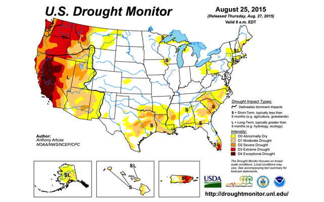
Tuesday February 28, 2017 - 10:00 AM - The storm ended last night around midnight, with a final super heavy burst in the mid to late evening. My rain gauge recorded 4.71" for the day! And just .01" after midnight this morning. The buckets, a more reliable measurement, were close to 4". It rained every hour yesterday, unlike the typical San Diego pattern of bursts of rain with broken clouds and bits of sky in between. The airport recorded 2.35". I read that the San Diego river crested at the 3rd highest level recorded. In our lower yard, a hunk of "the cliff" collapsed. Looking forward to this Thursday's drought report! Will post comparison pictures when it comes out. Monday February 27, 2017 - 12:42 PM - The storm is turning into a major headliner! My buckets are showing 1.5 to 1.75", the rain gauge 2.15", the airport as of their latest report @11:51 AM showing 1.07". Certainly at least 1.5" here. The date for the second drought picture in the February 2 post was incorrectly mentioned as January 1, 2017, now corrected to January 31, 2017. Monday February 27, 2017 7:35 AM - Yesterday, in the first of two advertised rains, I measured .03" here, the airport .05". The second storm is upon us and already has produced far more than originally predicted and much more is on the way. My gage is showing .92" right now for this morning and a steady rain is falling! The bucket looks like about 3/4". Monday February 20, 2017 9:16 AM - I was in New Orleans during the big Friday storm of February 17 returning late last night! My gauge measured 1.54" on Friday and then .30" more for the weekend's showers. As usual I think this is high, but certainly over an inch fell here! With the heavier rains in the L.A. area I'm looking forward to yet another reduction in the drought designations for CA this Thursday. Thursday February 9, 2017 4:45 PM - A another drought level reduction in the San Diego area occurred today, we are now in the color between yellow and orange, indicating "moderate" drought! Tuesday February 7, 2017 2:39 PM - The first rain event of February appears to be over. Airport .13" with .03" in the first stage and .10" in the second stage. My gauge .22", all in the second stage (last night). No buckets were set up. As usual, a lot more rain in the mountains and to the north. We may see a further reduction in the drought designations within California this Thursday. Thursday February 2, 2017 11:10 AM - The drought monitor has continued to greatly reduce the drought severity for California with major improvements as a result of the rainy December and January.
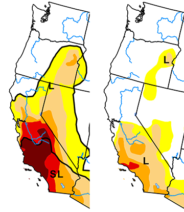 U.S. Drought Monitor November 29, 2016 & January 31, 2017 Thursday January 26, 2017 3:13 PM - San Diego Sea Levels has been updated for 2016. The average sea level reading dropped by about 2.5" for the year, but the average reading was still the third highest going back to 1906. The prior two years contain the two highest readings! The trend remains up. The drop in 2016 was likely due to the end of the latest El Niño influence. The 2016 updates are now complete. Wednesday January 25, 2017 12:15 PM - The airport is now showing 3.01" for the month, .05" yesterday. I recorded .12" yesterday. For the month I've recorded 6.72", my guess is actual is closer to 5" here. The weather outlook is for clear skies for the rest of the month, so 3.01" will likely be the total for January, 7.23" for the last two months, and 8.23" for the season which is at least 2" above average. Monday January 23, 2017 1:29 PM - Nitrous Oxide Levels have been updated for 2016. The slow but relentless increase continues. Monday January 23, 2017 10:01 AM - After two direct hits by small cells, my range gauge storm total is now .89". Bucket nearly matching with 7/8". Airport a laggard with .44". North county was deluged, Palomar showing 6.19", the extreme case; Temecula 3.16". Sunday January 22, 2017 9:50 PM - Methane Levels have been updated for 2016. 2016 levels declined from last year and was the first average level decline since 2006. 2016 was still the second highest average in since records were started in the late 1980's. Still waiting for Sea Level and Nitrous Oxide data. Meanwhile a front just went through and we had quite a bit of rain in the last hour. My gauge is now showing .70" inches! Sunday January 22, 2017 7:49 PM - So far the storm has been a flop locally from a rain perspective. The heavy rains have remained to the north, only a little bit "crept" into our area. LAX has over 2.8" and many areas in north county well over an inch. The airport reading as of 7PM is a pathetic .11", my gauge right now is showing .24". The winds are still strong from the south, certainly a front will go through sometime and could bring some strong frontal rain. The big rain shield in advance of the storm is now pretty much inland. The winds have been impressive, over 20 MPH all afternoon and early evening, with gusts in the 30's.
Sunday January 22, 2017 11:39 AM - The second storm lived up to the hype. In the first wave of rain Friday morning I recorded .71", in the second very heavy wave in the afternoon, 1.13" inches completely maxing out both systems of hillside swales and berms, then .17" in showers on Saturday morning, for a storm total of 2.01"! The bucket total was around 1.75". The airport recorded 1.11" on Friday and .03" on Saturday - my total for Saturday was a lot higher due to a direct hit by a small vigorous cell, plus on a micro scale rain funneled up the valley from the south. We had some strong winds too, but no damage or big branches down. The third and final storm was supposed to be here about now, but the rain this time is creeping to the south as rain cells are moving to the northeast unlike the previous storm which had cells moving more to the east. Next week's drought report should finally take San Diego down a notch! Thursday January 19, 2017 - 2:06 PM - The first of three storms has passed. While the county did receive 1/2 to 1" mostly to the north, local amounts were underwhelming. Airport .19" about the lightest anywhere along the coast as the initial rain shield of yesterday evening split into two, passing mostly to the south and one piece to the north dissipating. My gauge .33", bucket about .25". The NWS remains bullish for the next two storms, Friday and then Sunday. Wednesday January 18, 2017 - 3:36 PM - The text file for rain totals at San Diego Rain has been corrected. The total for 2016 was 10.23" not 10.44". In my spreadsheet I had May as being .65" when it was really .44". The text file had the correct number. Thanks to Jay Hansen for alerting me to the error for 2016. Wednesday January 18, 2017 - 9:58 AM - Looking with anticipation for the three storms predicted to hit starting tonight through next Tuesday. As of this morning, preliminary NWS predicted totals for the three storms is super impressive: Total Rain I did get .01" more rain later in the day on January 13. January 13, 2017 - 10:55 AM - January is following December as a rainy month. Our yard is full of very happy plants loving it, plus weeds! My total for yesterday and last night into this morning is 1.16", bringing my monthly total to 3.30". The airport is showing .55" for the latest storm, and only 1.04" for month to date. The bucket is back and is showing about an inch for the latest storm. Meanwhile the U.S. Drought Monitor's latest weekly update is showing northern CA (north of San Francisco) as being drought free for the first time in years, and a considerable reduction of the "Extreme Drought" area to the south. We remain categorized as in "Extreme Drought". Perhaps this most recent storm and yet more rain possible late next week will generate a lowering of the drought rating for this area. January 11, 2017 - 10:00 PM - Carbon Dioxide Levels have been updated for 2016. The levels reached a new record and the annual increase was the third largest since records began in 1958. January 11, 2017 - 6:13 PM - Some light rain this afternoon: .14" in my gauge, .05" at the airport. One more system is in the forecast for tomorrow/Friday with the current projection at .25-.50". January 9, 2017 - 11:36 AM - San Diego once again brushed by a vastly larger center of rain to the north. 0.18" in my gauge and .18" at the airport so far, looks to be about over. On January 5 recorded .25" here, the airport .16". The "bucket" gauge has been discontinued for now. Two more systems are in the forecast but neither one major. January 3, 2017 - 12:13 PM - Arctic Sea Ice has been updated for 2016. The average coverage dropped by 3.79% to a new low. The maximum coverage was just a tick greater than lasts year's record low maximum figure, while the minimum was 5.6% lower than last years minimum but short of the record minimum set in 2012. I'm still waiting for Carbon Dioxide, Methane and Nitrous Oxide figures. January 2, 2017 - 3:17 PM - San Diego's 2016 temperatures are in, 2016 was the 6th warmest with the three year average of the three most recent years the warmest on record. San Diego Temperature has been updated. January 1, 2017 - 5:38 PM - My total for the three phase rain came in at 1.57", with .22" in the first period, .32" in the second period and 1.03" for yesterday evening;s rain. The bucket figure was similar overall. The airport end up with 1.16" overall, 4.22" for December and 10.44" [Jan 18 Edit: Correct figures is 10.22"] for the year, above normal! With so much rain over California this past year, maybe we can get rid of the area of "Exception Drought" and lower San Diego's "Extreme Drought" designation to "Severe" or maybe even better! San Diego Rain has been updated. December 31, 2016 - 10:13 PM - Rain resumed late this afternoon, been a great day! Airport through 9:51PM is showing .58" for today and certainly will be more than that. My gauge as of right now is showing .94" and 1.48" for the last two days. I have the airport breaking 10" for the year with 10.34" so far. 'Lite have the final figures and updated chart tomorrow. Bucket is showing more than an inch for the Dec 30-31 period so far. Happy New Year! December 30, 2016 - 3:43 PM - Nice band of rain went through here this morning associated with an upper level low. Airport .28", my gauge .22", bucket maybe 3/16". This rainy December brings the airport total for 2016 to 9.53", very close to normal (9.85") and very close to last year's total of 9.89". If we score direct hits from the tail end of this system and the system forecasted to go through tomorrow, we might hit 10" for the year, the first time since 2010. December 24, 2016 - 11:14 AM - The final read for the second storm (Dec 21-22) was 1.10" for the airport, 1.96" for my gauge, and about 1.5" for the bucket. Last night's storm came short of coastal expectations of 1-2" locally as the main blobs of rain split and went north and south of here. The airport is currently showing .61", my gauge higher again at .86" and the bucket a touch over 3/4". There are still a few widely scattered showers about. December 22, 2016 - 11:08 AM - A lot more rain! Right now the airport is showing .98" so far for this storm. My gauge says 1.68", again I think that is high, but we did get a lot. My "bucket" gauge is showing about 1 1/4". The storm last week registered 2.10" on my gauge, 1.32" at the airport and about 1 3/4" in the bucket. May still get some more showers out of this surprise"Baja" storm, then maybe an inch from the "Alaska" storm late Friday into Saturday. December 21, 2016 - 5:25 PM - Excellent forecast - rain tonight and tomorrow morning, then a "major winter storm" during the night of December 23-24.  Rain approaching from the south, late afternoon December 21 December 16, 2016 - 11:44 AM - The NWS nailed this one! Although the rains were a few hours late, they did come. Lindbergh is showing .90" of rain so far. My Acu-Rite rain gauge is working again and shows 1.33"! However, I think that is high, a well placed bucket with vertical walls is showing about 1". In any case a wonderful soaking rain with very little runoff. I expect an explosion of green in the yard next week.
December 15, 2016 - 11:51 AM - NWS has been predicting rain here for almost a week. Latest has rain starting after 5PM and ending tomorrow with .5 to 1.25" along the "coastal basin". The Pacific satellite imagery at http://counterintelligence/Storm/Hurricane/Pacification is not too promising, the movement so far has been to the north us as usual. The "100 percent" chance of rain tonight has been reduced to "90 percent", tomorrow is still at 100 percent. We need rain locally! Meanwhile substantial rains again are falling in northern CA, the reservoirs are full or nearly full. Here's hoping for an inch! November 29, 2016 - 4:09 PM - Generous rain fell in San Diego North County, about an inch, and exceeding more than 2 inches in the Julian / Cuyamaca areas. But, locally (nearer the airport), amounts were far less. My gauge is still down, San Diego International Airport (also known as Lindbergh), received .11" on Nov 26, .17" on Nov 27 and .10" yesterday, Nov 28. I think we received about the same maybe a little less. I can dig a couple inches into garden mulch and the ground is still bone dry! No rain will fall tomorrow, so I can say that November's total will come in at .61", about 1/3 inch below normal. November 20, 2016 - 3:50 PM - Rain is predicted! Not clear how much is predicted here, but 1/2" seems to be possible as the amounts have gone from 0.2", 0.4", 0.5" then ranging from 0.25" to 0.75", then no figure mentioned, and then most recently "four to six hours of heavy precip with rainfall amounts exceeding 1/2 inch per hour will be possible", but without location attribution. 2015 turned out to be a good year after years of drought, then this year much drier again. Our yard needs rain so badly. The system of berms and swales we built on the hillside went untested last winter due to the failure of the El Niño rains to materialize.... maybe this rain will do it. November 2, 2016 - 11:08 AM - October came in almost bone dry with .07", well below normal. Nothing on the horizon for November. We need rain! Center and northern CA did receive very good amounts. Also, October was 3.9 degrees warmer than average. Particularly disturbing is that the Arctic Sea Ice has returned to a path of record shrinkage as the Arctic Ocean's sea temperature is way above normal. If we do not get a big freeze up there this winter, next summer could see some very dire readings. September 20, 2016 - 7:14 PM - Rain today! Worked its way from the south very slowly and fell in my area as generally light rain all afternoon and into the evening with pauses. My rain gauge is not working (still shows 0.00" on the display). My guess is we've had somewhere between .1" and .2" so far. September 19, 2016 - 11:57 AM - Impressive thunder and lighting around 3AM this morning! Forerunner activity from hurricane Paine off the coast of southern Baja. On the lookout for showers tonight! Raindrops last night but zero as measured in my rain gauge, maybe .01" actual. Prior to today, there has been virtually no measurable rain since May 6th, that's over 4 months without rain. We need it badly! June 1, 2016 - 7:40 PM - Been dry since the last entry, just a few traces here. Lindbergh recorded .01" towards the end of the month. May 6, 2016 11:28 AM - Rain! Showers went through late yesterday evening, I recorded .10". Today some good steady rain in the early morning followed by another line of showers a short while ago added .55" here, bringing the storm total to .65". The rain was much needed here, the plants in my yard will be quite happy! The airport is showing .43" so far for the storm, well about the normal for the whole month of May, the second year in a row this happened. May 2, 2016 11:43 AM - The subsequent systems mentioned on April 7 all flopped. So the year got off to a great start with the 3.21" of rain in January, then fizzed with February-April bringing in just1.36" at Lindbergh compared to a normal of 4.86" And now the dry season is upon us.. The ground is dry up driving up the need to irrigate again. Northern California is in great shape with the huge Shasta and Lake Oroville reservoirs approaching capacity! April 7, 2016 6:50 PM - The advertised wetter weather is upon us. I recorded .30" of rain so far today, this compares favorably with Lindbergh's .27". More showers are nearby, and three additional systems are fore-casted to arrive in the next week. April 1, 2016 1:51 PM - March saw just .76" of rain, 1.01" below the NWS normal for the month. We may get some tropical rain in a week, but surely El Niño has to be considered a flop so far for water hungry Southern California. For Northern CA, the main reservoirs are now ABOVE normal for this date, a huge relief for that area! My rain gauge recorded .82" for the month. March 7, 2016 9:31 AM - Well once again San Diego has to settle for the southern tails of the storms. Yesterday I measured .18" and in today's much anticipated storm, only .16" from the front which just passed through here, although the rain was briefly heavy with some lightning and thunder. Central and northern CA again have received considerable rains, severe drought conditions up there have lessened substantially. March 1, 2016 10:32 AM - February set a new record as the warmest February in San Diego weather history. The average temperature of 63.9 broke the previous record of 63.5 set in 1980. In third place is 63.1 set just last year, So 2 of the 3 warmest Februaries have been in the last two years. The two coldest February were set long long ago: 50.4 in 1894 and 50.5 in 1880! February was also one of the driest February with just 0.05" inches of rain. Not extremely unusual, as there have been eight Februaries with lower amounts going back to the mid 1850's, with 1912, 1924 and 1967 at zero. The good news is that the weather models are predicting considerable rain starting as soon as March 6. Current talk is 1" along the coast in the following week, perhaps more! February 11, 2016 4:25 PM - 10th day in a row of super dry weather. Third day in a row of record heat. Feb 9 - 83 broke record of 77 set in 2008; Feb 10 - 86 broke record of 84 set in 1988; today - 84 broke record of 83 set in 1988. February 9, 2016 5:20 PM - We've had 8 days in a row of increasingly warm super clear weather, virtually cloudless and very dry. The generous rains of January are drying out and once again we need rain badly although the northern reservoirs are doing well. We had a record high temperature today, although the previous record of 77 was a record waiting to be broken as the typical record high around now is in the mid 80's. Today 83. At my place, just slightly further inland than the airport, I recorded 92 as the high! February 1, 2016 1:55 PM - The San Diego Sea Levels data for 2015 is out! Again the collective data flashes a warning for global warming. The levels for 2015 set a new record. While big increases are frequently followed by decreases, the trend has been up, and the last two years certainly jump out! Also, on January 29 Arctic Sea Ice was at the lowest levels for that date since recording began around 1980. January 25, 2016 2:18 PM - The Methane data for 2015 is out! And alas, once again a new record was set for the year, plus the increase was the biggest in 24 years. See Methane Levels. January 24, 2016 - Been about two weeks since we've had any rain (except .06" on the 14th, bringing the monthly total here to 3.74" and a few traces). There's talk of a fairly good chance of a rain event at or near the end of the month. Meanwhile still waiting on Methane and Sea Level data to close out 2015. January 18, 2016 10:40 PM - The December CO2 data is in. I've updated the Carbon Dioxide Levels page, adding the 2015 data to the main chart, and I created a new chart showing the change in parts per million for each year since records began in 1958. 2015 not only set a new CO2 level records, it also had the biggest increase since records began, breaking the 3.0 parts per million barrier. January 12, 2016 12:26 PM - Did the annual update for the Nitrous Oxide Levels chart, another increase. Still waiting on the CO2 data for December. 2015 CO2 will show a record level for sure and disturbingly a good chance at a record increase for the year! Will post the data when I see it. Also still waiting on December sea level data, that will likely show up in a couple weeks. No idea when 2015 Methane data will be out. Meanwhile we are back to a dry pattern, the jet stream is pushing the El Niño storms well north of us again. Still, with 3.68" of rain so far this month, we are well above normal. January 6, 2016 8:15 PM - Another rainy day although the main action was to the north of San Diego, including multiple waterspouts off the coast to the north. I have measure 0.69" since midnight, and there must have been another .02" late yesterday as the January total is now 2.93". Showers, possibly strong, are predicted for tonight. Meanwhile I have updated the Arctic Sea Ice page for 2015. Noteworthy is that the maximum ice extent for 2015 was at a record low, while the average and minimum were low but not records. January 5, 2016 9:26 PM - What a storm! I measured 1.98" today, and just now a little squaw has brought the total up to exactly 2 inches, with the total since all this began a couple days ago to 2.22". Had some flooding issues on the property. January 5, 2016 - Finally! El Niño enhanced storms are upon us. I received .22" from the first and weakest of the storms (.16" initially then .06" in residual showers). Rain gauge is in south Mission Hills. Storm number 2 is in progress and I've picked up .18" as of this morning with a coastal forecast of 1 to 1.5" and 2 to 4 in the mountains. Storm 3 is expected to be strong, too and a fourth one this weekend! January 1, 2016 - Year 2015 average temperature was 67.50 and almost set a new record but not quite, as 2014 came in at 67.54 degrees. December 31, 2015 - Rain: San Diego came in a just about normal for the year regarding rainfall. The super unusual thing about this though is that most of the rain fell in the normally very dry summer! Temperature: San Diego was on track for having its warmest year on record, but with a rather cool second half in December, I think we are going to miss breaking last year's record by just a few hundredths of a degree! The last two years are the warmest back to back years in San Diego. Globally, Earth set a new record high average temperature for the year. Sea Level: In late January the ocean level data for December San Diego will be coming in and will be posted on the Sea Levels page. Based on the first 11 months 2015 will be well above 2014's record by more than an inch! Carbon Dioxide: CO2 was at a new record last year yet again (will update as soon as I get the update). Methane: Methane could take months, my source was very late last year. This year has seen a huge methane leak in CA, currently unplugged. The Aortic Sea Ice extent looks to come in at the third lowest, although the current year-end level is at a new low. Summation: Things continue to get worse. Go solar, eat less meat, recycle and re-purpose. December 23, 2015 - Northern CA, Oregon and Washington have received super impressive rains this past month. Here in San Diego, amounts along the coast have been light, although some mountain stations have received 2-3". My rain gauge is now operational, although not yet working for the Internet (transmitter not being picked up by the "Internet Bridge"). In the past few days it recorded .34", with .11" a few days ago and .23" in the most recent round. These figures are very close to Lindbergh Field's .11: and .20"! December 14, 2015 - Waiting for El Niño!. We had .19" on December 11 (mixed with pea size hail and some thunder and lightning) and .16" yesterday evening, bringing the monthly total to .35". But this is -.21" below normal so far for the month. Northern CA has had a lot of rain this month, but so far the reservoir levels have barely budged, they continue well below normal throughout the state. We may see some rain in a week, but the forecasts at this time are not talking a big event. Longer range continues to keep rain well to the north. I have recently purchased an ACURITE weather station! Not yet set up, hope to be able to connect my station to the Internet for data sharing! At some point in the future I plant to migrate my environmental section from this website to a new website and make it publicly interactive. November 4, 2015 - Heavy rains in May, July, September and now continuing the every-other-month streak this November, substantial rain fell in the San Diego area yesterday evening. Bringing memories of the thunderstorms last July, about four thunderstorms went through San Diego yesterday evening accompanied by many flashes of lighting and booming thunder, scaring the dogs. Combined with some earlier showers and later sprinkles, the storms dropped 1.12" at the airport, most of it in a couple hours. The storm came from the cold Alaskan climes and was not tropical in nature .I've been working on having our sloping yard terraced for water catchment and yesterday's storm caught us with an incomplete system! I have San Diego's year-to-date total at 8.59", and is well ahead of the last three below normal full year totals of 6.63", 5.57" and 7.77". November 2, 2015 - October's San Diego average temperature came in at 74.4 degree's smashing the previous record of 72.2 degrees set in 1983 to smithereens, with records going back to 1851. Again and again, evidence continues to pound us in the face that a serious warming trend is in place. October 19, 2015 - Amazing factoid from the National Weather Service: SUNDAY [October 18, 2015] WAS THE NINTH DAY IN A ROW WITH A LOW TEMPERATURE OF 70 OR GREATER AT LINDBERGH FIELD AND THE 10TH SUCH DAY SO FAR THIS MONTH. PRIOR TO THIS YEAR...THERE HAD NEVER BEEN MORE THAN TWO DAYS IN A ROW IN OCTOBER WITH A LOW TEMPERATURE OF 70 OR GREATER IN SAN DIEGO AND NO OCTOBER WITH MORE THAN FOUR SUCH DAYS...THAT BEING OCTOBER 1997 WITH FOUR LOWS OF 70 DURING THE FIRST FIVE DAYS OF THAT MONTH. THIS RECENT STRETCH OF WARM NIGHTS HAS BROUGHT THE 5 WARMEST NIGHTS IN OCTOBER IN THE HISTORY OF SAN DIEGO AS WELL ASTHE 7TH WARMEST. October 13, 2015 - San Diego continues with well above normal temperatures. September, according to my records was the 32nd consecutive month above normal! In the last four days San Diego record 99 degrees, a tie, 96 degrees, a record, 94 degrees, a record, and 94 degrees, a tie. Some record high low temperatures were set. So, October is on track on becoming the 33rd above normal month in a row. NOAA says that February, March, May, June, July, and August of this year have set monthly all time records for monthly global average temperatures. Is the ongoing global warming accelerating? In the rain department, today's forecast mentions a good chance of a significant rainstorm on Sunday, October 18th. September 15, 2015 - The remnants of hurricane Linda finally made significant landfall, causing September to join May and July as freakishly wet months during what is normally the dry season for San Diego. A wave of rain swept in from the sea today penetrating well into San Diego county. San Diego airport received 1.07" of rain in just two hours and 1.15 in all, through mid evening. The five month period of May through September this year has been the wettest in San Diego recorded history! I have the five months (with September only half way done) coming it at 5.30", the previous 5 month record with September being counted as a full month was 3.95" in 1977. September 8, 2015 - Been mostly dry since the big rains of July. July ended up with 1.71" and August just .01" (about normal) with some early showers mid month and nothing so far in September. Yesterday there were some pretty impressive towering cumulonimbus in east county and Agua Caliente had close to an inch of rain. Nothing here as mentioned. We are getting close to the end of the monsoon season. There is some tropical moisture to the southeast, will be on the lookout for more big clouds over the mountains. July 19, 2015 - Yesterday was one of the most incredible days in San Diego weather history. Thunderstorms from the remnants of tropical storm Dolores struck San Diego for several hours bringing record rainfall amounts for July. The three wettest months for July going back to 1852 were 1.29" in 1865, .51" in 1868 and .92" in 1902. In the single day yesterday San Diego received 1.03" with hundreds and hundreds of lightning strikes. The previous record for the date was just .01". The average for the whole month was just .03"! Then today a new round of storms struck and as of 6:51PM .57" has fallen, bringing the month to 1.64", a record in recorded history. As of 6:49 PM it is still raining! What is particularly incredible is that May had 2.39", the second wettest May in history. The May, June, July total comes to 4.07" smashing the previous record of 2.54" in 1921. So while California is considered to be in a very severe drought, the last three month must start showing up in the overall data, we've been having record rain!! July 2, 2015 - There have been some early monsoon showers over San Diego county this week. .04" on the last day of June, kept that month from being a zero; .01" on July 1. Scattered heavier amounts elsewhere. May 31, 2015 - The heavy rain predicted for May 15 did not materialize, May ended up coming at 2.39", 0.15" shy of the record set in 1921. Although San Diego officially is in "Extreme Drought" mode, the latest season's rain is less than an inch short of normal. Local vegetation is looking pretty green! The reservoirs though out California remain well below normal. Also the month came in a just about normal temperature-wise, breaking a streak of considerably above normals. May 15, 2015 - Yesterday evening extreme rain fell at the airport and nearby locales. I was in north county so I missed the really intense part! I read that .71" fell in just 9 minutes at the peak, a rate reserved for intense thunderstorms and hurricanes! 1.30" fell in one hour, 1.51" in two hours, yesterday's total was 1.63". This is quite incredible considering the normal amount for the whole month of May is 0.25". The previous one day record for May 14 was .40". Blame the jet stream. With the 1/2" which fell earlier this month, 1.63" yesterday and .18" through noon today, this month has already seen 2.31". Since records began in 1851, this total has been exceeded just once, 2.54" in 1921. Given today's forecast of more rain, this number could be easily broken. Will be interesting to see how plants react as they were already in summer desert mode. The YTD figure is now 3.96", still well below the normal 6.35" for a full five months, but much better than a couple weeks ago. The seasonal total (July-June) is now 8.91" not that far off from the normal of 9.86". This rain has been mostly confined to Southern CA, overall the state's reservoirs remain well below normal. May 8, 2015 - 1/2" of rain fell in San Diego in the past 24 hours, twice the normal amount for the whole month! Won't do much for the extensive drought but very, very welcome. Some hints that we may receive more towards the end of next week. March 28, 2015 - March 2015 will set a new all time record high monthly average temperature record for March. The current record is 64.05 degrees and that was set just last year in 2014. Through the first 27 days, March 2015 has averaged 66.6 degrees, it would have to be in the high 40's for the last four days, this is not going to happen. Since the last post some more records were set or tied: March 16, 2015 - A record heat wave is ending February 23, 2015 - A rainstorm came through San Diego county in the past 24 hours; it was completely out of the long range forecast last week. Dropped over 2" in the mountains and mostly over 1" in north country. South county didn't get much, and the SAN airport received a paltry .18", that rain gauge is well below normal year to date. February 4, 2015 - Added Nitrous Oxide Levels data page. February 3, 2015 - Added Methane Levels data page. January 20, 2015 - Added Analysis sections to the Rain, Sea, Temperature and CO2 pages. January 19, 2015 - I've updated the San Diego Sea Levels page and the San Diego Temperature page, adding annual change graphs for further discussion. January 1, 2015 - I have 2014 as being the hottest in San Diego's recorded weather history going back to 1852, with 2014 beating the previous record of 67.24 by .3 of a degree. December 31, 2014 - Only .08" at San Diego from the latest rain (corrected from .09"), but closer to an inch in some North County places. And snow inland! Will update the various charts in the coming days. Happy New Year everybody!
December 30, 2014 - The first 29 days of December have come in with an average of 61.1, the last two days would have to be pretty close to zero to fail to have a record warm year. However in one of the recent discussions, the Weather Service said that this year is shaping to be "one of the warmest on record", not the warmest on record. Hmmmm. Curious to know which year is the warmest so far since records began. According to my records, it was 1984 coming it at an average of 67.24, followed by 1983 coming in at an average of 67.04. My guess is 2014 will come in at around 67.54. December 29, 2014 - Here is a correction to yesterday's post. December has to have an average of 56.99 degrees or above to set a new record (not 56.41 as mentioned yesterday). Still a new record is a given as yesterday's cold weather brought the first 28 days of December down by just .3 degrees to 61.2, and would require the last three days to be in the 17's to bring the monthly average to below 56.99. December 28, 2014 - Colder than normal weather has been in this area for the past couple days with frost inland. The cold is predicted to persist for the rest of the year although not as extreme. Does this threaten 2014 being the warmest in recorded history? No, not by my calculations. I'm figuring December has to average 56.41 or above for the annual average to set a new record. For the first 27 days, December has averaged 61.5 well in excess of this. For the final four days to bring the average to 56.4 for "only" a tie, the final four days would have to average a frigid 22 degrees. Not going to happen. December 20, 2014 - A third but smaller rainstorm mostly on the 16th, brought in 0.84" at Lindbergh, bringing the monthly total to 4.42" way above normal. Again there were much greater amounts well to the north. And today there is yet more rain in northern CA although nothing here. Reservoir levels, while improving, remain well below normal. The most impressive thing about the rain on the 16th was the spectacular rainbow which appeared shortly before sunset as the storm moved out. Visible was a fairly unusual "supernumerary rainbow" effect: interior fainter bows of color!
December 15, 2014 - With the first 14 days of December averaging 6.2 degrees above normal it is almost certain 2014 will come in as the warmest in San Diego weather records history. The remaining 17 days would have at come in at around 50 degrees average, super extremely unlikely. December 12, 2014 - Another impressive rainstorm. 1.05" of rain at Lindbergh, about in line with the general area. Huge amounts of rain fell in central and northern California with many areas reporting 3 to 6". Plus, this time it was cold enough to bring snow to the mountains, to help build storage for next summer. Combined with the first big storm, maybe, finally, the extent of the drought shown at drought.gov will shrink. Already this month, San Diego has received well more than in the first 11 months. And more is predicted to come! December 4, 2014 - A very heavy rain cell crossed the airport early this morning, dumping over 1" of rain over their poor rain-starved gauge within an hour, catapulting Lindbergh's storm total to the top of the heap for San Diego Country coastal stations! As of 4AM, the storm total for Lindbergh was 2.53" (corrected from 2.58").This brings Lindbergh in line with the rest of the county since early November, and with November doubles the year-to-date totals to over 6". Still well below normal, but now not freakishly so. Already there is talk of another rain maker around December 11-12. December 3, 2014 - Best rain in quite some time. Bit unusual as the rain is from the tropics rather than the southern tail of a frontal storm. However, as usual, the heavier amounts are to the north and inland, with San Diego getting a less than expected. Still, amounts exceeding 1" or more are common with some mountain areas getting more than 3". Should be enough to bring about substantial greening of the landscape. Meanwhile the 10 day forecast is for above normal temperatures, so the chances of setting a temperature record for the hottest year on record for San Diego are increasing. November 30, 2014 - If December comes in at normal temperature or warmer, 2014 will be the hottest year recorded for San Diego. November 27, 2014 - Record high temperature in San Diego, 85 degrees, breaking the previous high of 83 set in 1903. I think we've tied 3 records this year and broken 6. This year is on track to being one of the warmest on record with an outside shot at being the warmest.
November 21, 2014 - Reports of heavy rain last night in some areas of San Diego county. Some places received more than in inch. Poor Lindbergh received just .04". May 22, 2014 - We've had a bunch of record temperatures here - broken or tied. Fire storms accompanied the second batch. I was surprise today, San Diego county remained in "extreme drought" instead of being moved to the worst category "exceptional drought", by the USDA's weekly Drought Monitor update. January 17, 2014 - For drought commentary along with monthly notes, scroll down to Recent San Diego Rain File Updates. August 30, 2013 - I created a super cool time-lapse video of the weather for the last four days from mid Monday August 26, 2013 through mid-day Friday, August 30, 2013. In retrospect I should have let the video run through the end of the day on Friday as there were some cool clouds over the mountains later in the day.
July 23, 2013 - On July 21 there were some impressive thunderstorms in East County, with Agua Caliente receiving well over an inch of rain. But here along the coast, nothing. The next day was advertised to be a potentially explosive day with a clear morning providing lots of heating for convection over the mountains. I now have better equipment for doing time lapses and I ran the camera facing east for most of the day yesterday. In late morning things were looking up, but drier air began to move in from the coast and things went down hill from there.
Today I have the camera running in case something isolated pops up this afternoon, but so far very, very little activity. |


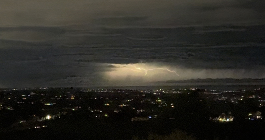
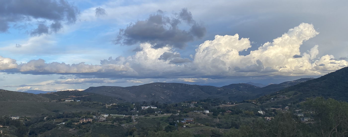


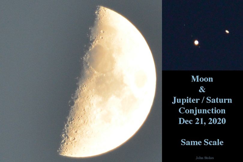
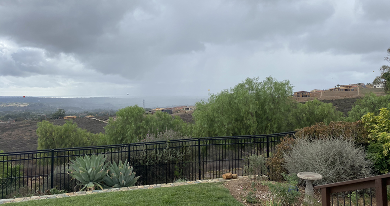

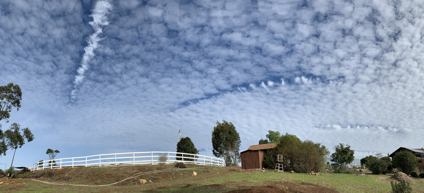
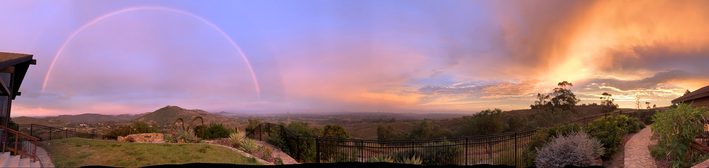
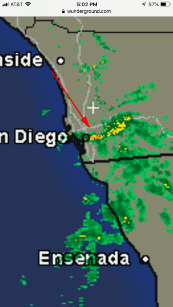
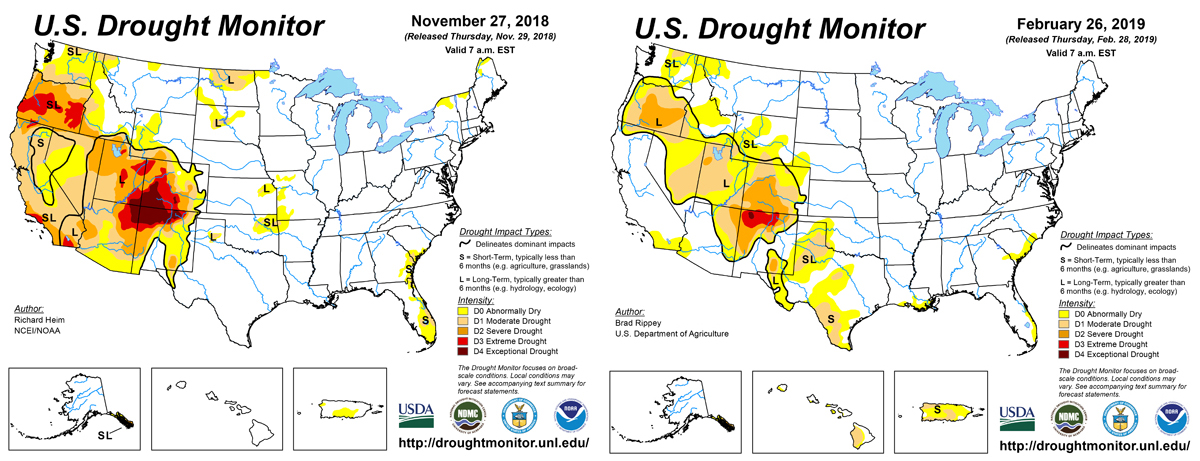
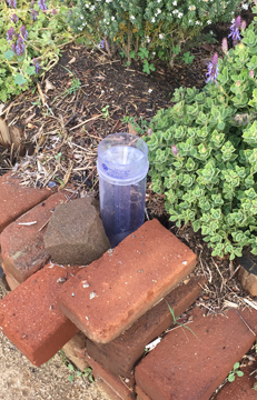


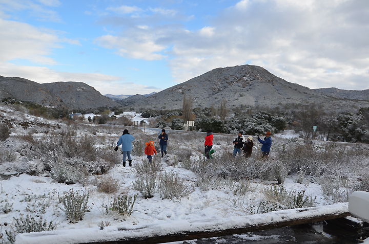
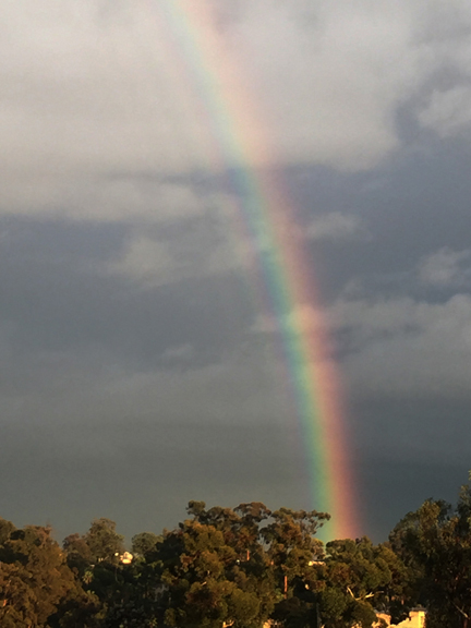

September 7, 2005
Monday 6:10 pm - Another interesting cloud feature in the sky today, a "sun dog". I greatly increased the photo's contrast to show off the unusual streak extending to the right. I've seen a lot of "sun dogs", but do not recall ever seeing such a long associated ray.
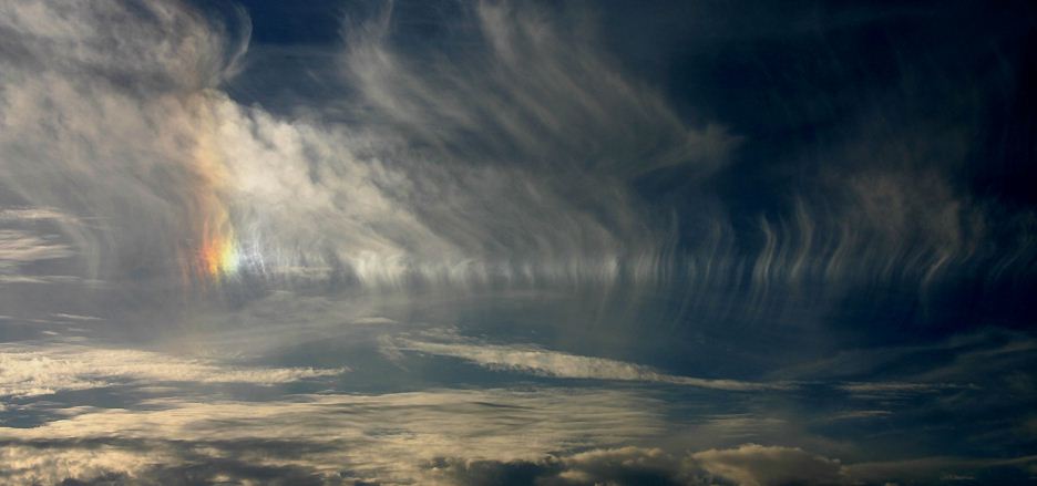

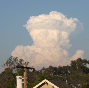
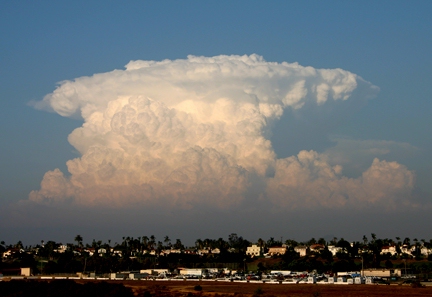
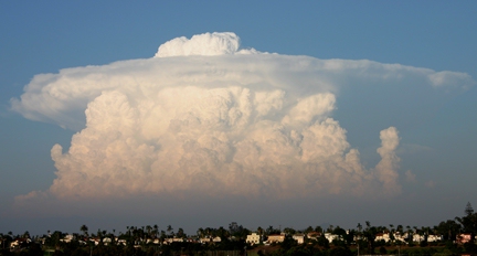
